* Member, American Meteorological Society
Graphical Climatology of Nashville, Tennessee: Daily Temperatures, Rainfall, and Snowfall

The following is a graphical climatology of Nashville. Tennesse temperatures and precipitation, covering predominantly the years 1948 into 2024. Included are summary overview charts followed by 77 year-to-year graphs depicting daily temperatures, temperature anomalies, rainfall, and snowfall. The 1948-to-present period of record comprises observations accessed from the Utah Climate Center, the National Centers for Environmental Information (NCEI), the NOAA Online Data Weather Data Site (NOWDATA) and the NWS Office-Nashville online page
Latest Update: 1 Jul 2024 e-mail contact: cjfisk@att.net
CLIMATE OVERVIEW GRAPHS
2024 Daily Temperature and Precipitation Chart for NWS-Nashville – New (7/1/24)
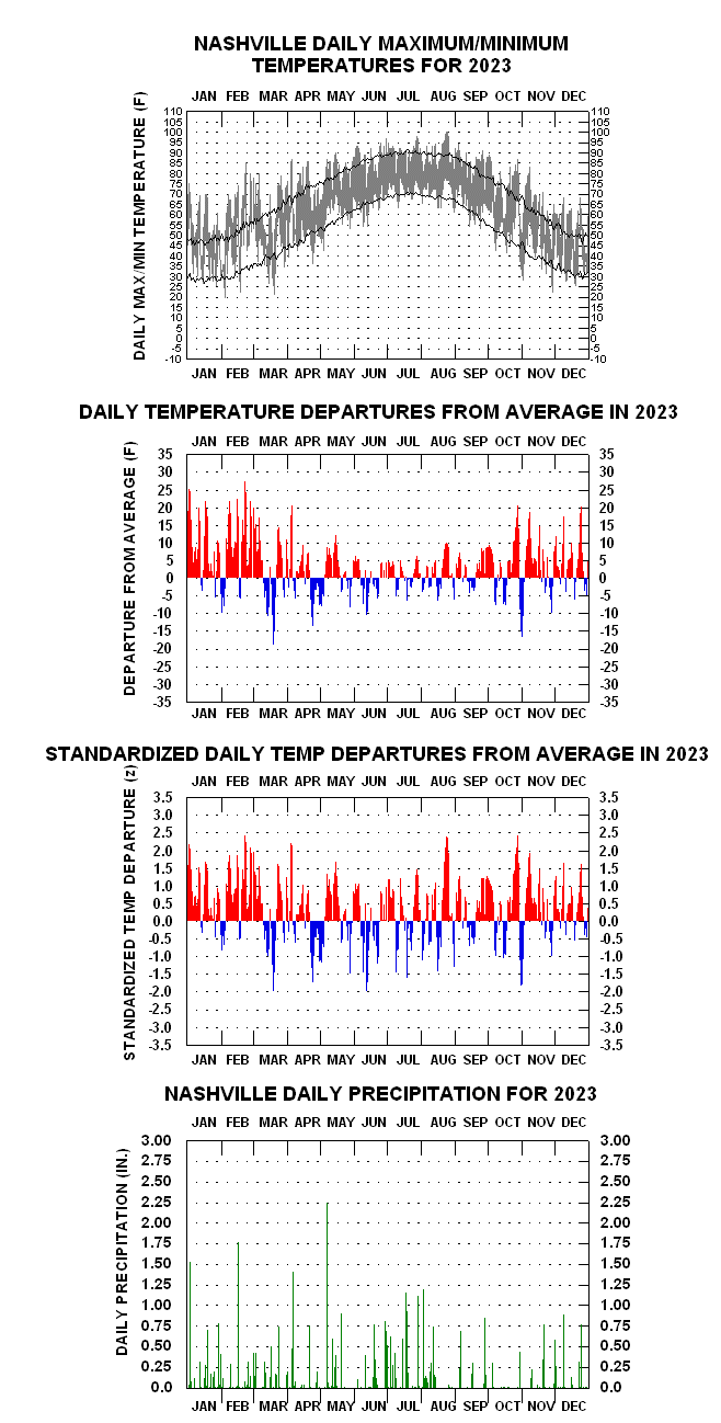
2023 Daily Temperature and Precipitation Chart for NWS-Nashville — Warmest Year in History (62.9 F)
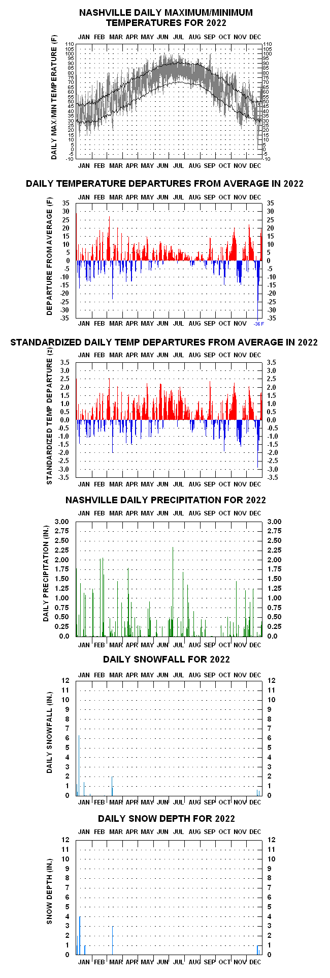
2022 Daily Temperature and Precipitation Chart for NWS-Nashville
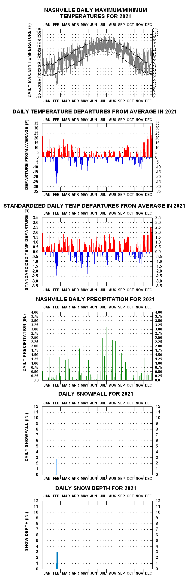
2021 Daily Temperature and Precipitation Chart for NWS-Nashville
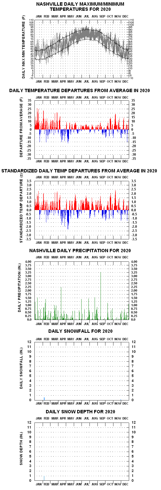
2020 Daily Temperature and Precipitation Chart for NWS-Nashville
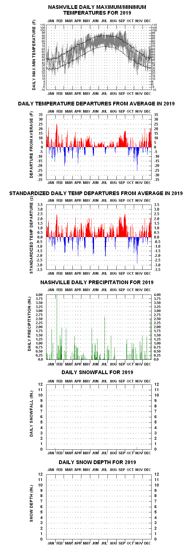
2019 Daily Temperature and Precipitation Chart for NWS-Nashville
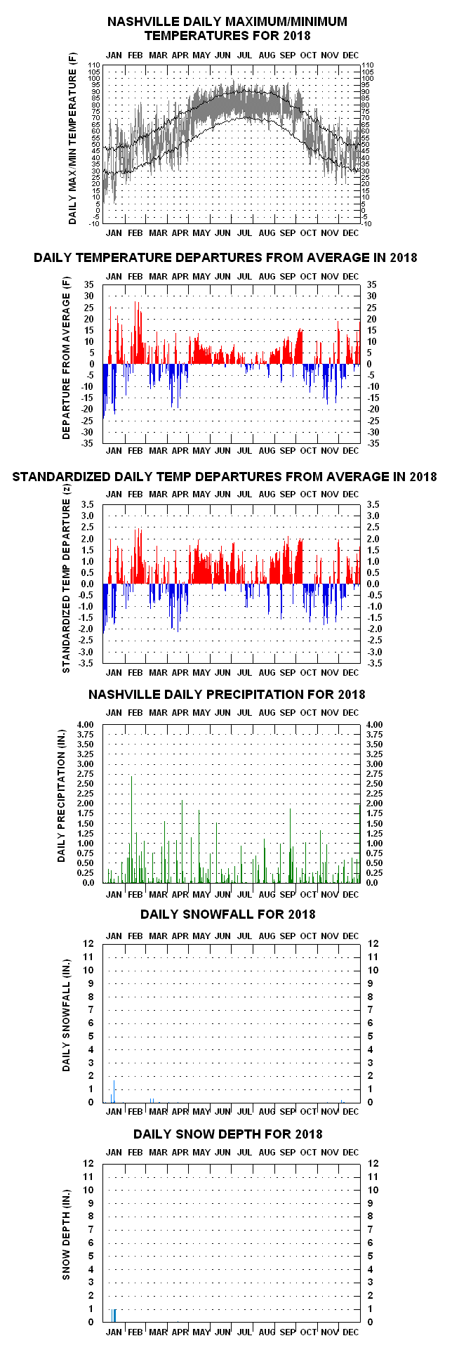
2018 Daily Temperature and Precipitation Chart for NWS-Nashville
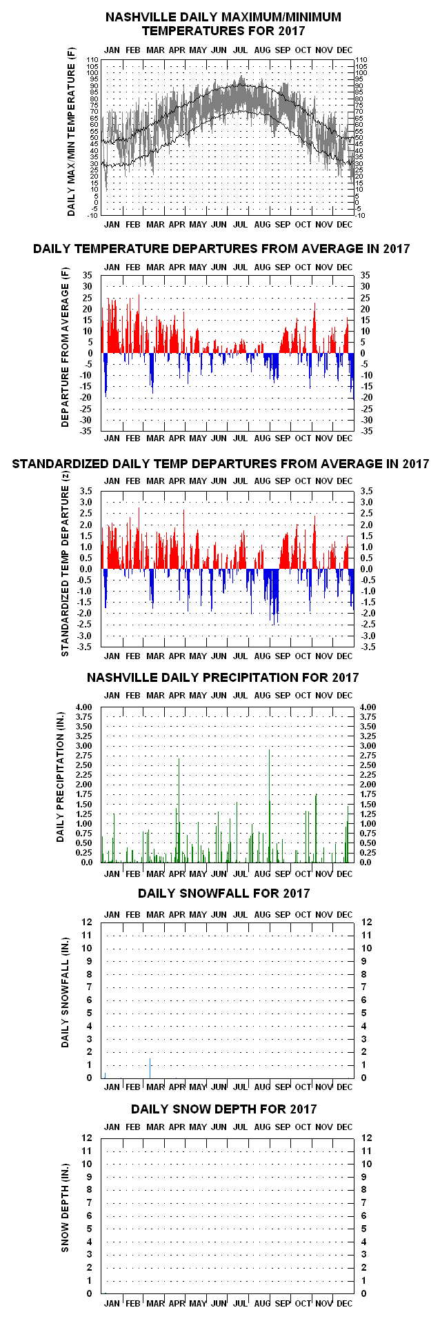
2017 Daily Temperature and Precipitation Chart for NWS-Nashville
– HISTORICAL SERIES –
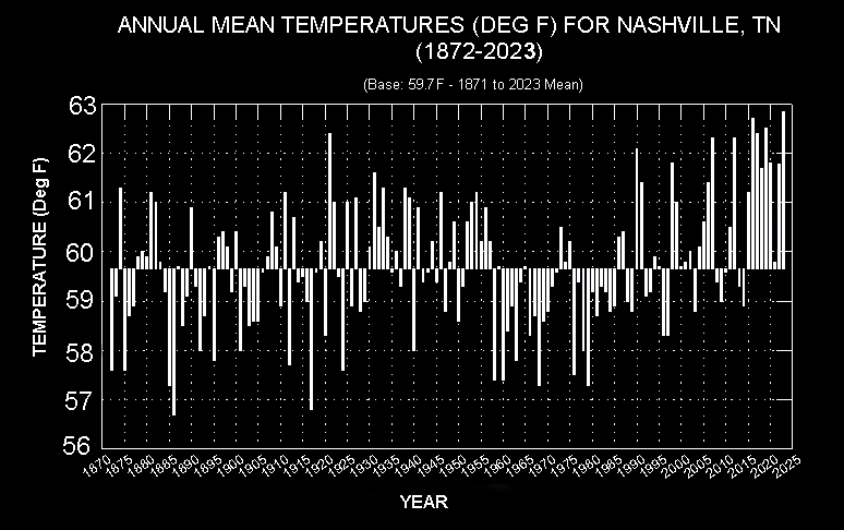
- Nashville Annual Mean Temperature History (1872-2023) New (1/6/24)
- Nashville Calendar Year Precipitation History (1871-2023) New (6/9/24)
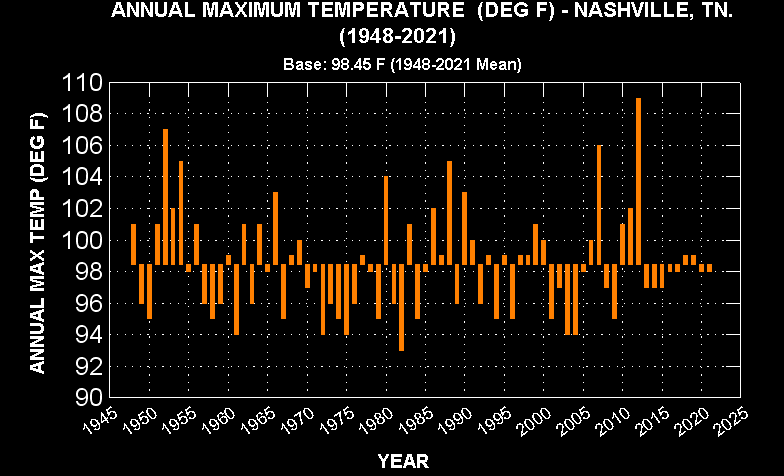
- Nashville Annual Maximum Temps (1948-2021)
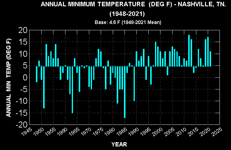
- Nashville Annual Minimum Temps (1948-2021)
HOUR-BY-MONTH CLIMOGRAMS FOR NASHVILLE
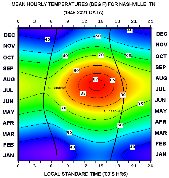
- Mean Hourly Temperatures
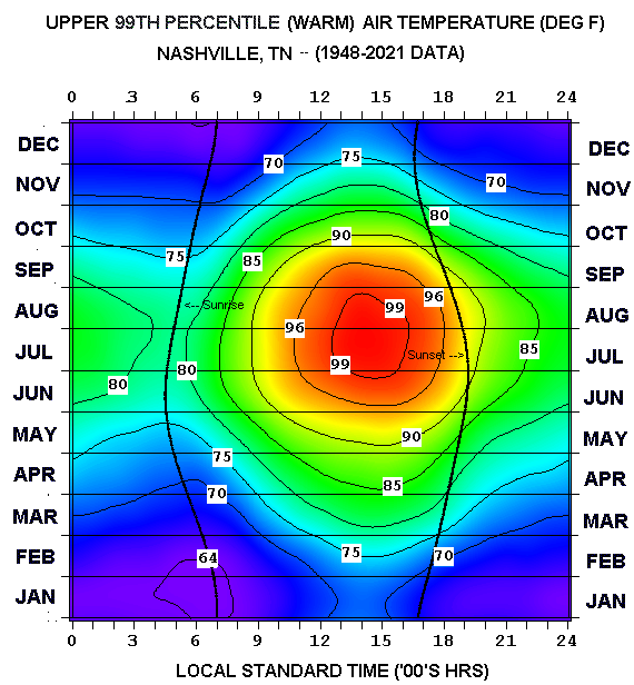
- Upper 99th Percentile Threshold Hourly Temps
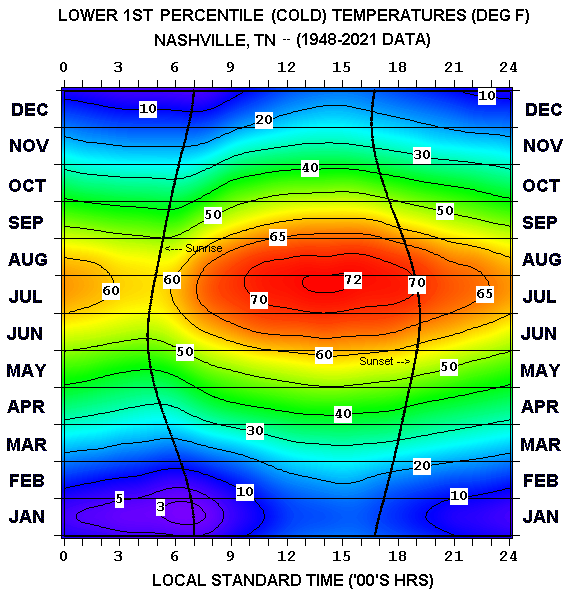
- Lower 1st Percentile Threshold Hourly Temps
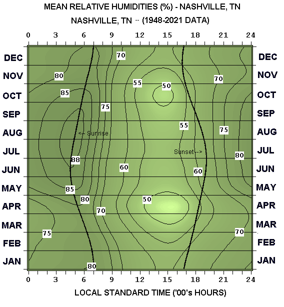
- Mean Hourly Relative Humidities
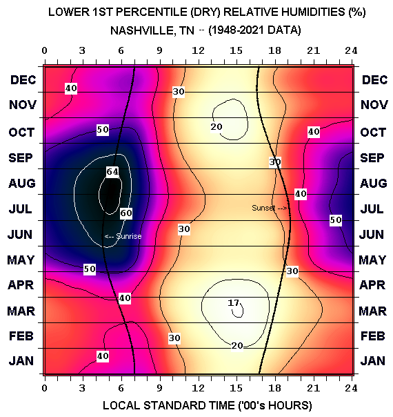
- Extreme Low Relative Humidties by Hour
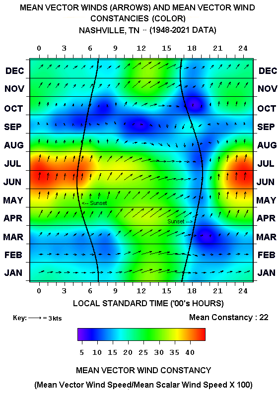
- Mean Vector (Resultant) Winds
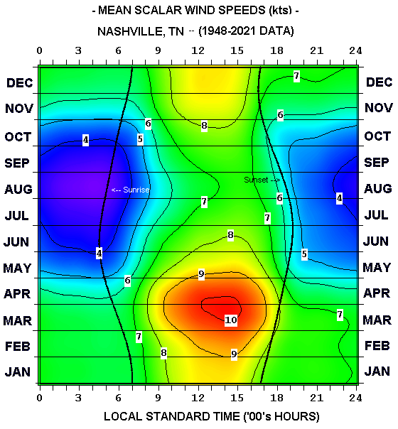
- Mean Scalar (Sustained) Wind Speeds
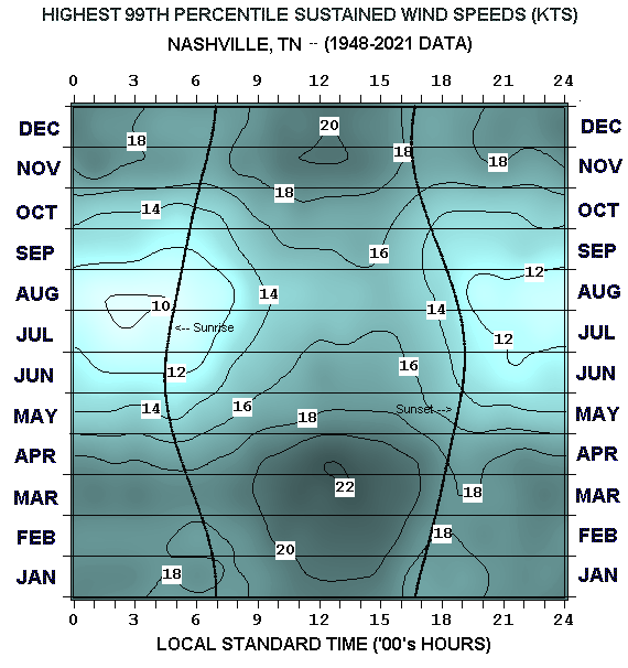
- Upper 99th Percentile Sustained Wind Speeds
OTHER SUMMARY CLIMATE CHARTS:
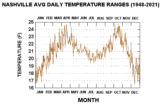
- Nashville Average Daily Temperature Ranges, by Calendar Day
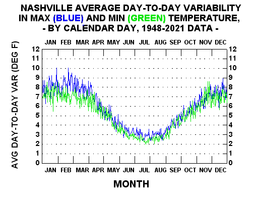
- Nashville Average Day-to-Day Variability in Max, & Min Temperatures, by Calendar Day
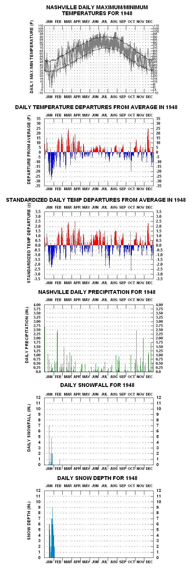
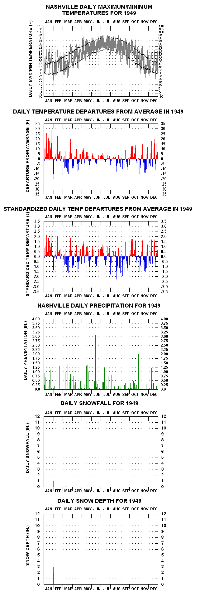
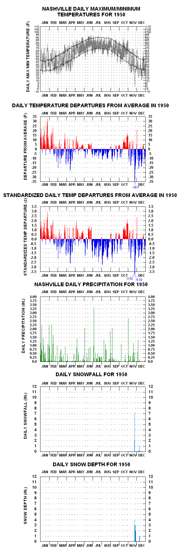
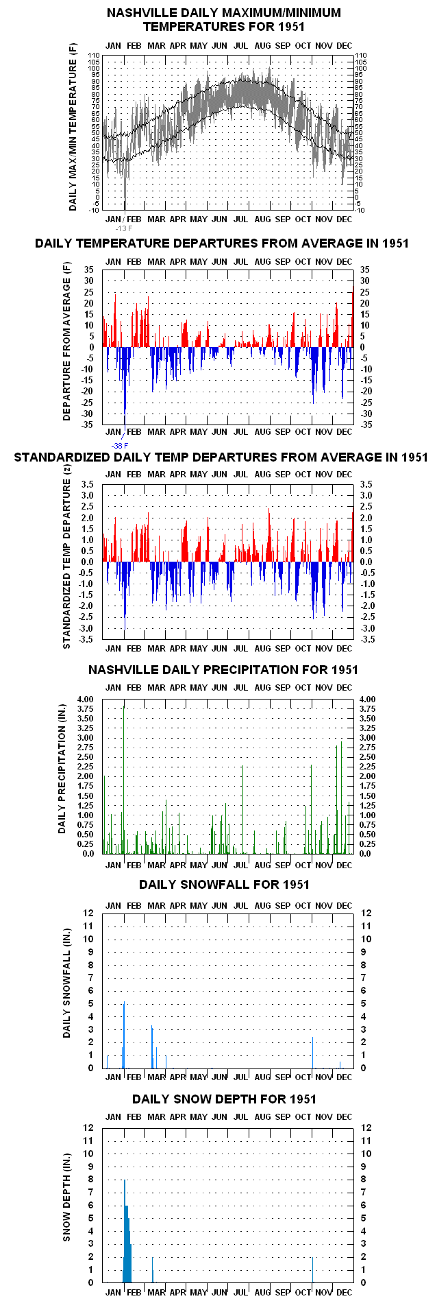
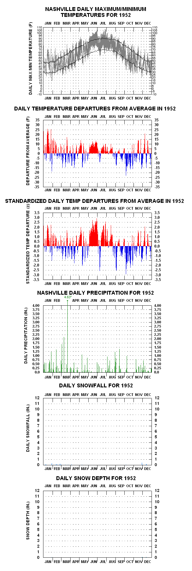
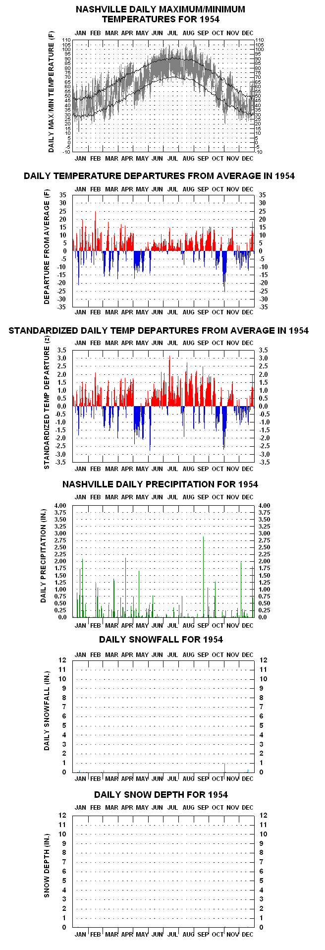
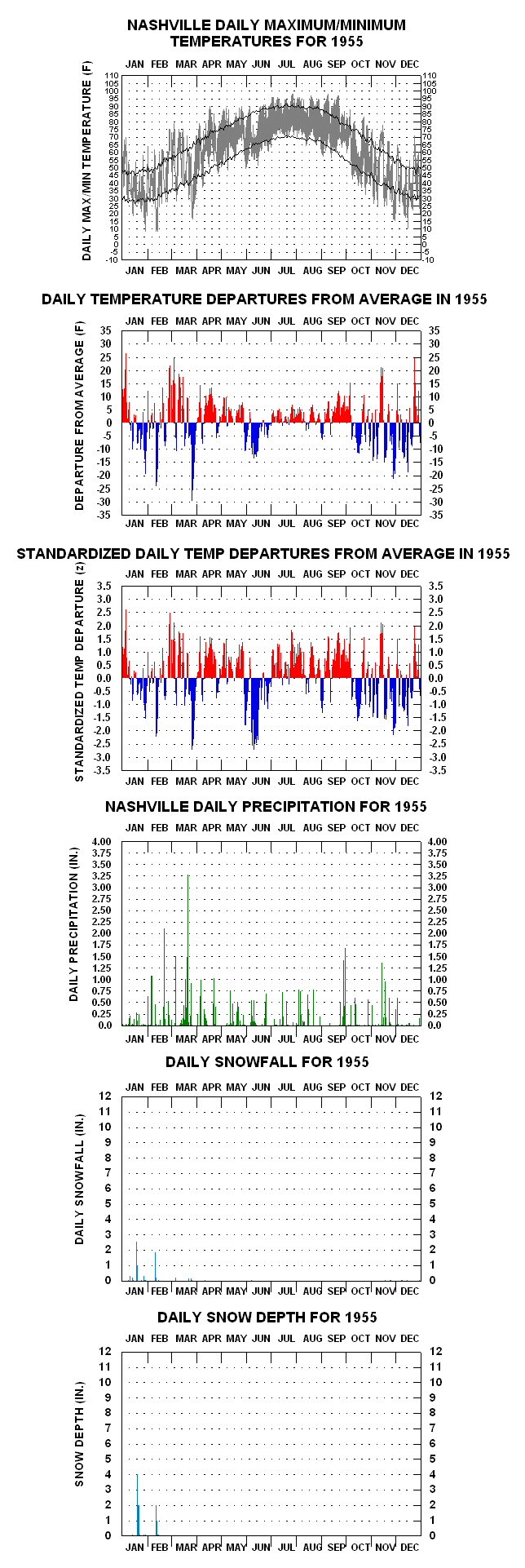
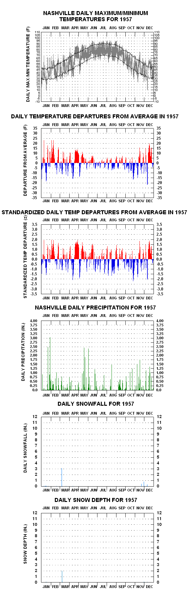
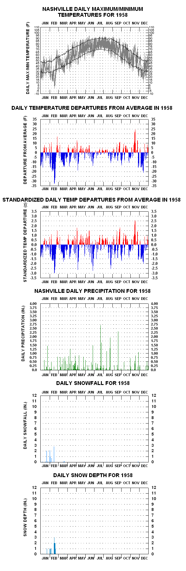
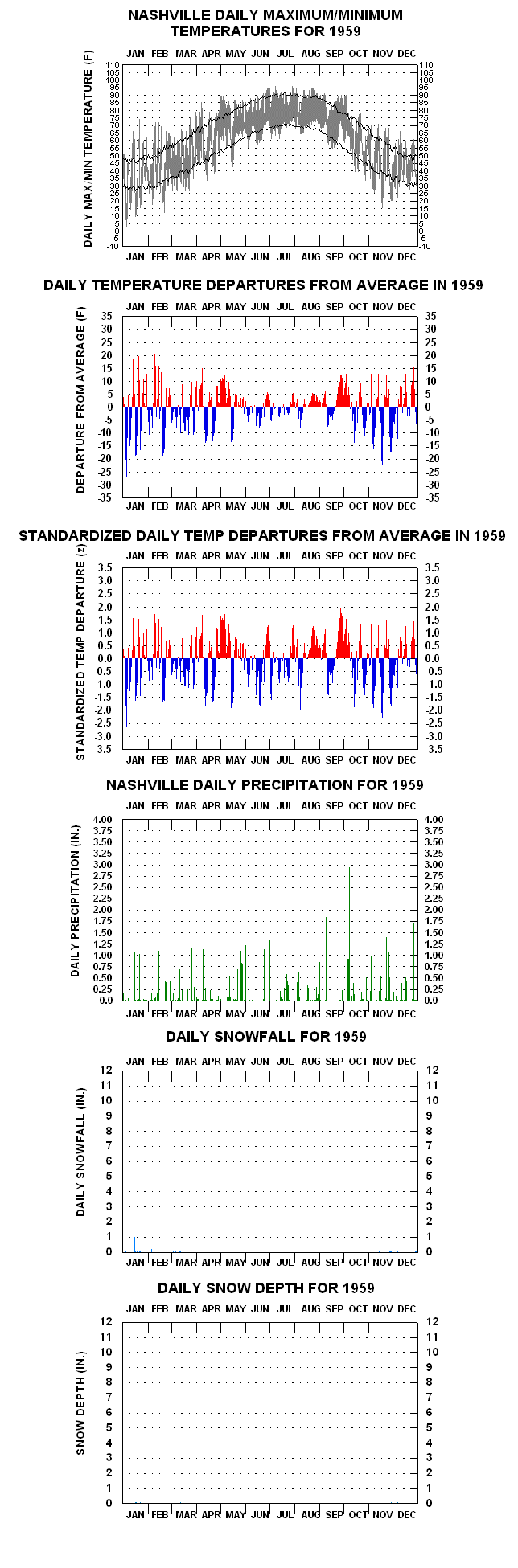
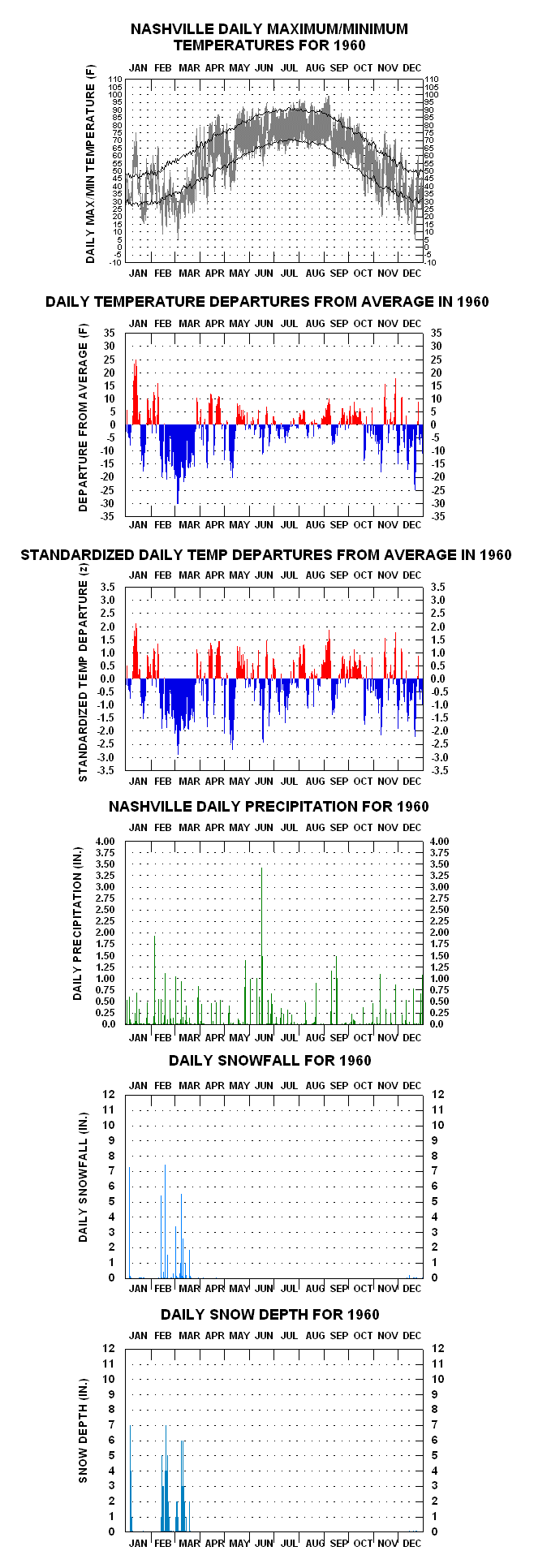
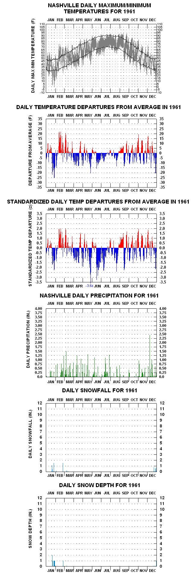
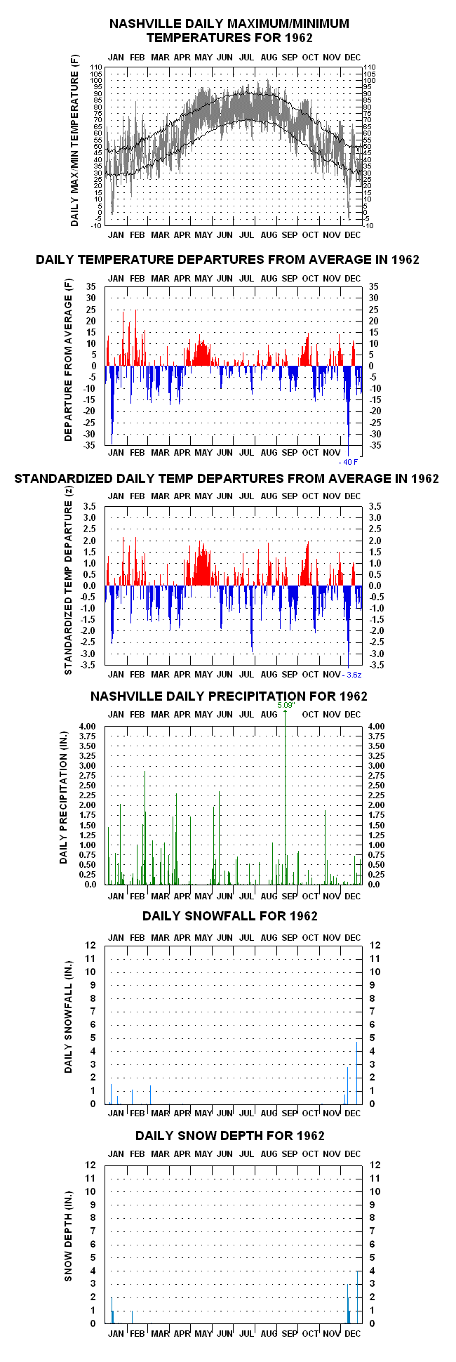
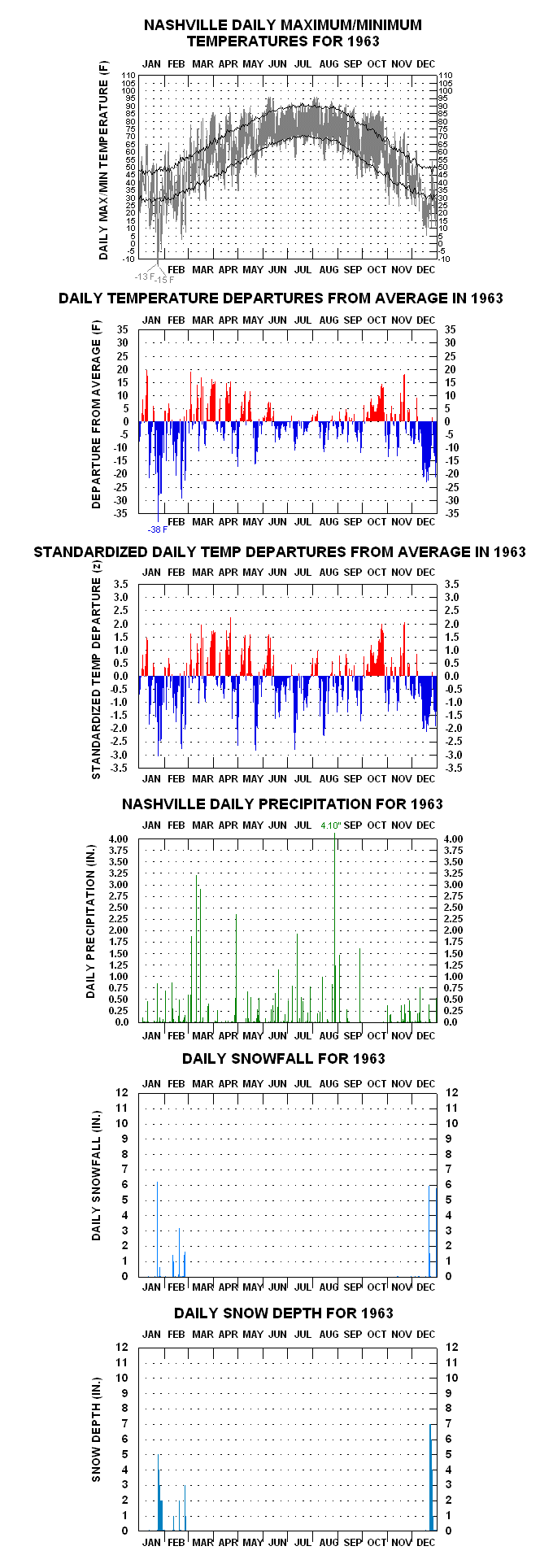
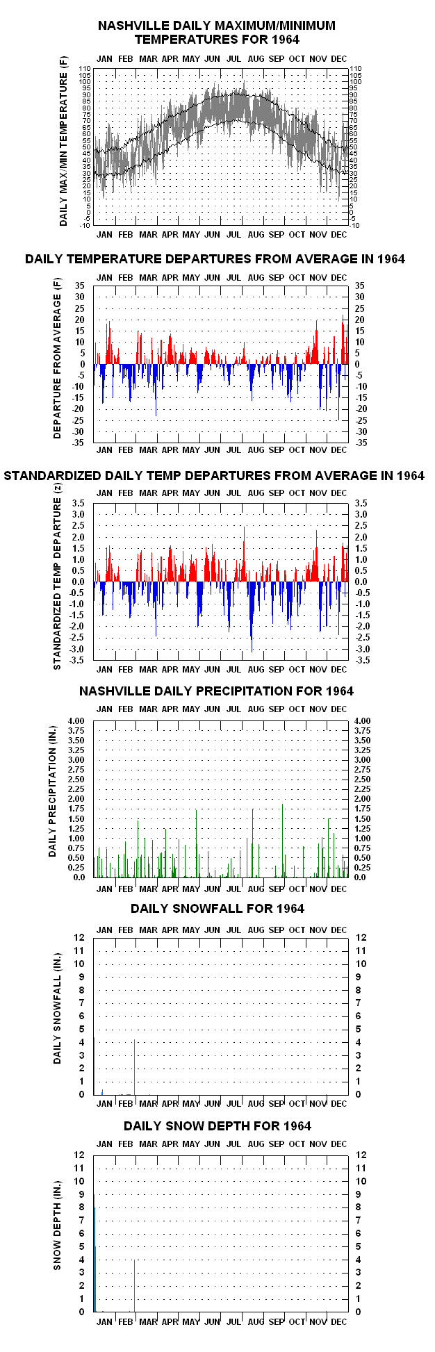
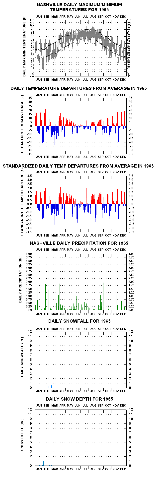
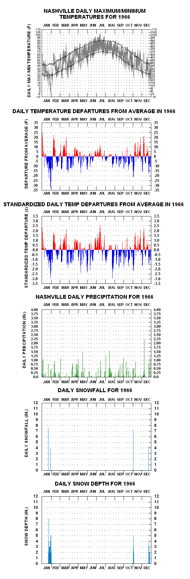
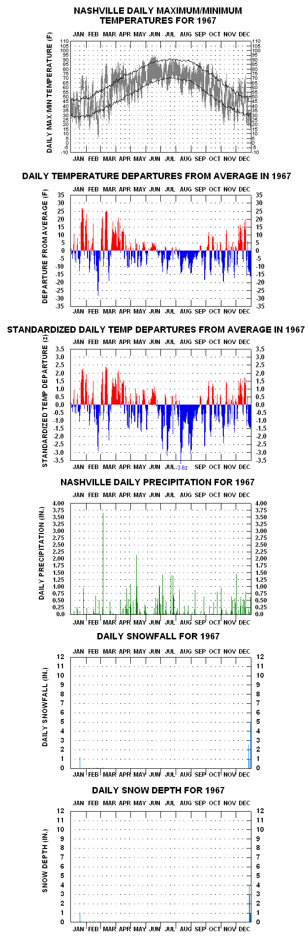
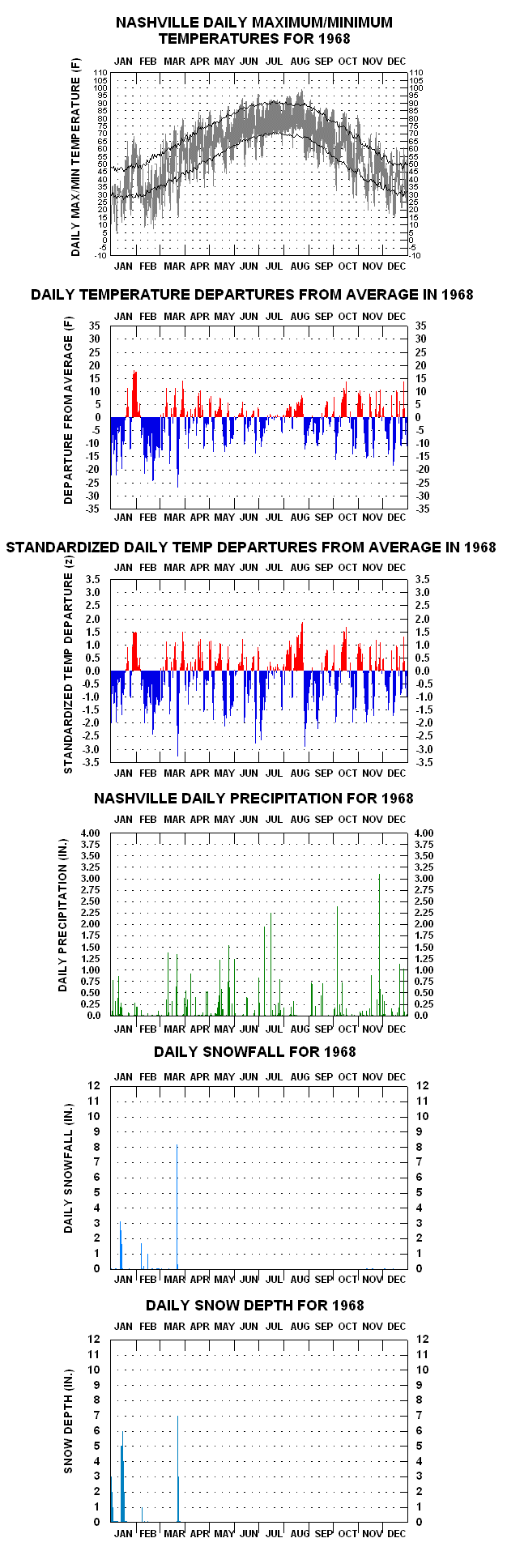
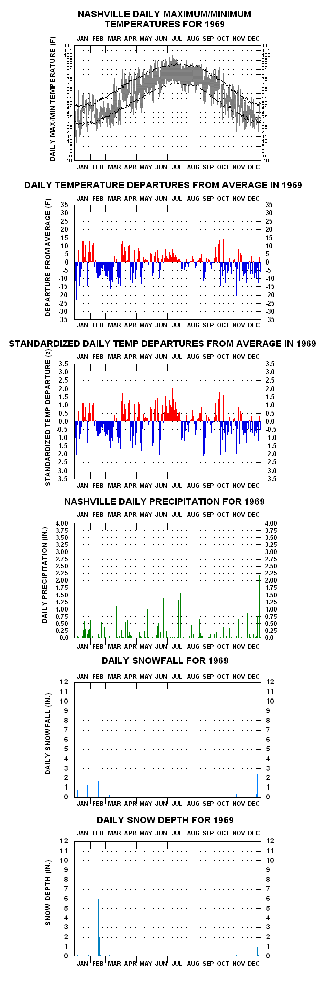
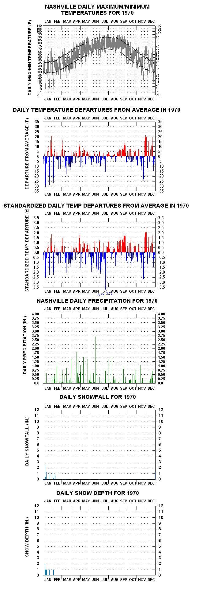
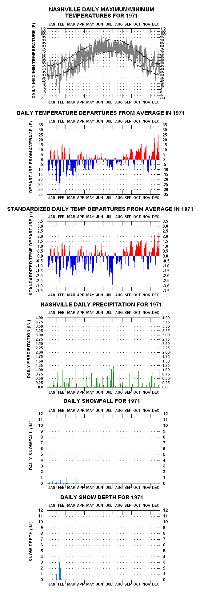
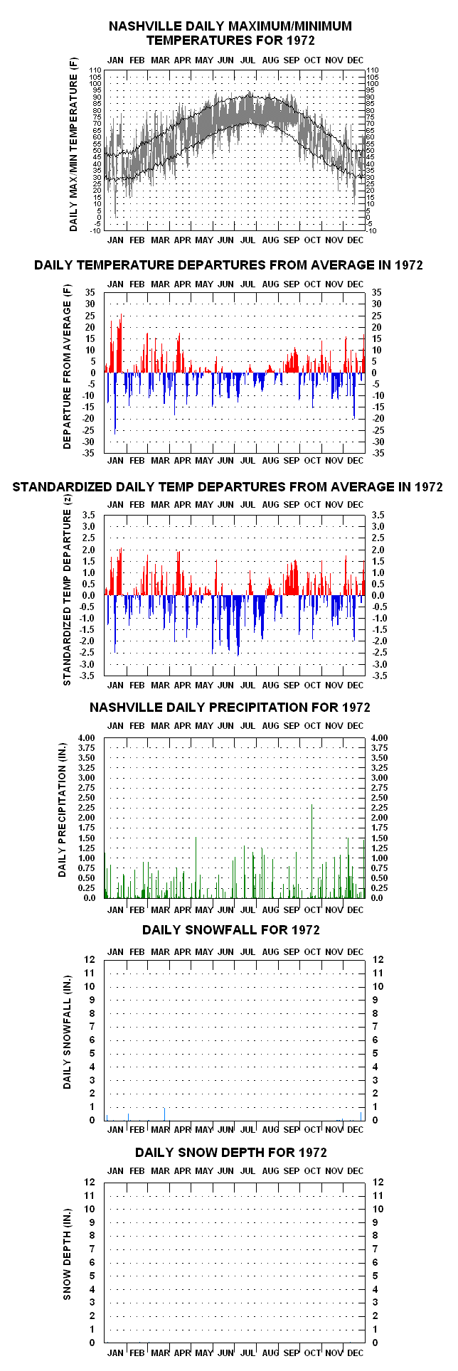
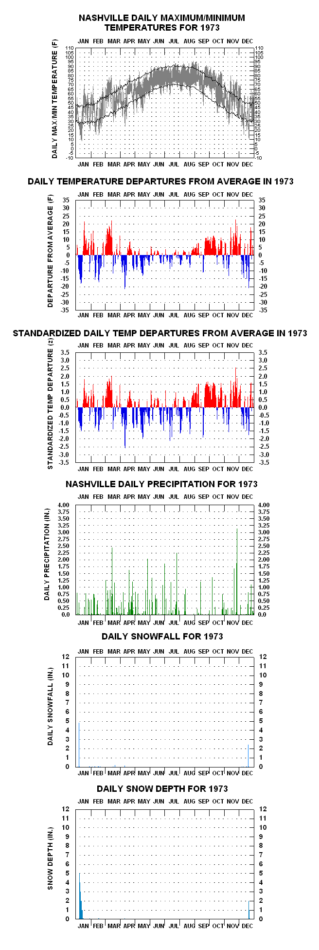
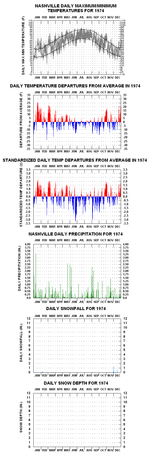
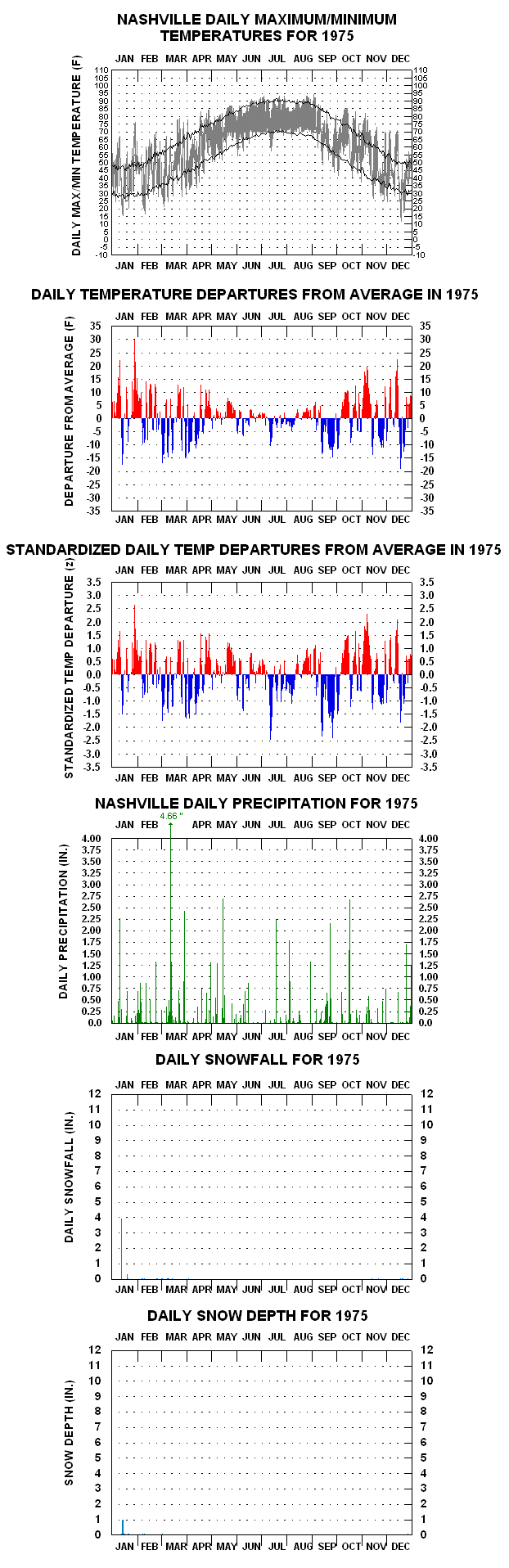
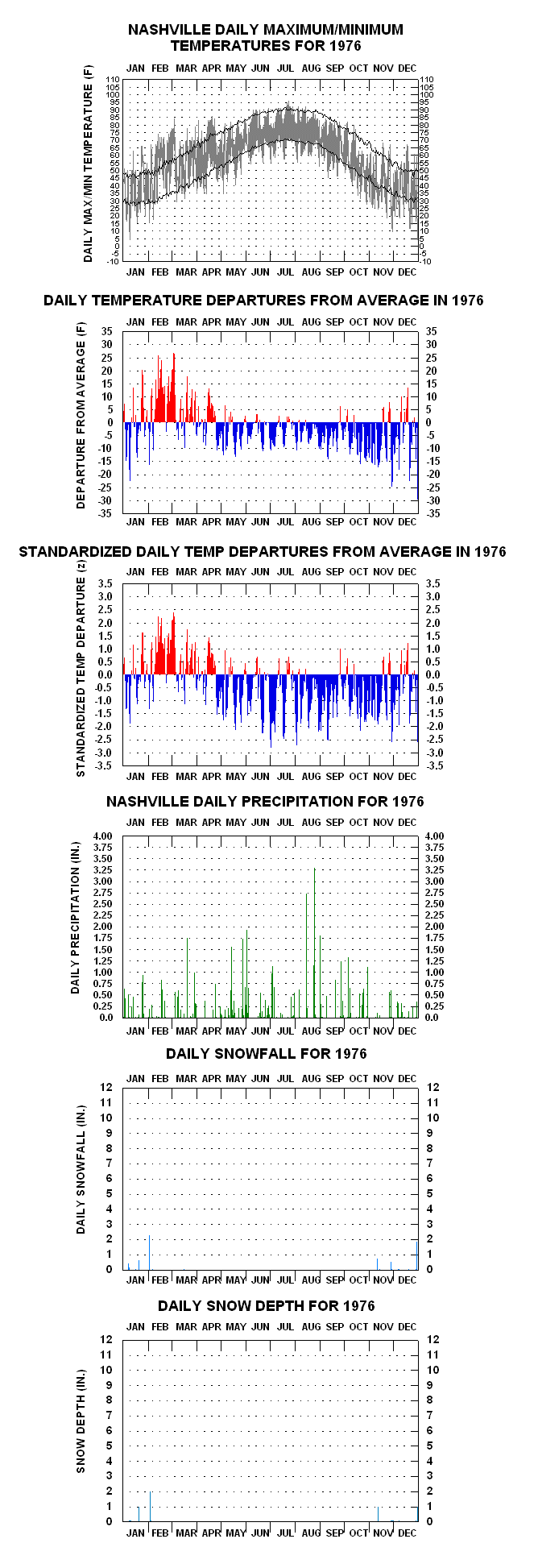
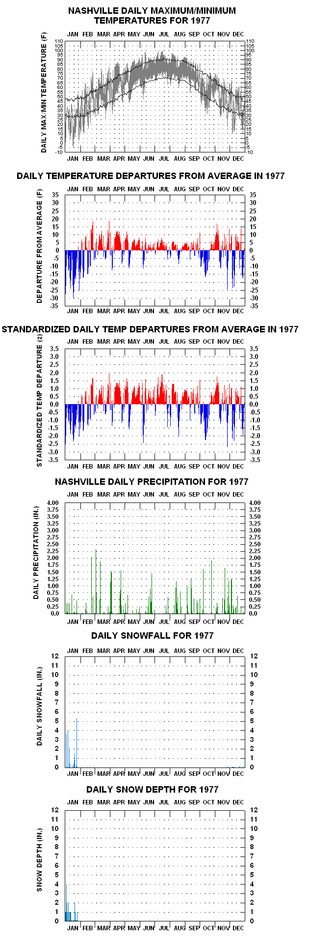
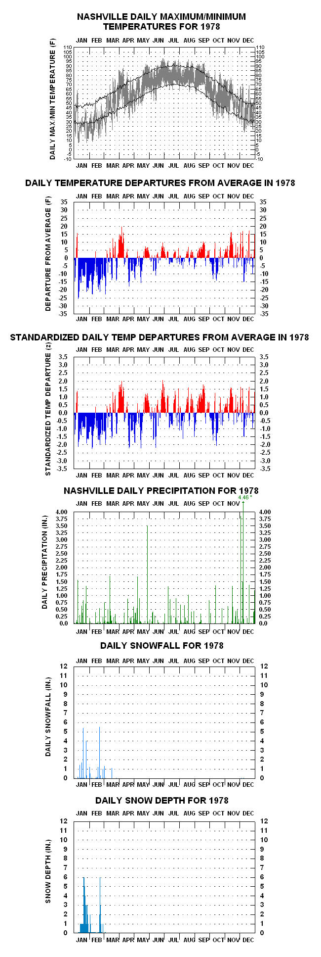
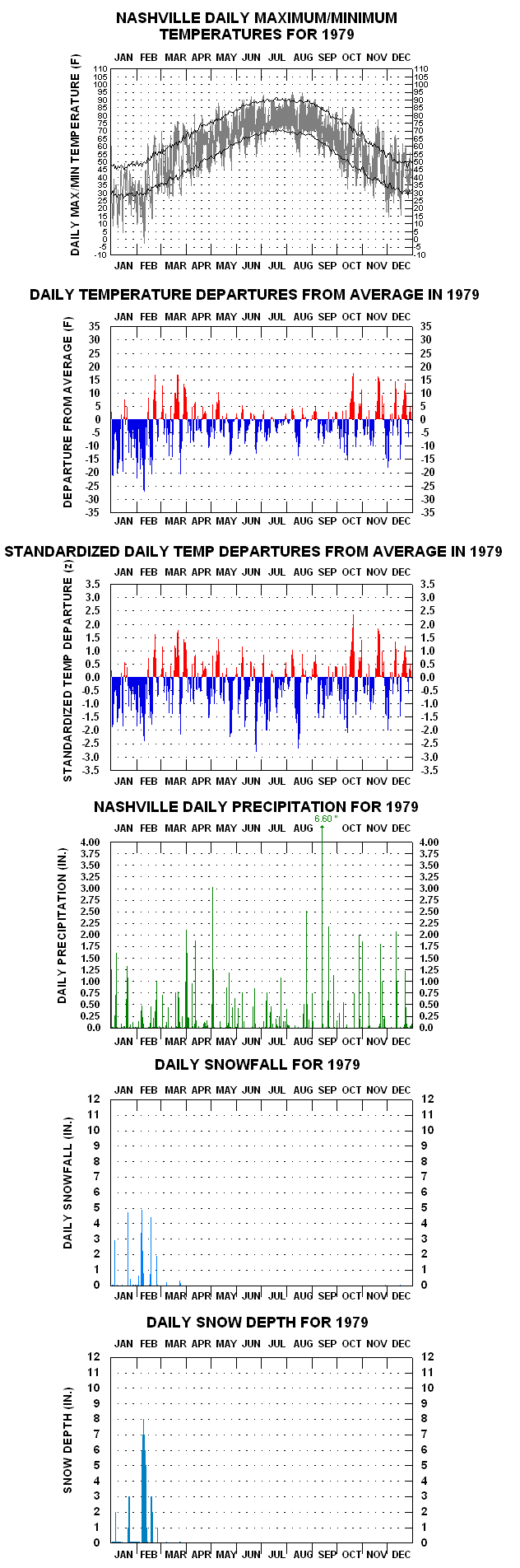
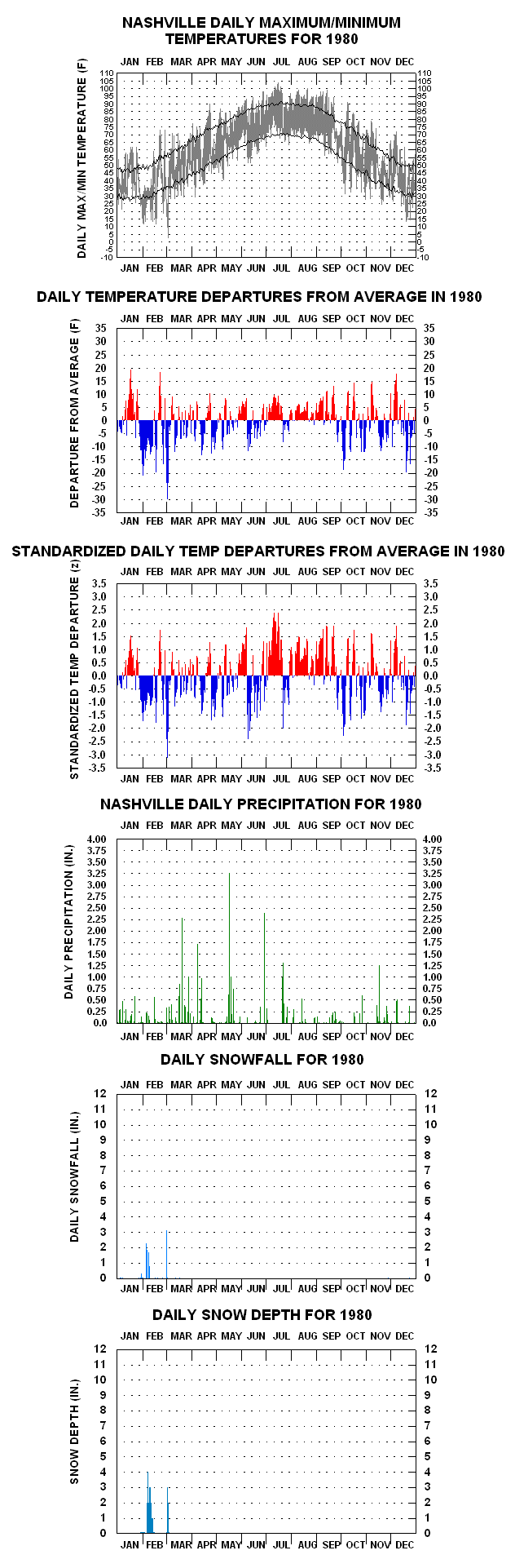
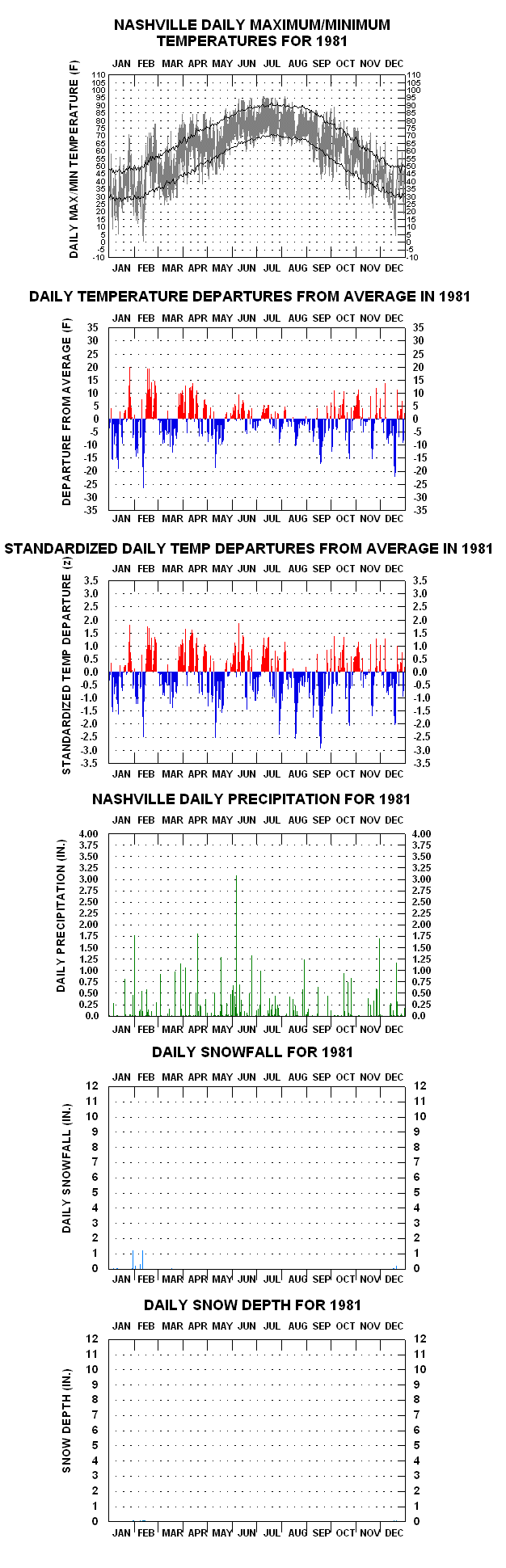
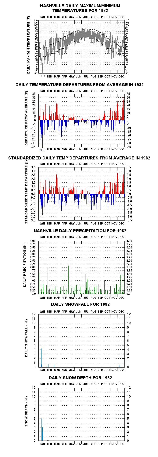
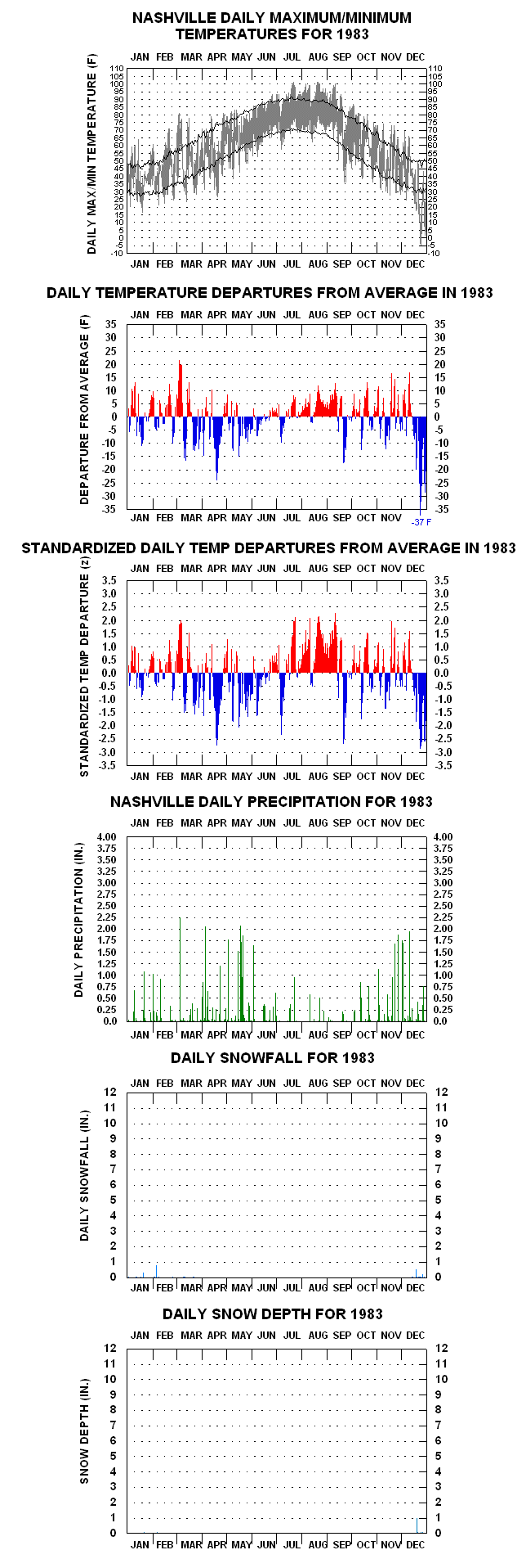
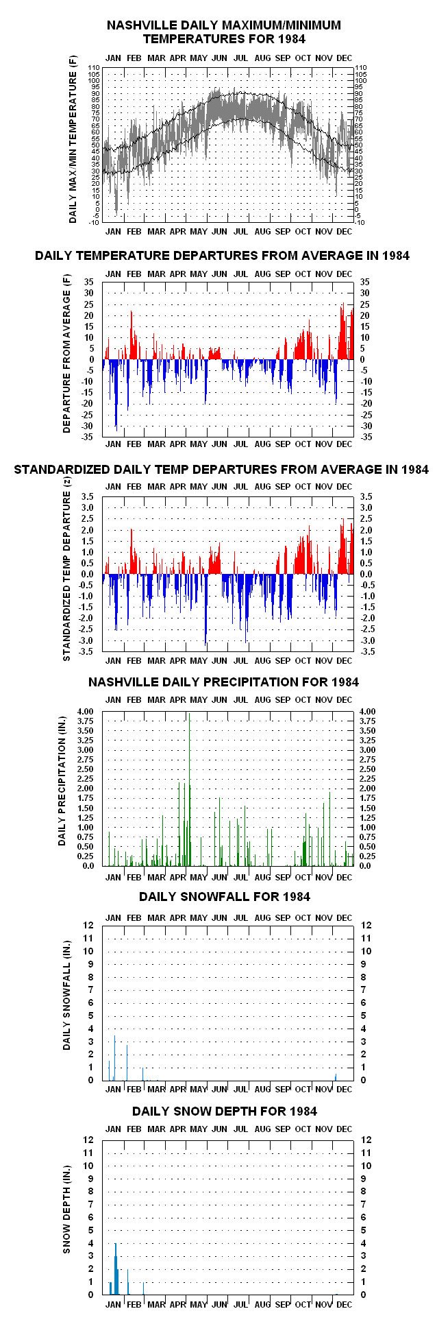
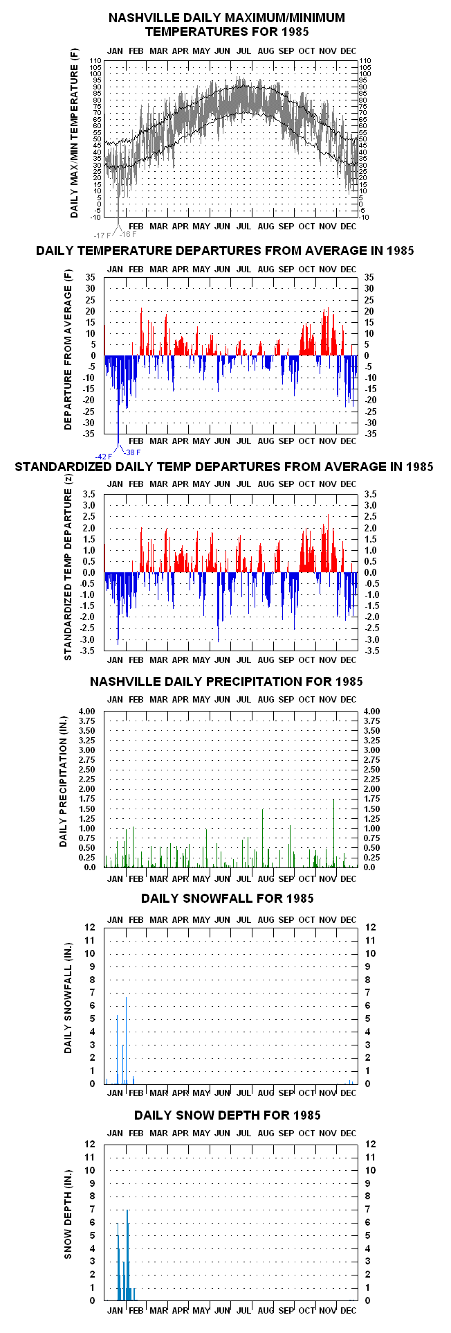
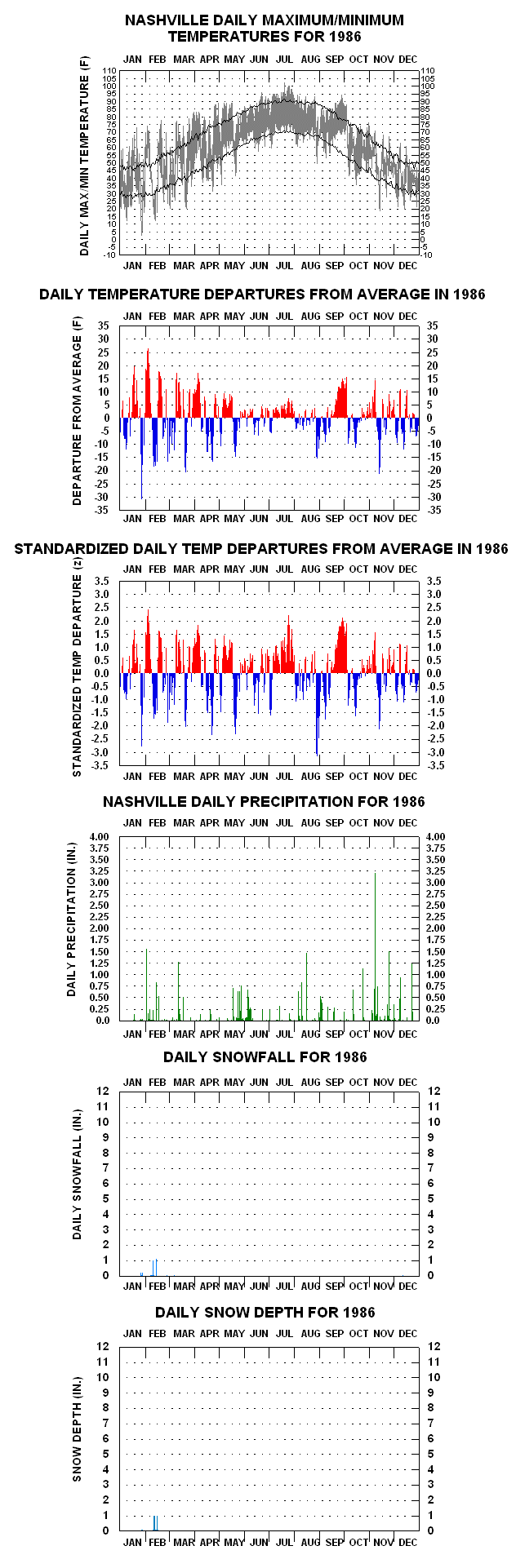
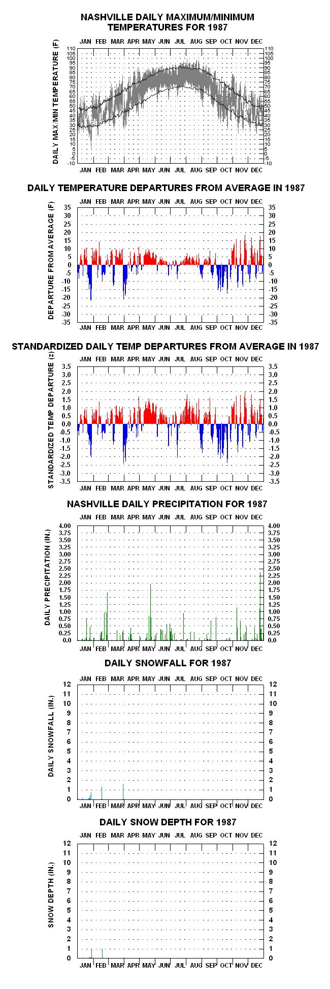
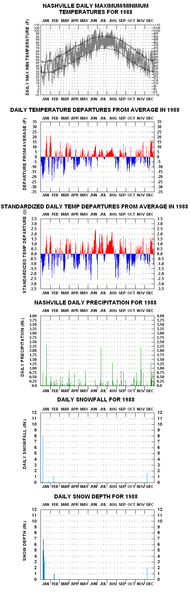
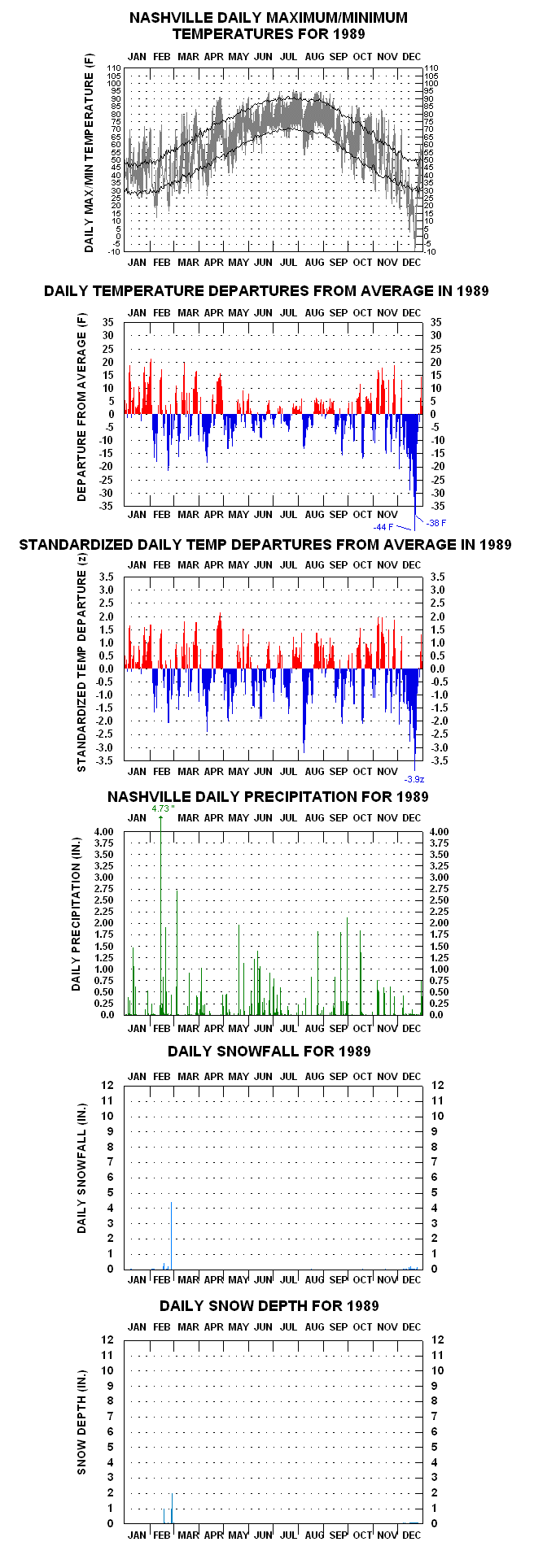
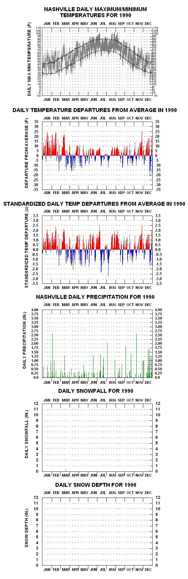
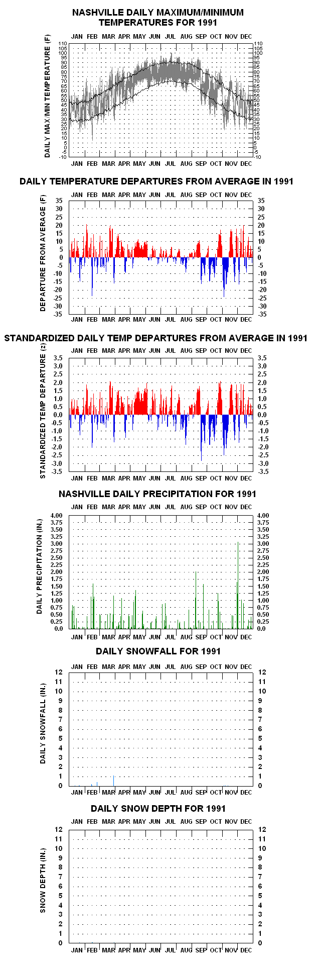
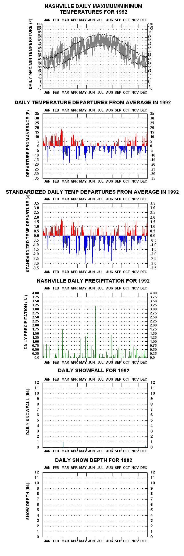
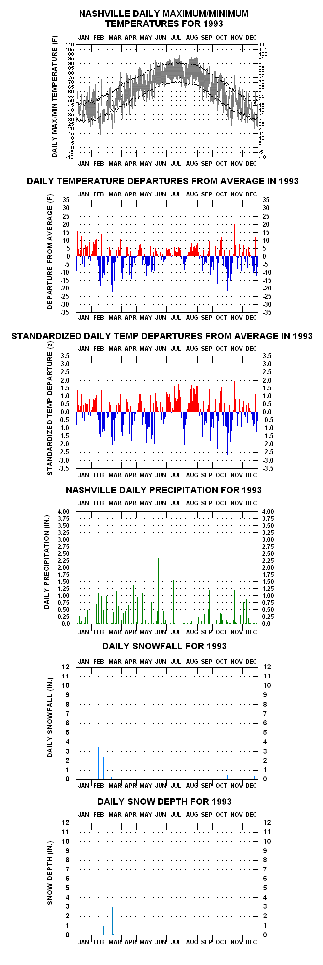
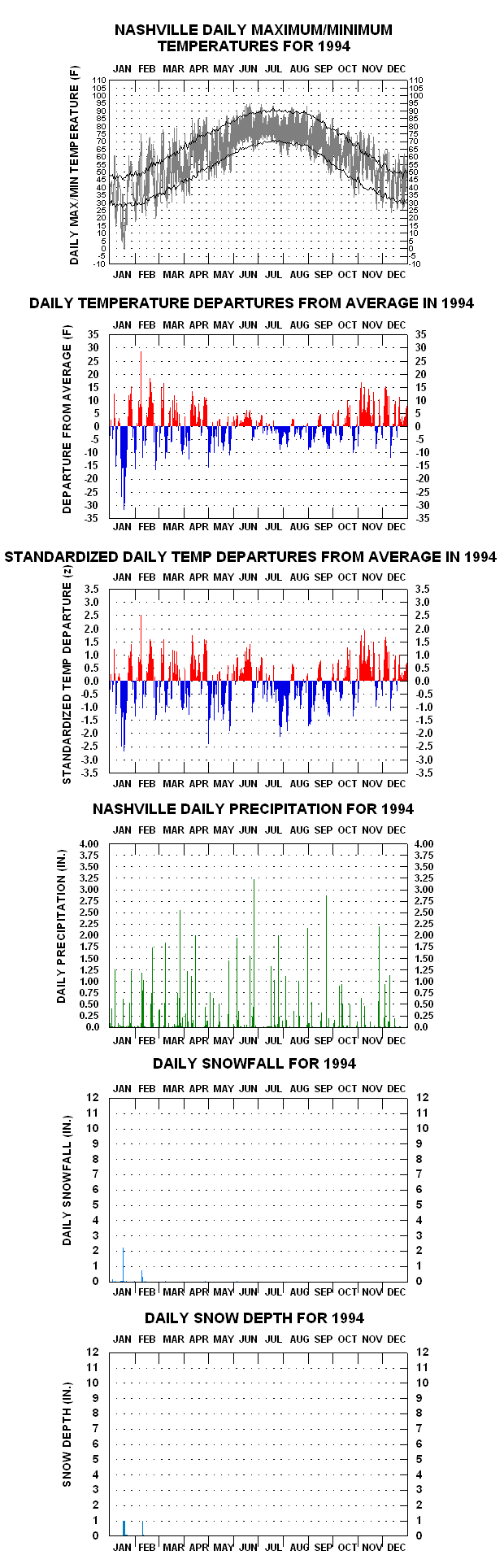
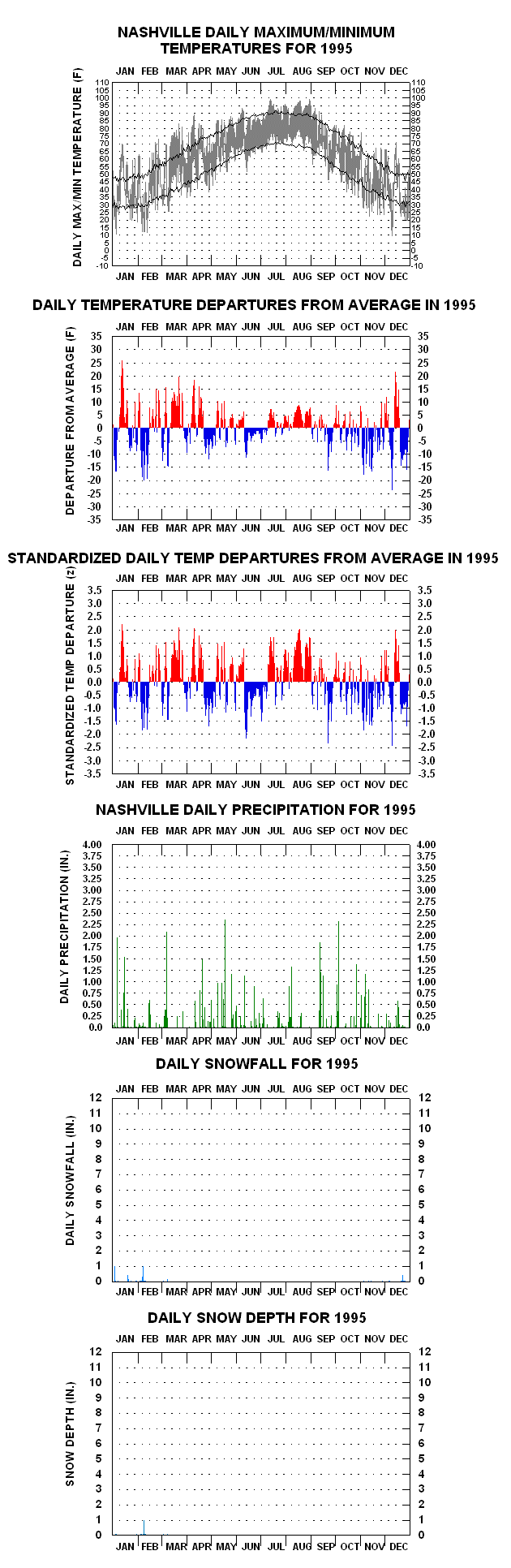
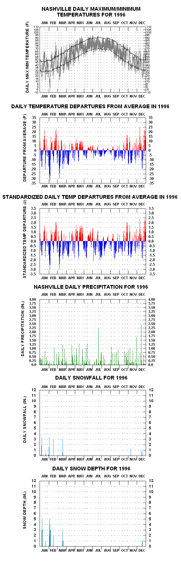
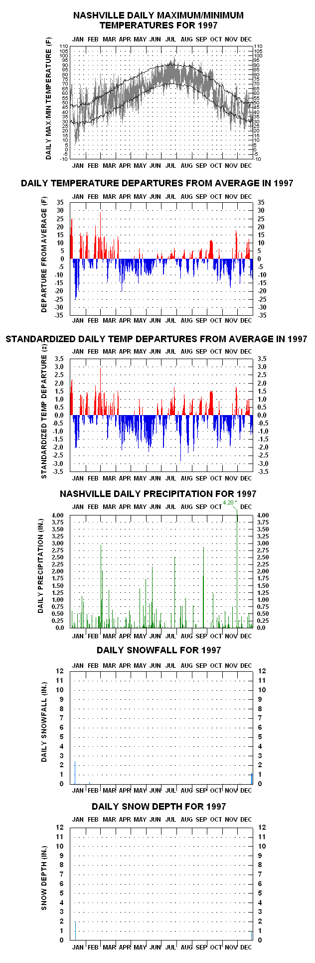
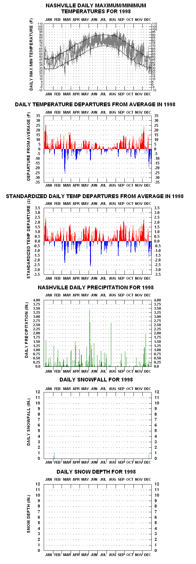
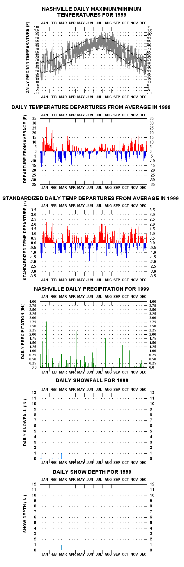
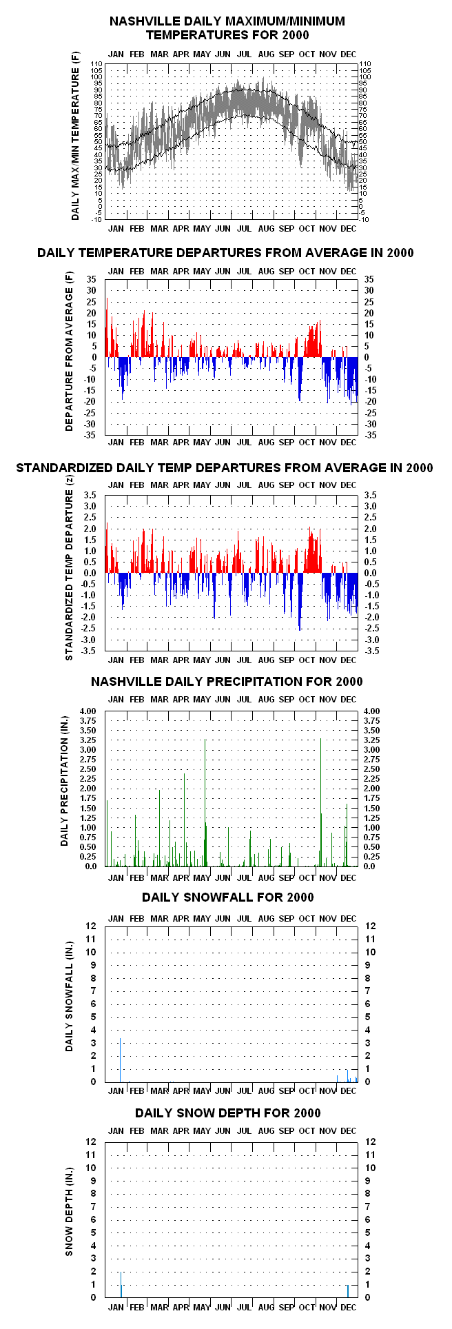
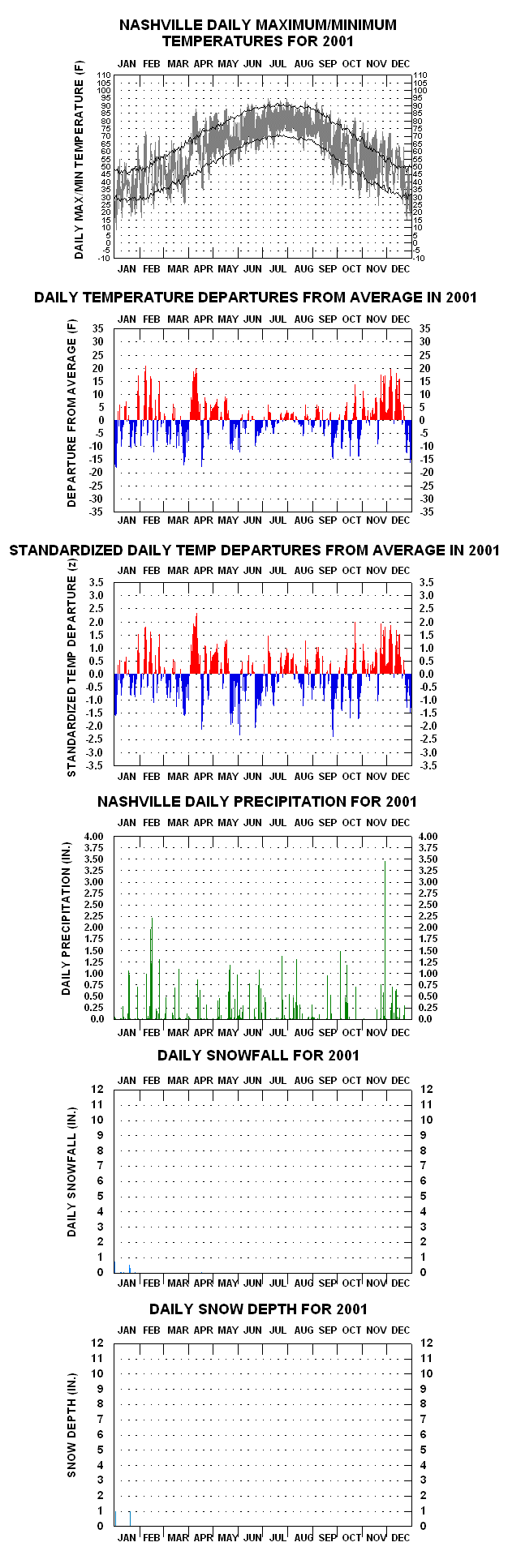
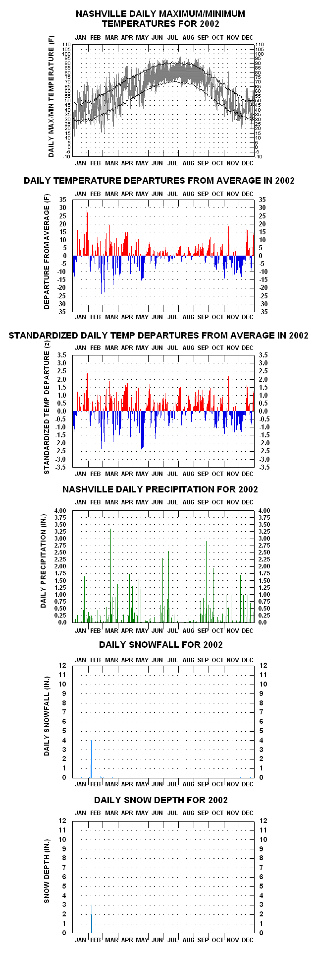
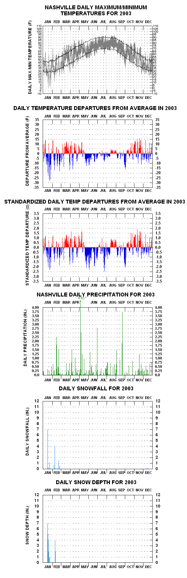
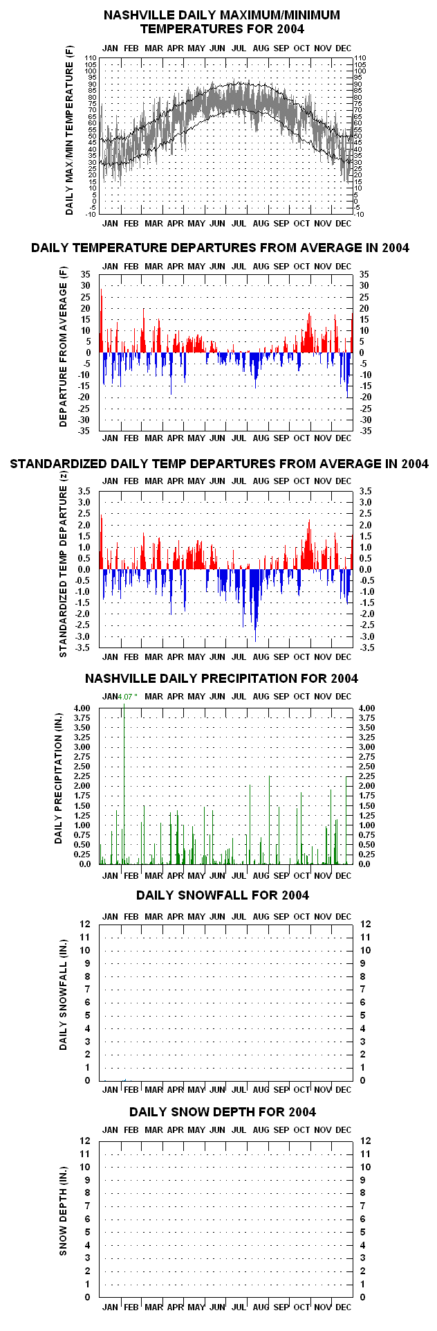
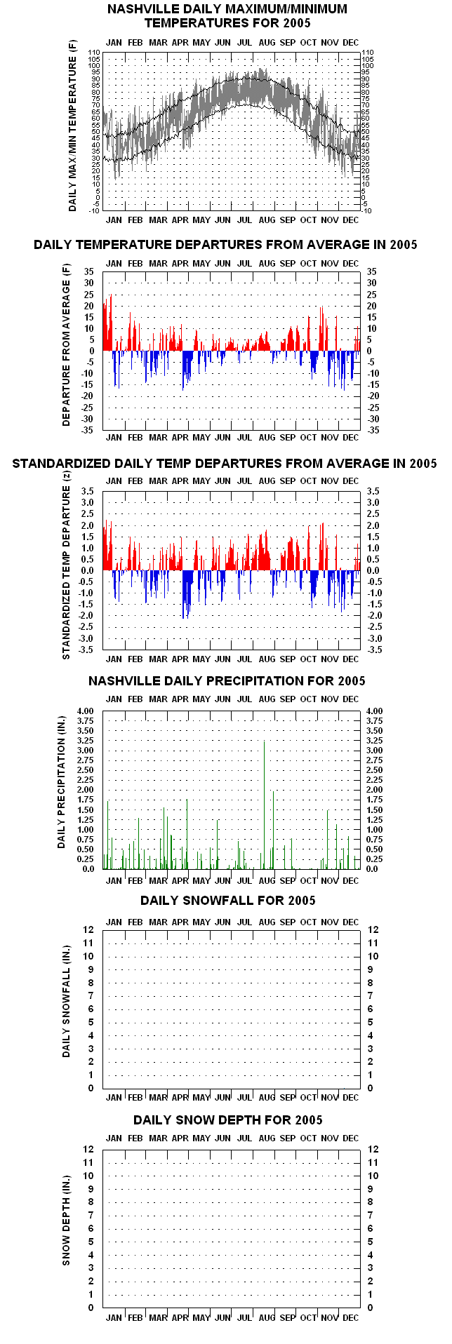
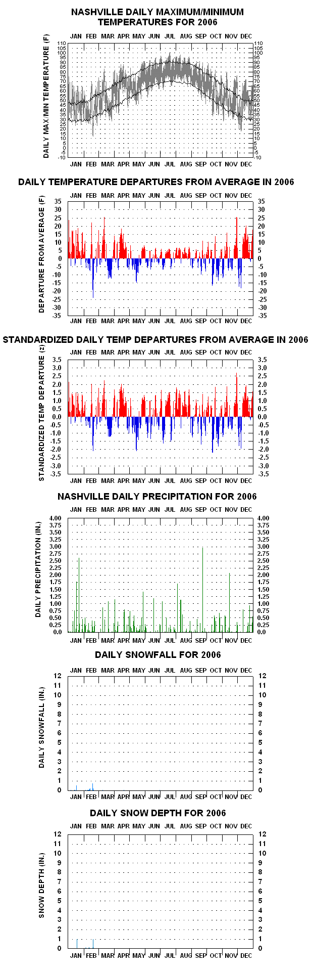
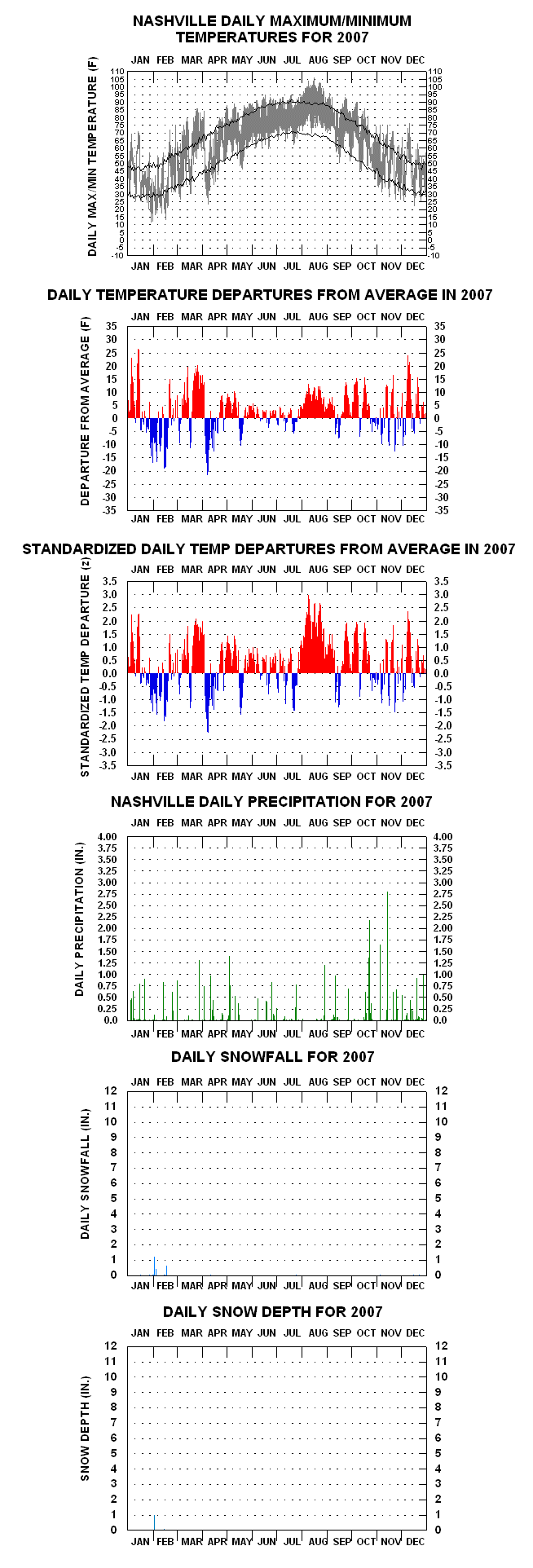
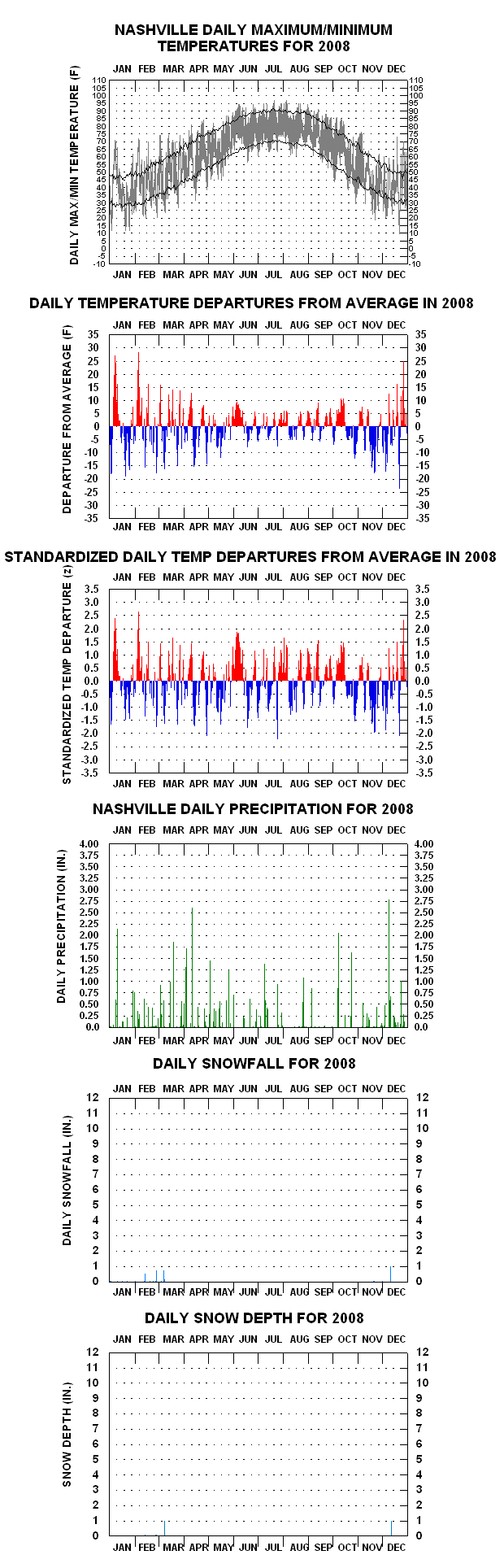
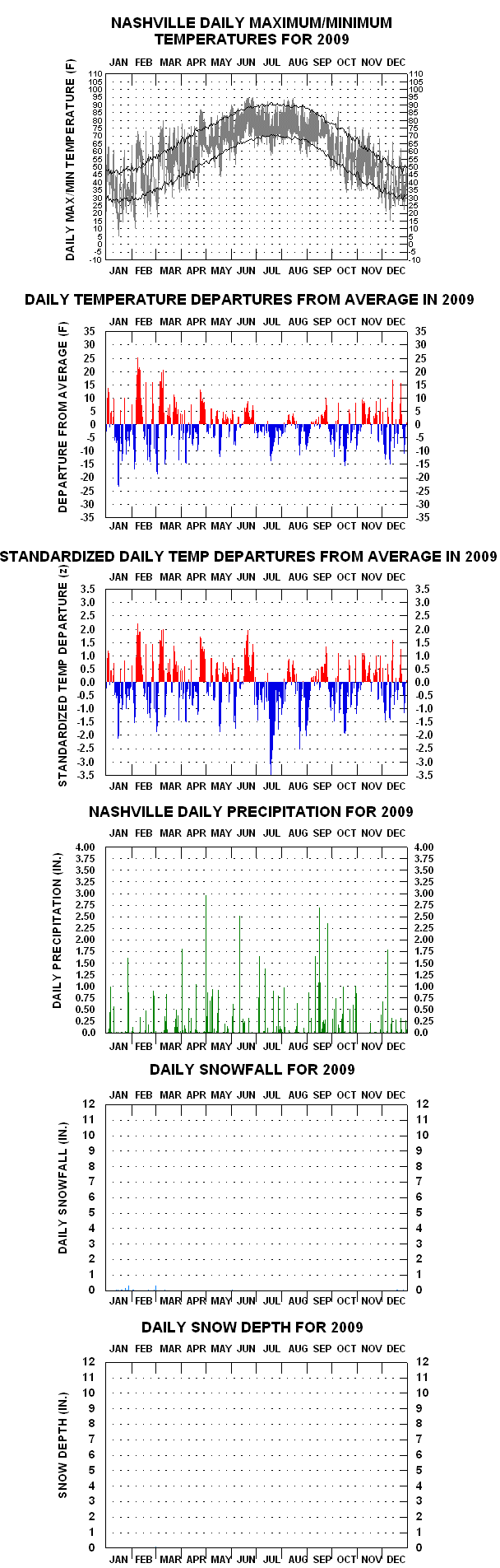
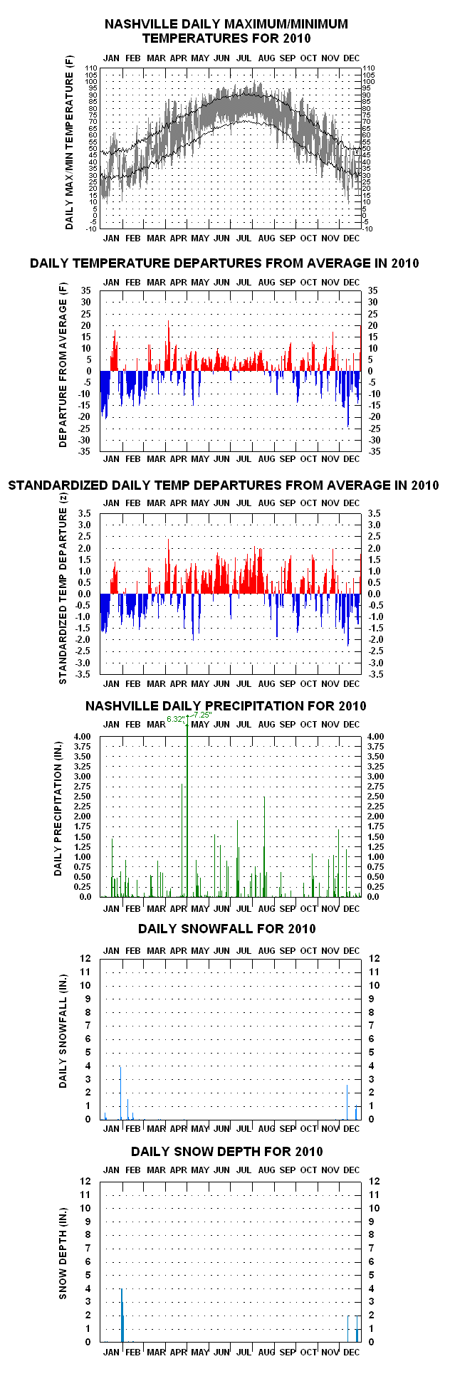
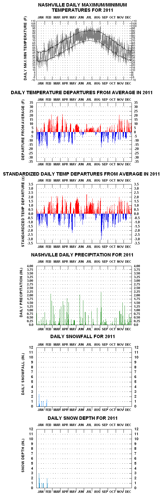
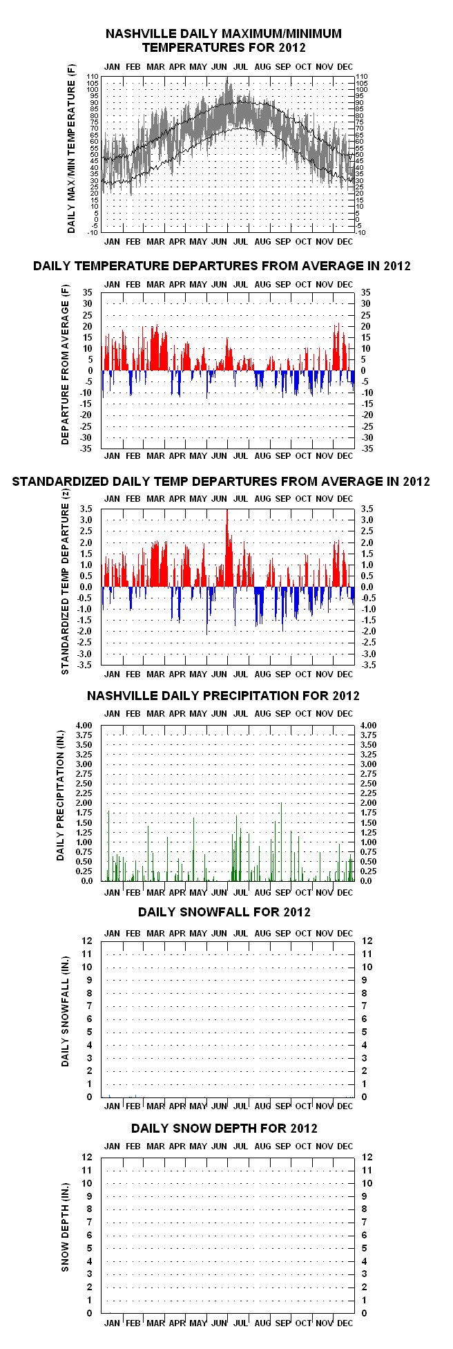
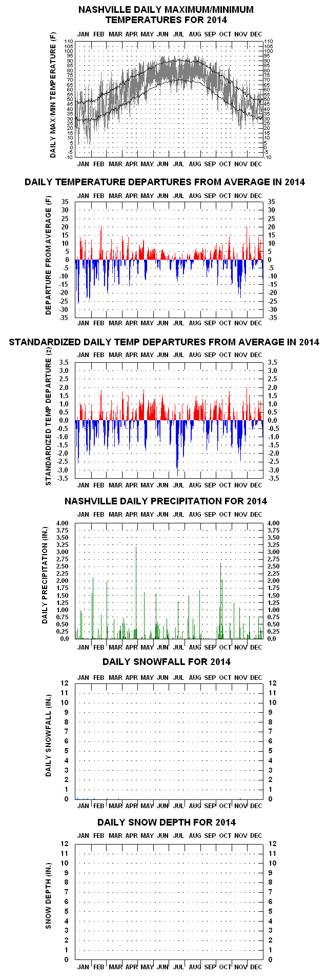
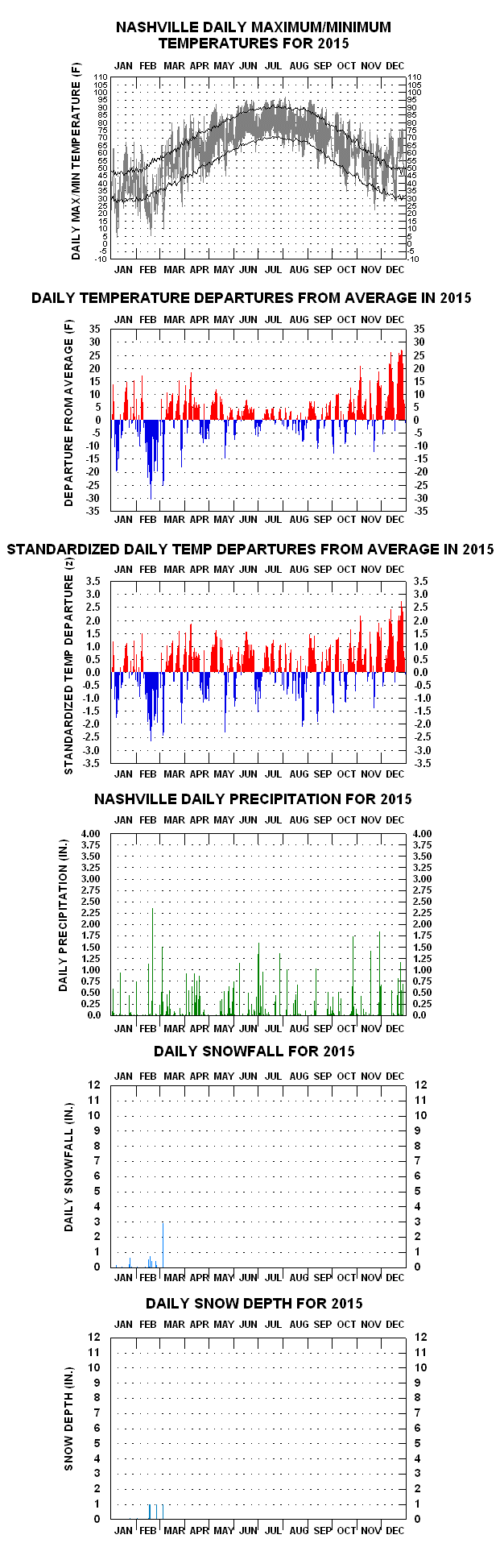
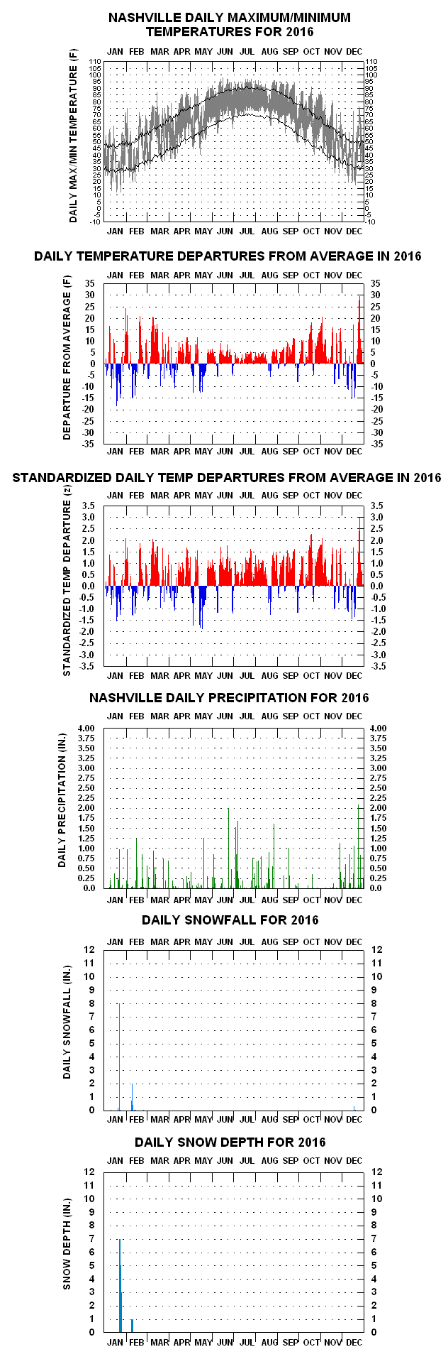
The uppermost chart for a given year’s page (accessed by the links below) are “floating-bars” of the year’s daily maxima and minima temperatures. Superimposed on the bars are two line traces, the upper one connecting long-term mean daily maxima, the lower one mean daily minima.
The bars depict the varying diurnal, synoptic, long-wave and seasonal anomaly influences on temperature over time, and for visual effect, the bars are adjoined with no spaces in-between, creating a sort of signature appearance. The same is applied on the two anomaly time-series further below.
The second chart down shows the day-to-day mean temperature anomalies (daily mean temperature less the corresponding long-term climatological mean). Vertical lines extending upward from the zero line indicate above average means for the day (colored red), those extending downward indicate below average daily means (colored blue). (Clicking on the floating-bar charts a second time after they appear on the screen will enlarge them even further).
YEAR-TO-YEAR GRAPHS – COMPLETE SET OF LINKS
1948 1949 1950 1951 1952 1953 1954 1955 1956 1957 1958 1959 1960 1961 1962 1963 1964 1965 1966 1967 1968 1969 1970 1971 1972 1973 1974 1975 1976 1977 1978 1979 1980 1981 1982 1983 1984 1985 1986 1987 1988 1989 1990 1991 1992 1993 1994 1995 1996 1997 1998 1999 2000 2001 2002 2003 2004 2005 2006 2007 2008 2009 2010 2011 2012 2013 2014 2015 2016 2017 2018 2019 2020
The third chart down shows the second chart’s anomalies in deseasonalized (“standardized”) form. Those stats of plus or minus 3.0 z represent just 0.2% of the total 1948-2021 Nashville daily means, nearly all of these (40 out of 43) negatively signed. Greatest positive departure in the record is +3.47 z for 30 June 2012, greatest negative –4.01 z for 25 November 1950.
Fourth chart down depicts daily precipitation totals, as high as 7.25 inches (2 May 2010), the fifth and sixth charts indicating daily snowfall and snow depth recordings, respectively.
LINKS TO SOME OF THE MORE INTERESTING YEAR-TO-YEAR GRAPHS, WITH ACCOMPANYING NOTES
- 1950 – Average day-to-day difference in maximum temperature (6.6 F) highest figure of 1948-present period. Daily mean temperature on 25 Nov (10 F; max: 19 F, min: 1 F) four standard deviations below average.
- 1952 – Warmest June in history (84.8 F). Warmest Summer (82.3 F) in history
- 1960 – Coldest March in history. Frequent snows in late February into March. Coldest Spring (March-May)
- 1967 – Mild January-April, Cool Summer.
- 1976 – Coldest year of 1948 to date period; coldest Summer & Fall each.
- 1977 – January coldest calendar month in history (24.4 F).
- 1978 – January-February coldest adjacent calendar month period in history (28.4 F).
- 1979 – Wettest year in history (70.12″). Frequent-snow days early.
- 1985 – Minus 17 on 21 January, coldest recorded temperature in history.
- 1988 – Average daily temperature range (23.6 F) highest in history.
- 1989 – Extreme temperature spells, both above & below average.
- 2007 – August mean temperature (86.9 F) highest of any calendar month in history.
- 2010 – May wettest calendar month in history (16.46″).
- 2012 – 109 F on 29 June, highest recorded temperature in history.
- 2015 – Quasi-periodic far above normal temperature surges late in year.
- 2016 – Warmest year in history (62.7 F) until 2023.
OTHER CLIMATOLOGICAL WEBSITES OF INTEREST
AGRICULTURAL AND METEOROLOGICAL SOFTWARE