Graphical Climatology of Las Vegas Temperatures, Precipitation, and other Variables (1937-Present)

Latest Update: 31 May 2026 e-mail contact: cjfisk@att.net
CLIMATE OVERVIEW GRAPHS
2026 Daily Temperature/Precipitation Graphs for Las Vegas – New (5/31/26)
2025 Daily Temperature/Precipitation Graph for Las Vegas – New (12/31/25)
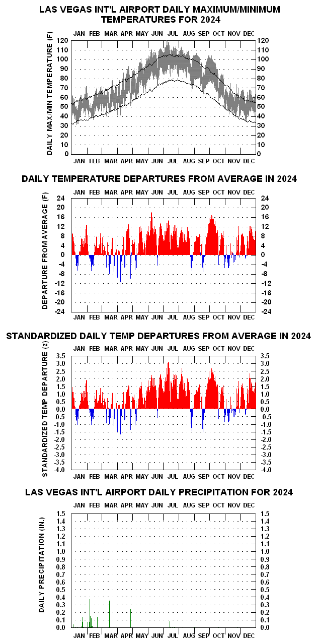
2024 Daily Temperature/Precipitation Graph for Las Vegas — Ties 2017 for Warmest in History (72.3 F).
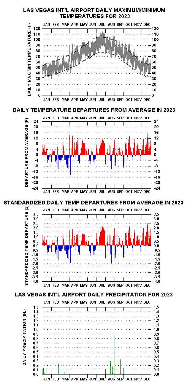
2023 Daily Temperature/Precipitation Graph for Las Vegas
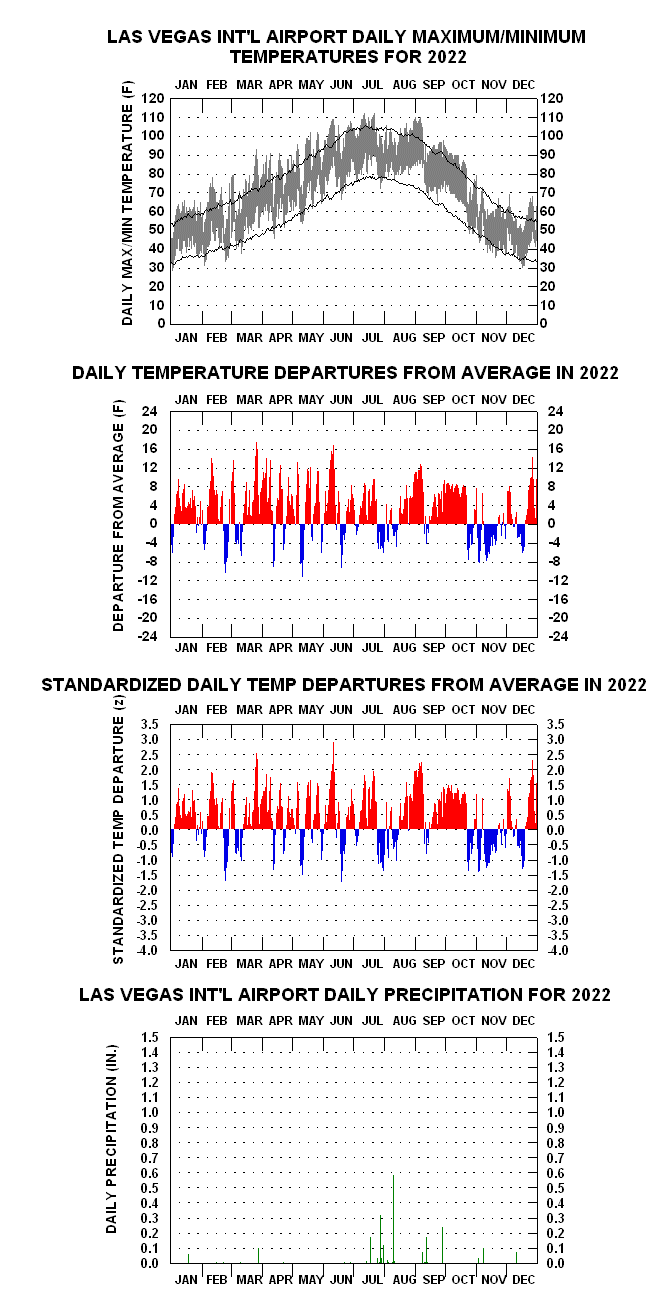
2022 Daily Temperature/Precipitation Graph for Las Vegas
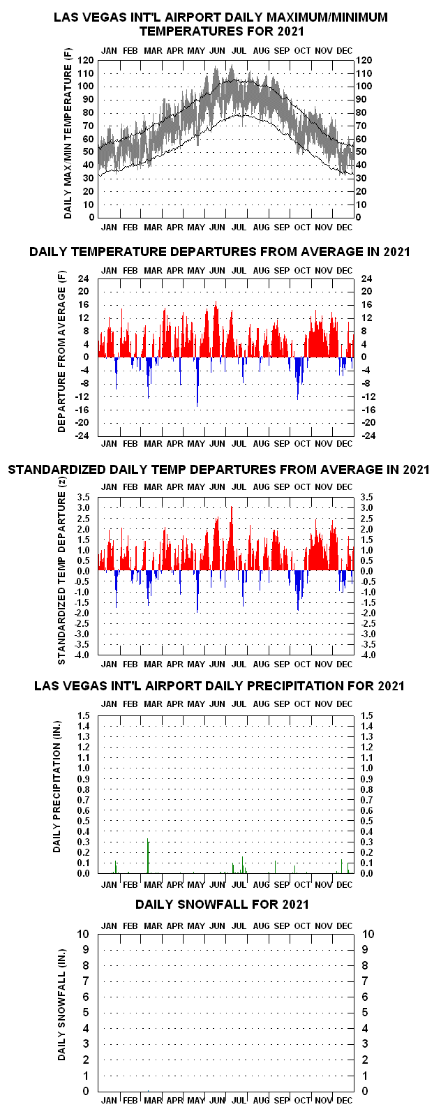
2021 Daily Temperature/Precipitation Graph for Las Vegas
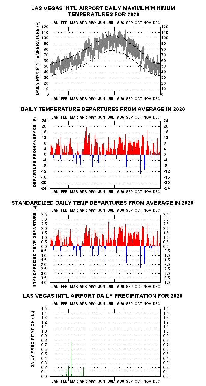
2020 Daily Temperature/Precipitation Graph for Las Vegas
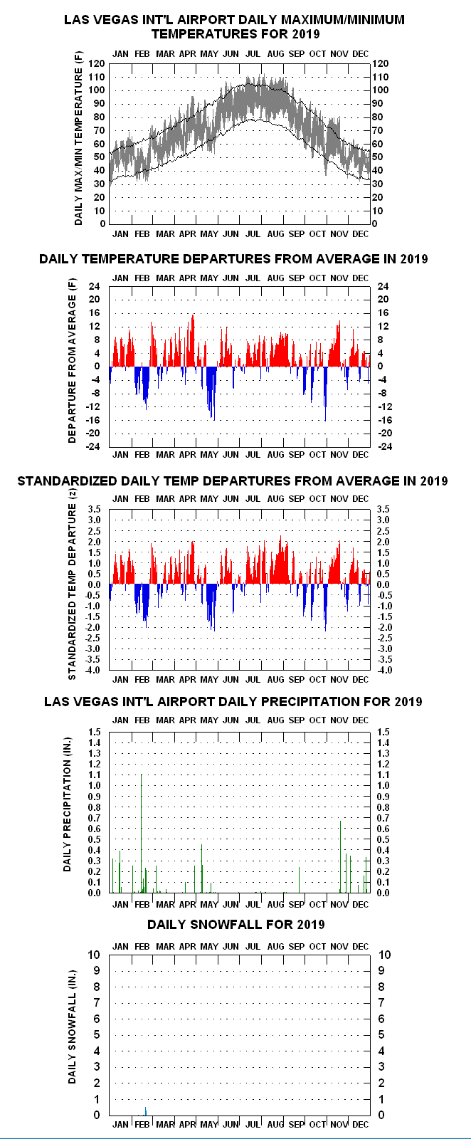
2019 Daily Temperature/Precipitation Graph for Las Vegas
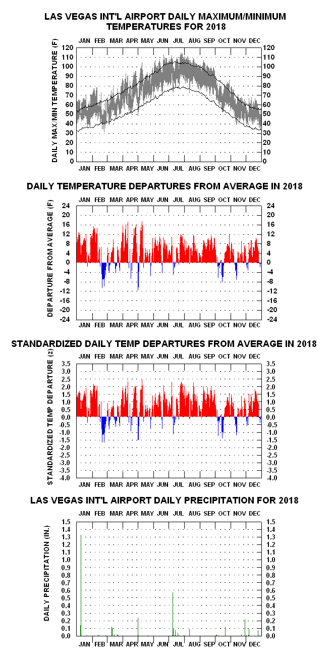
2018 Daily Temperature/Precipitation Graph for Las Vegas
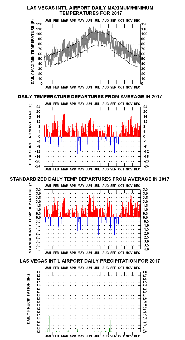
2017 Daily Temperature/Precipitation Graph for Las Vegas (Warmest in History: 72.3 F)
TEMPERATURE AND RAINFALL CLIMATOLOGIES:
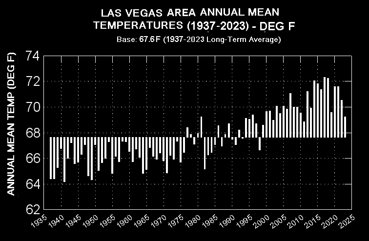
- Las Vegas Area Annual Mean Temperatures (1937-2025) New (1/8/2026)
Las Vegas Area Annual Precipitation (1937-2025) New(1/8/26) - Las Vegas Annual Maximum Temperatures (1937-2025) New (1/8/26)
- Las Vegas Annual Minimum Temperatures (1937-2025) New (1/8/26)
HOUR BY MONTH CLIMOGRAMS & OTHER CHARTS:
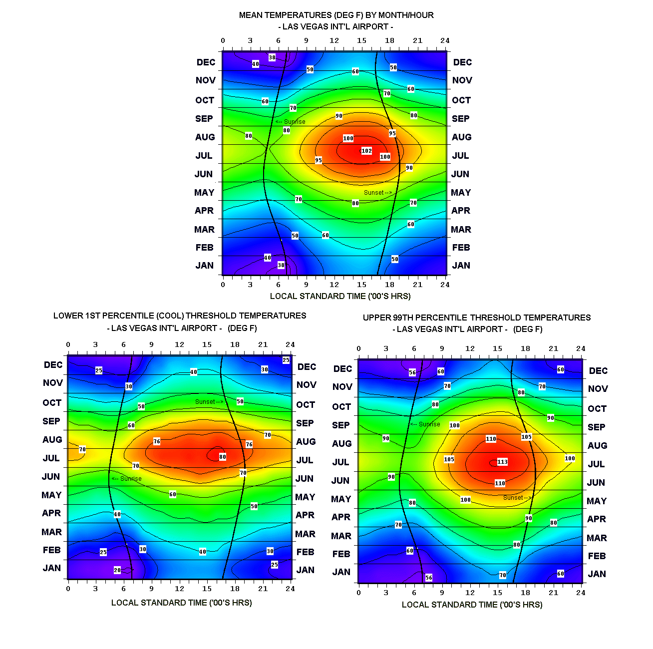
- Las Vegas Mean, Lower 1st Percentile, and Upper 99th Percentile Temperatures
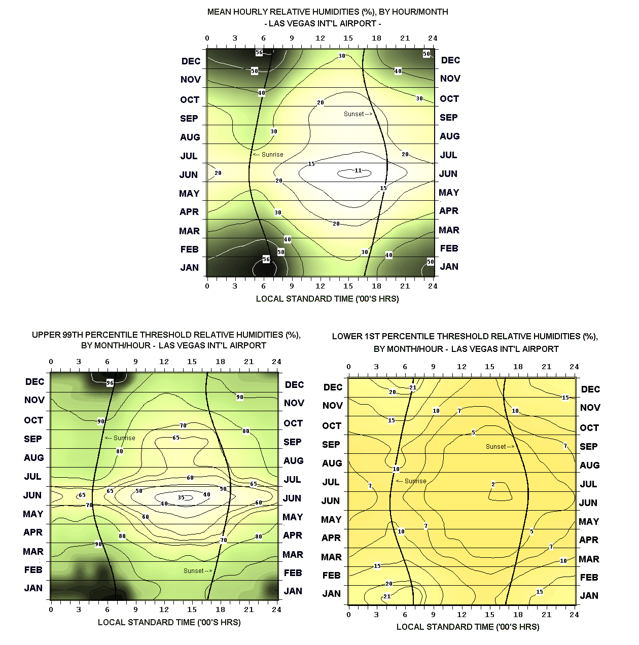
- Las Vegas Mean, Upper 99th Percentile, and Lower 1st Percentile Relative Humidities
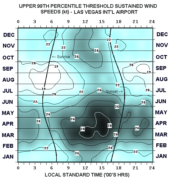
- Las Vegas Upper 99th Percentile Sustained Wind Speeds
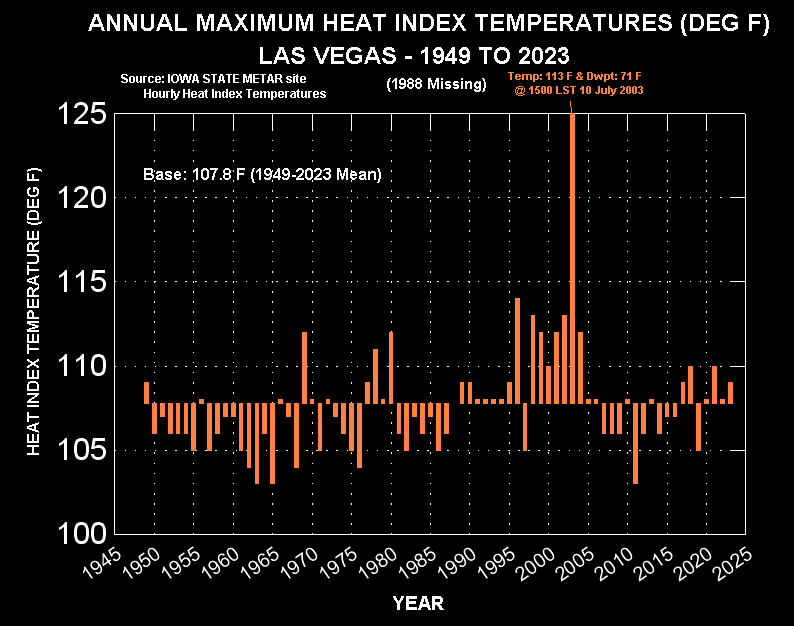
- Las Vegas Annual Highest Heat Index Temperatures (1949-2023)
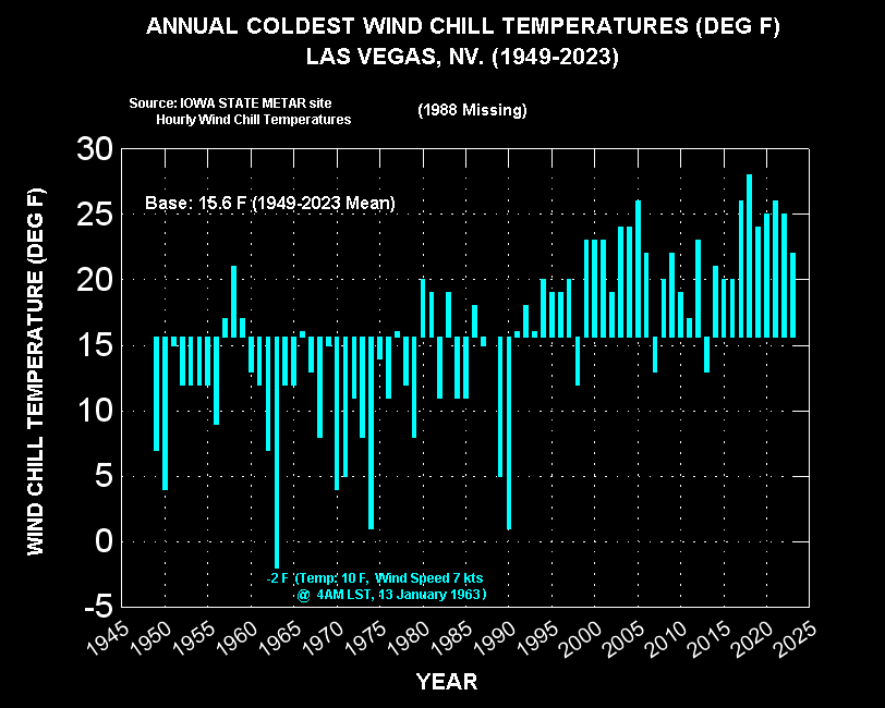
- Las Vegas Annual Coldest Wind Chill Temperatures (1949-2023) –
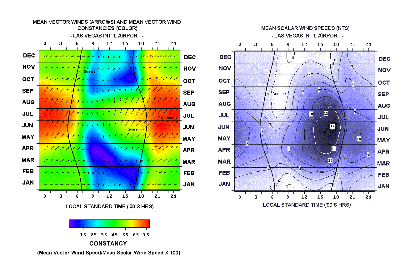
- Las Vegas Winds (Mean Vector Winds, Mean Speeds)
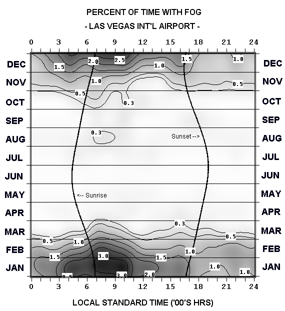
- Las Vegas Fog Incidence
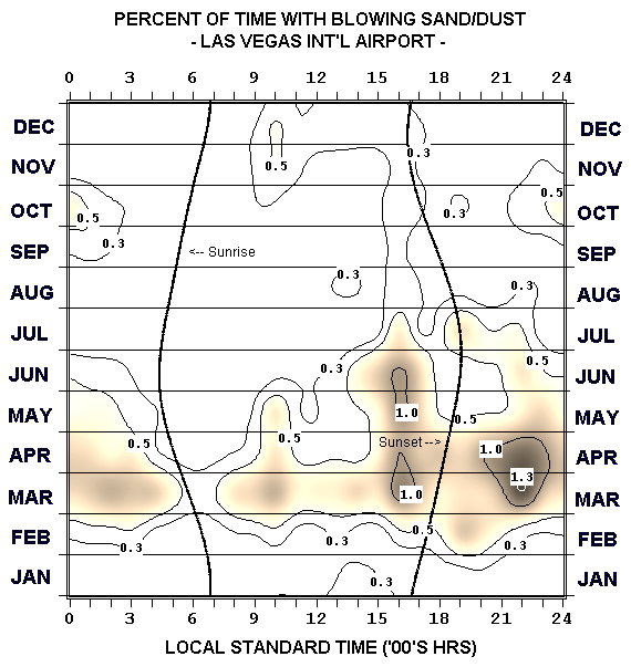
- Las Vegas Blowing Sand/Dust Incidence
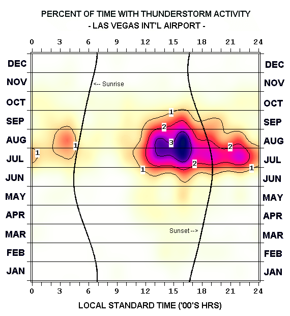
- Las Vegas Thunderstorm Incidence
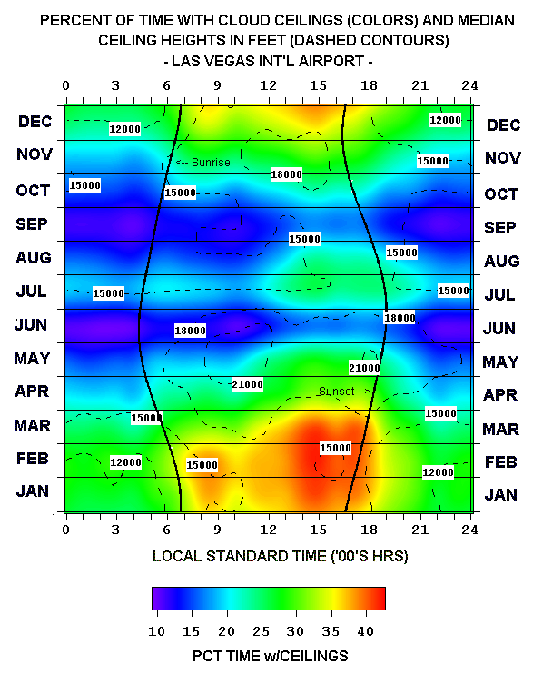
- Las Vegas Percent Frequencies with Cloud Ceilings & Median Ceilings’ Heights
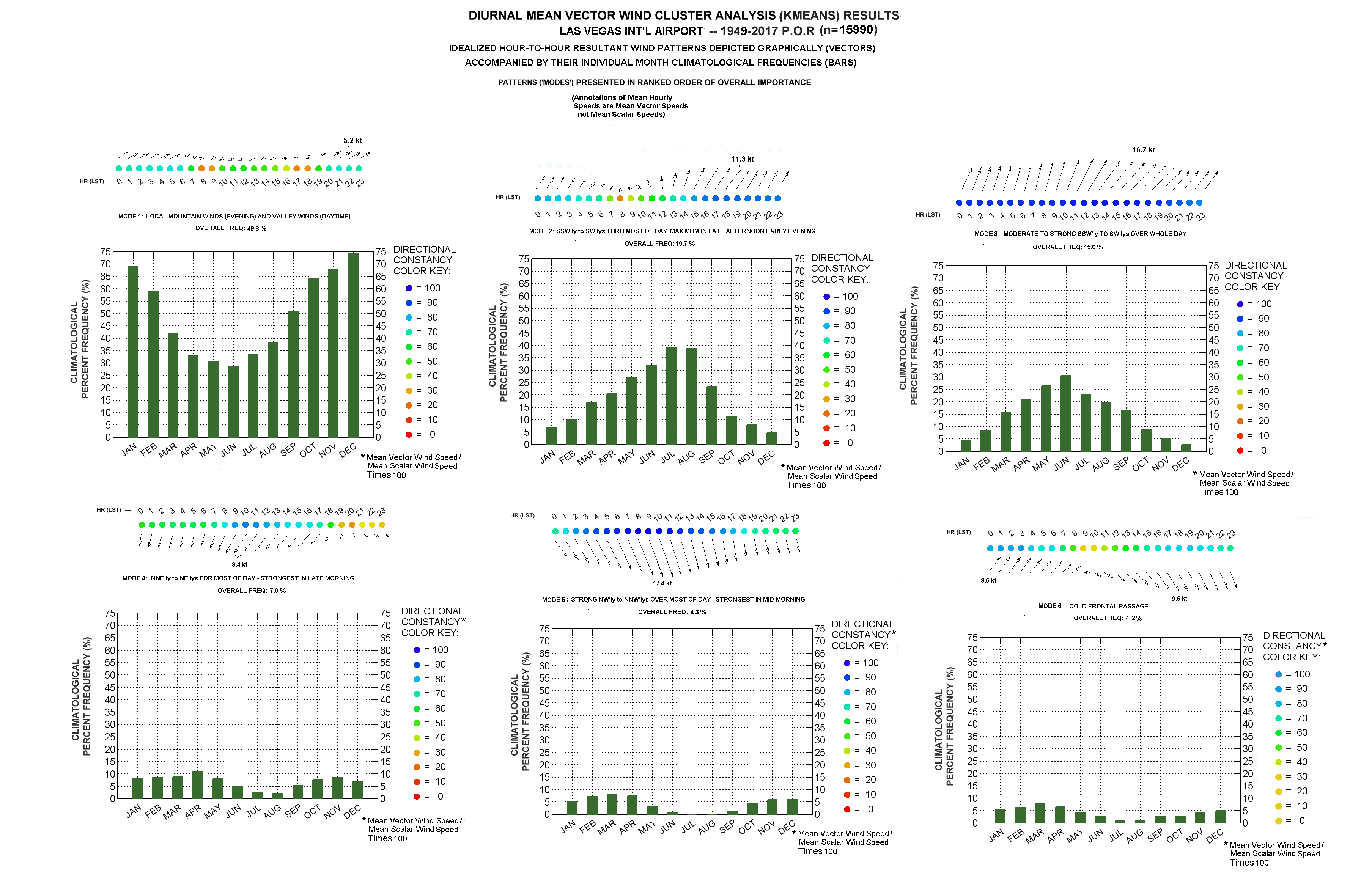
- K-Means Cluster Analysis of Las Vegas Midnight-to-Midnight Resultant Wind Patterns
YEAR-TO-YEAR GRAPHS:
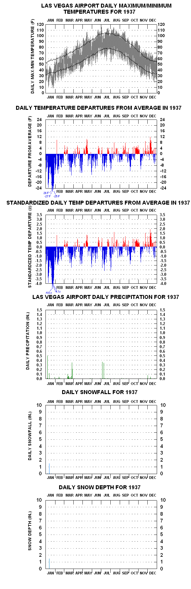
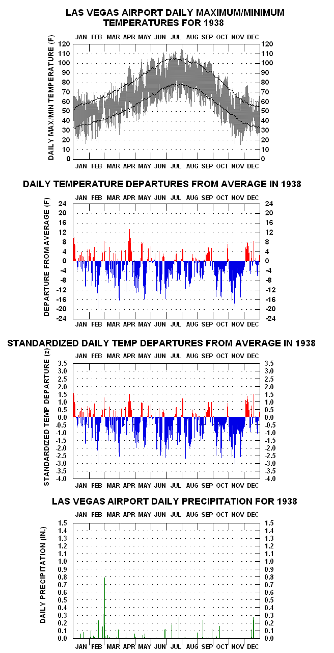
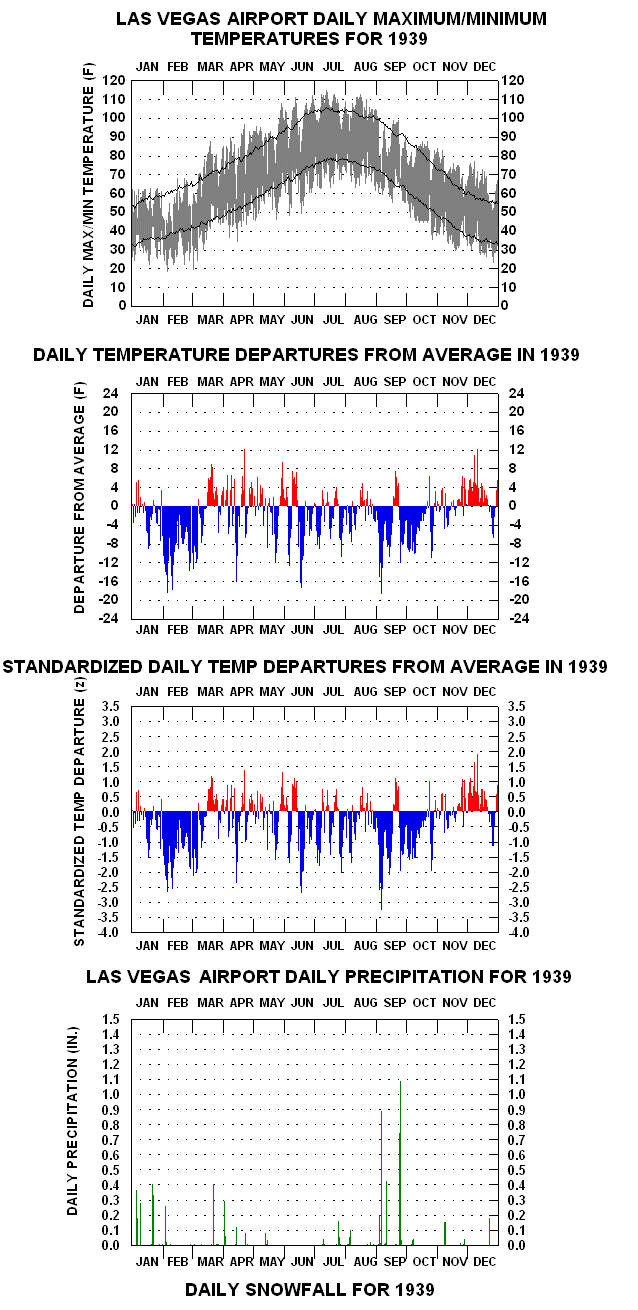
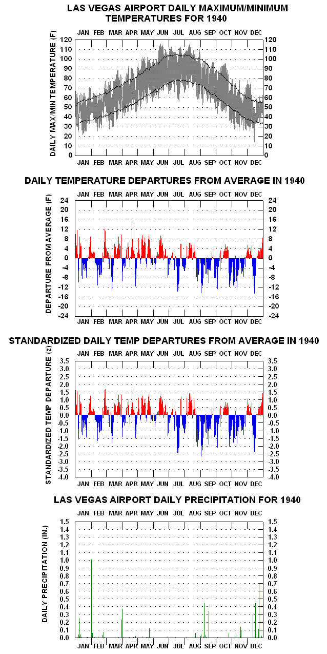
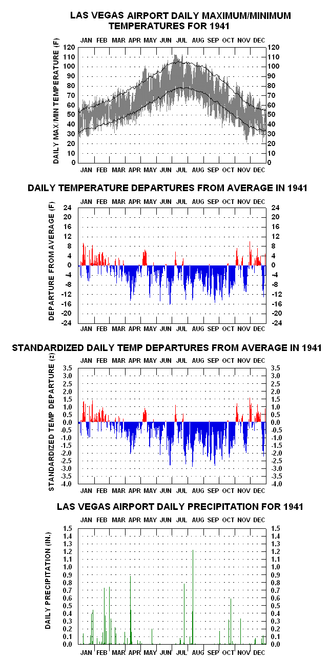
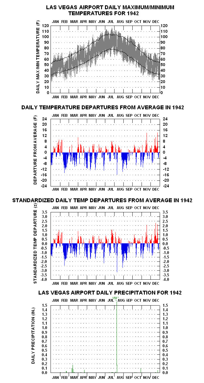
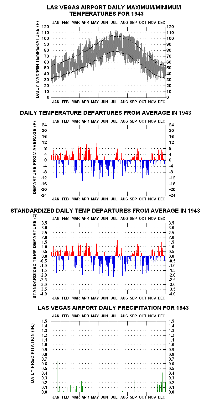
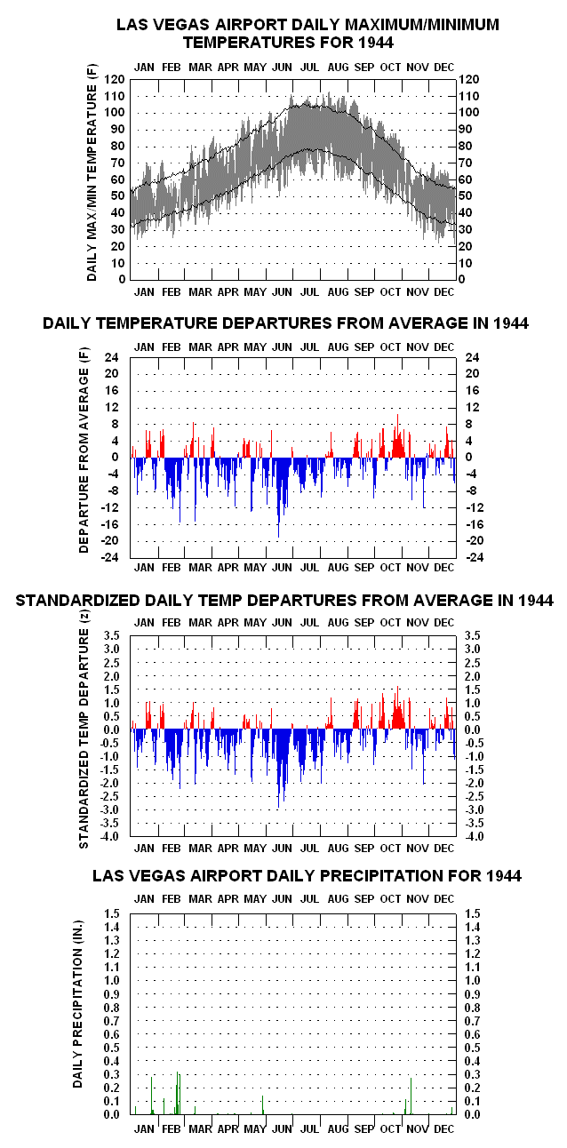
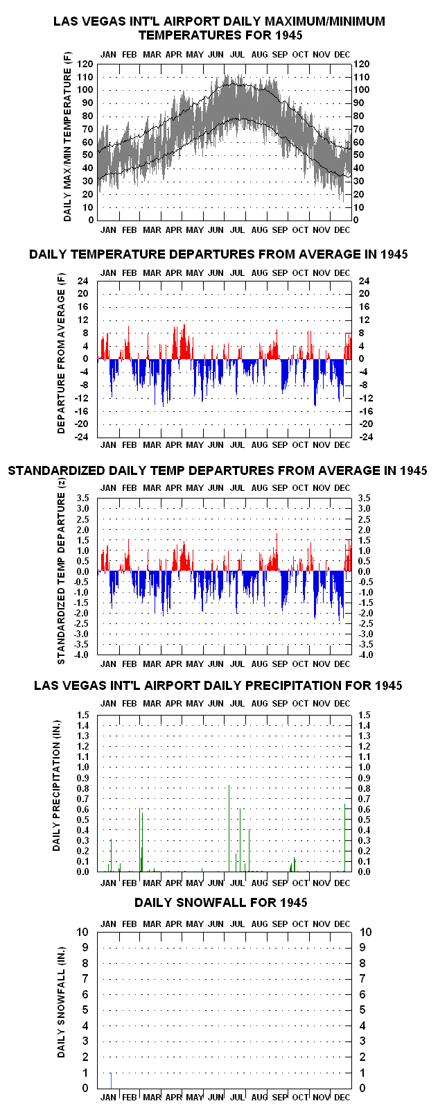
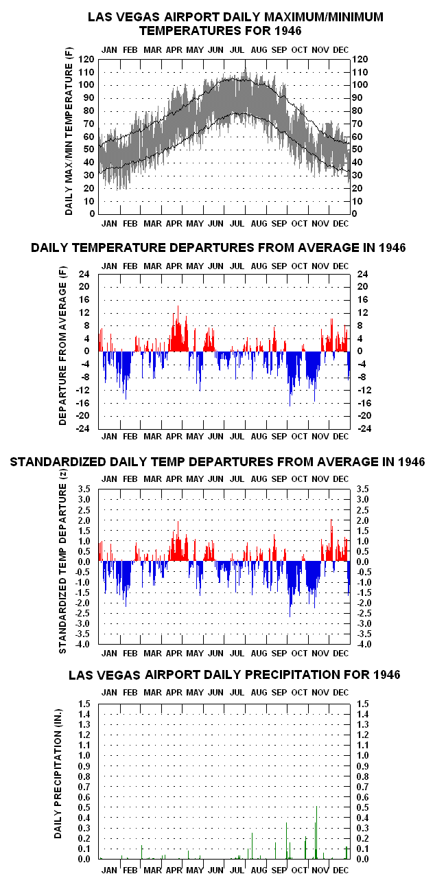
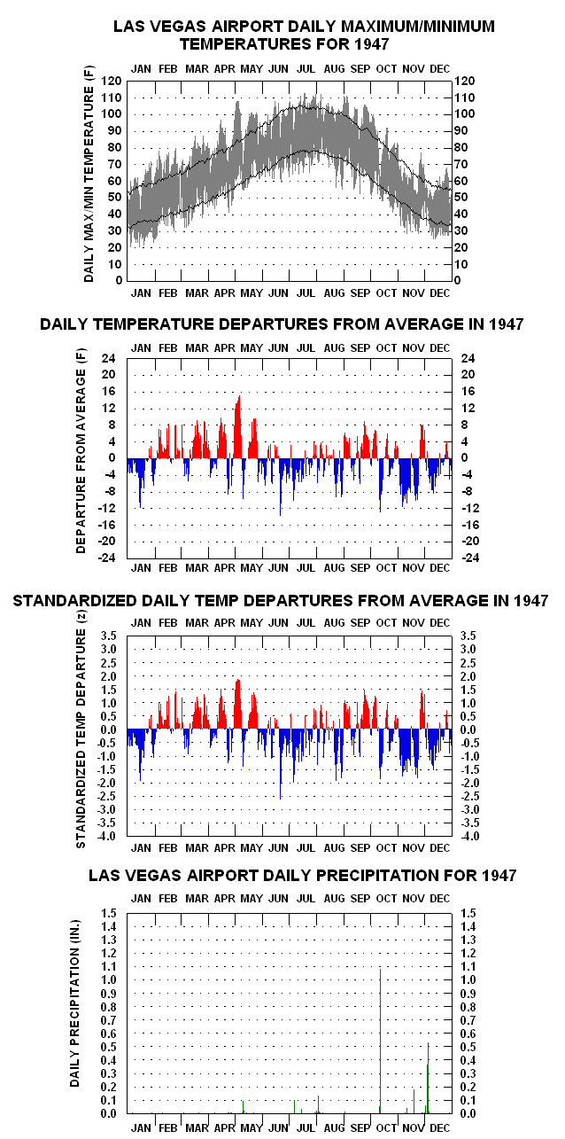
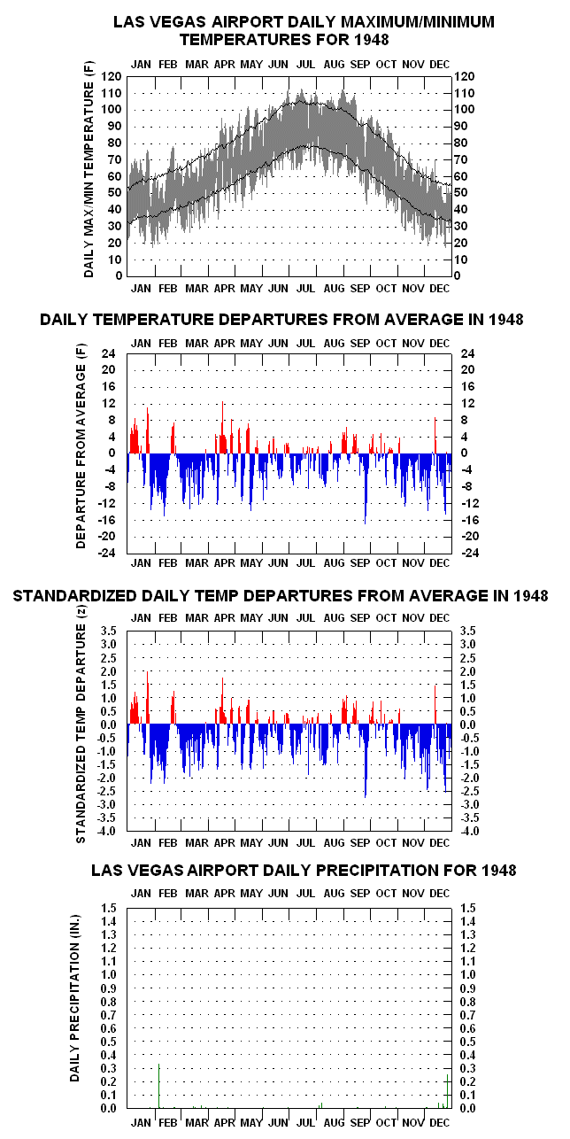
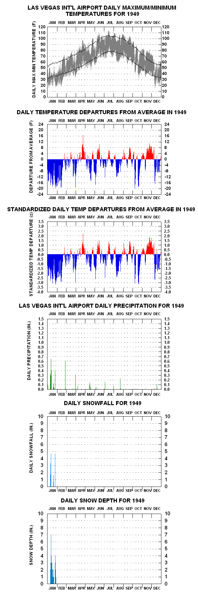
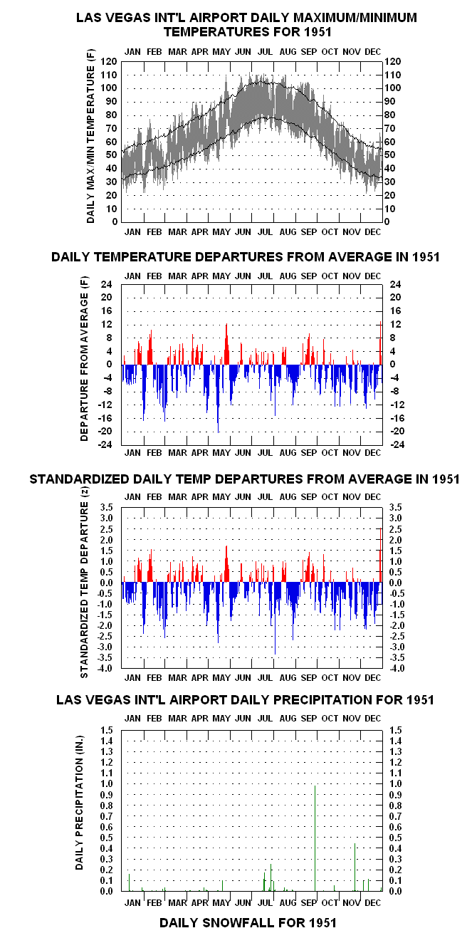
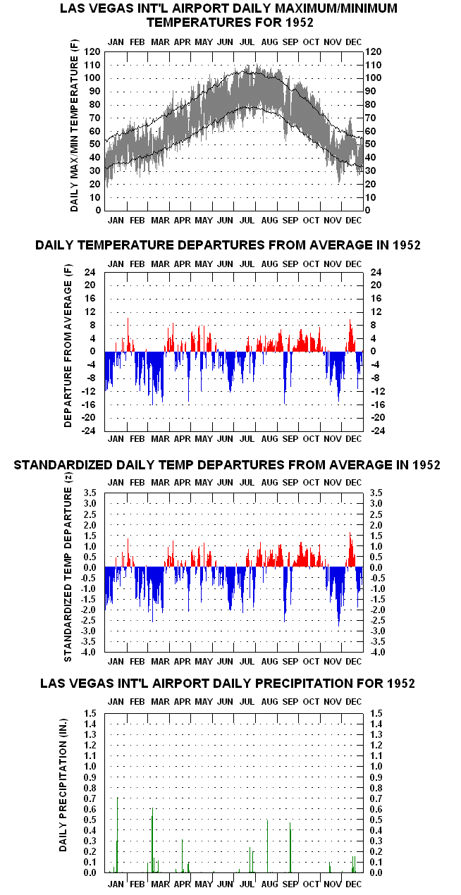
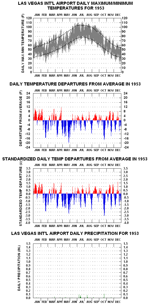
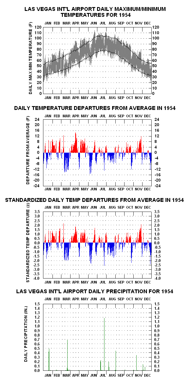
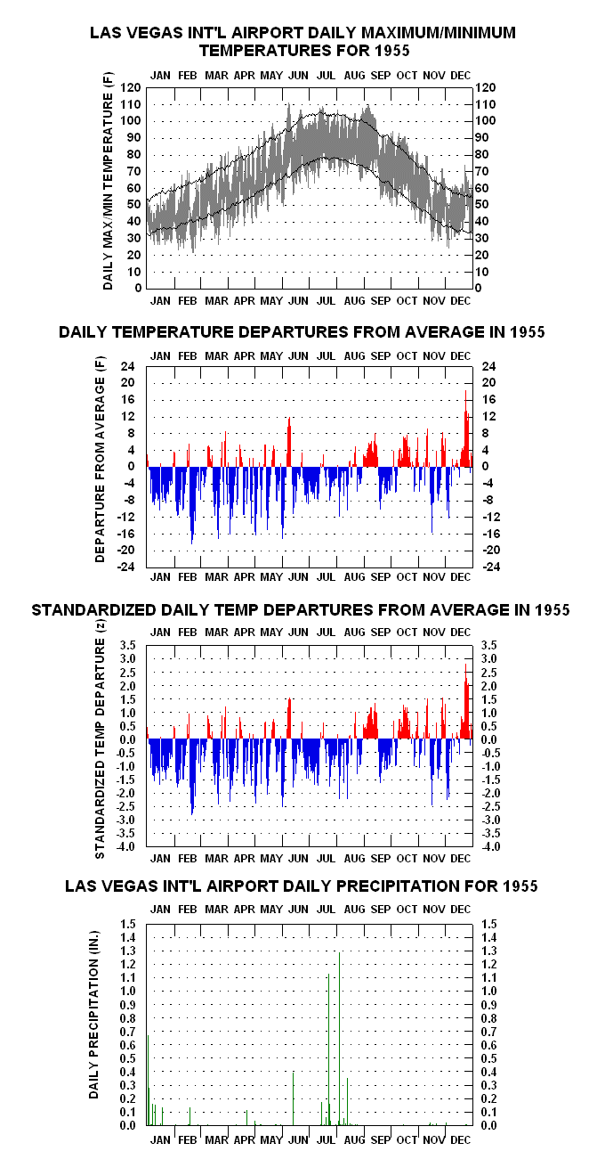
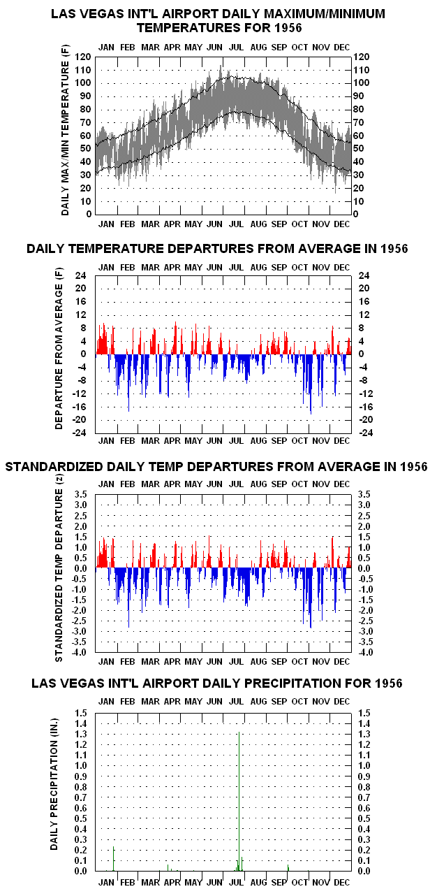
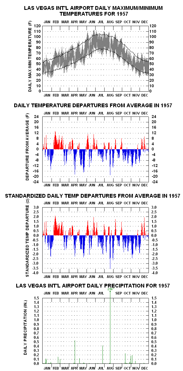
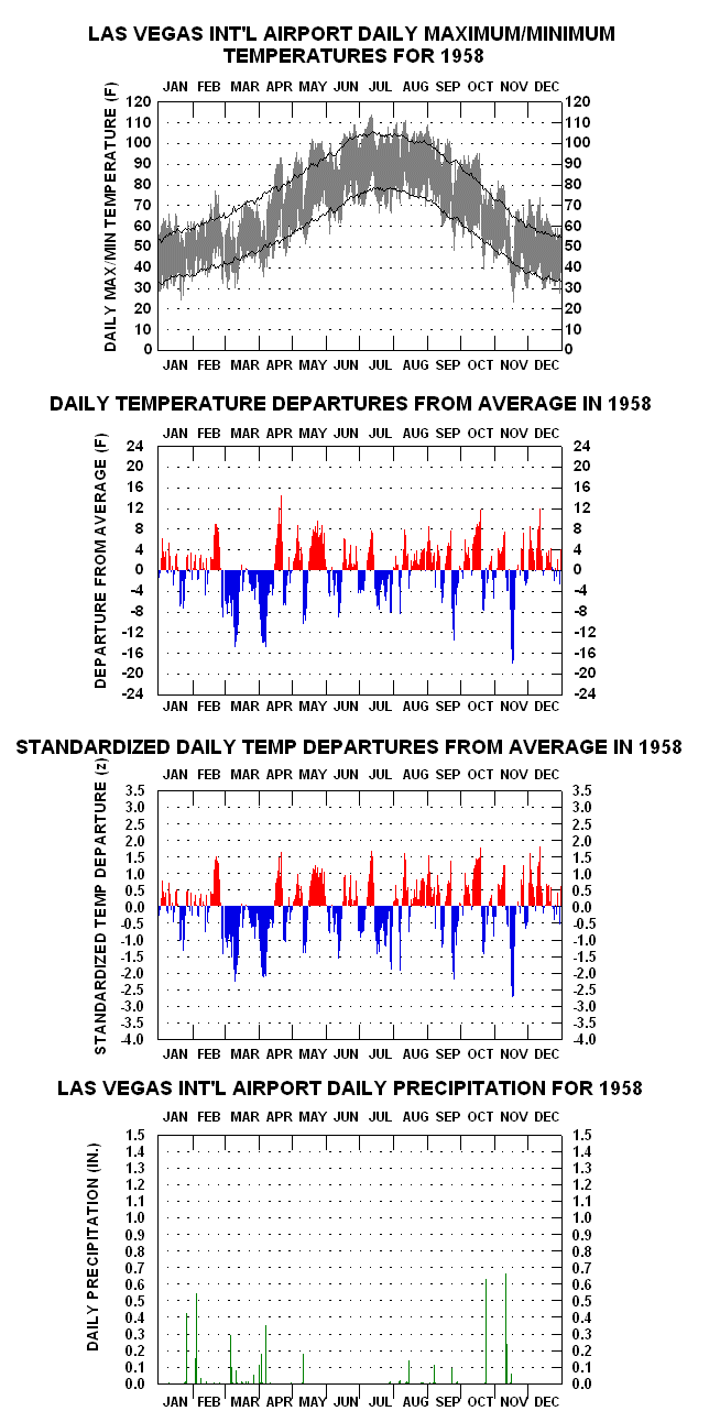
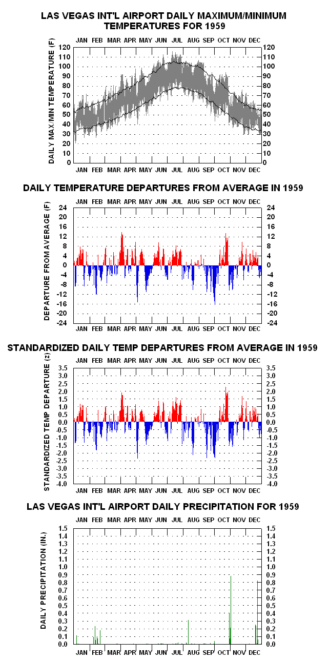
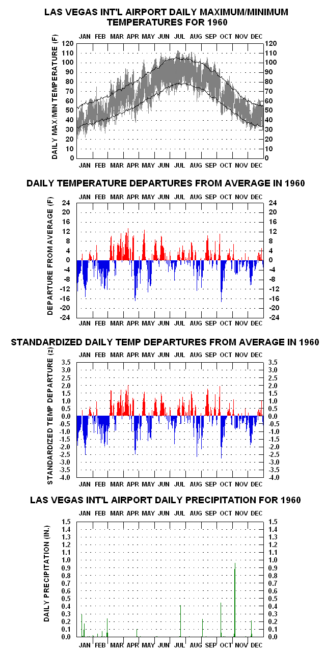
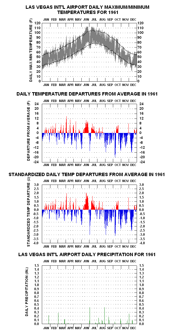
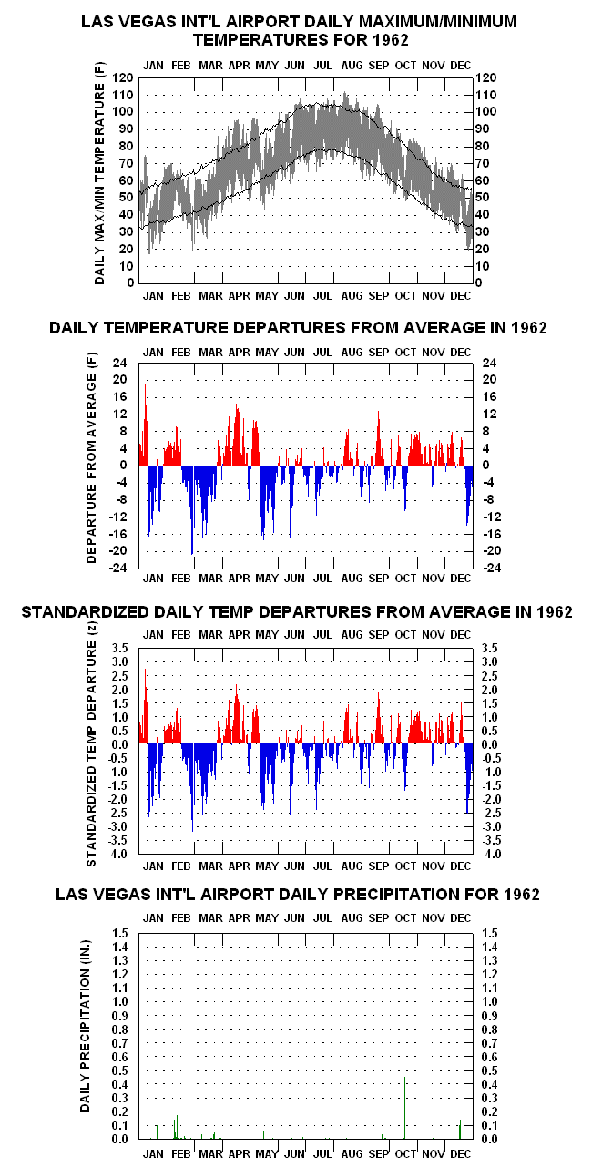
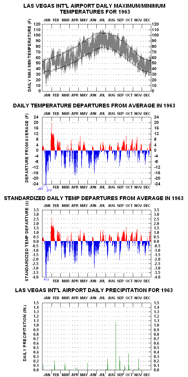
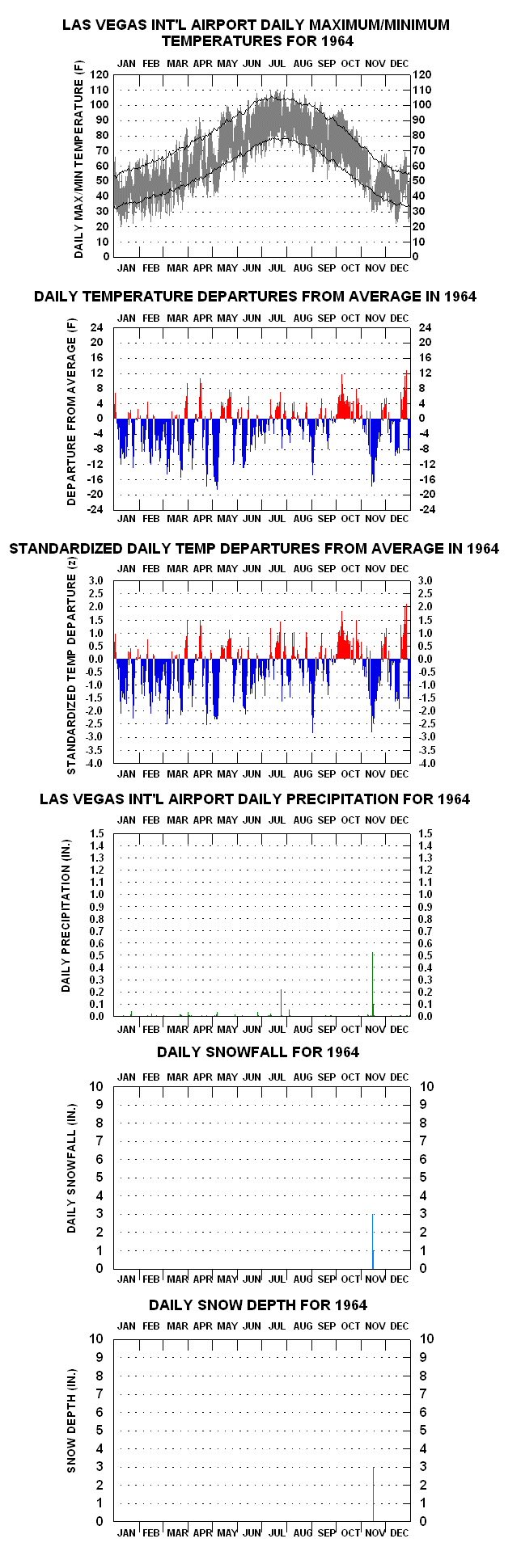
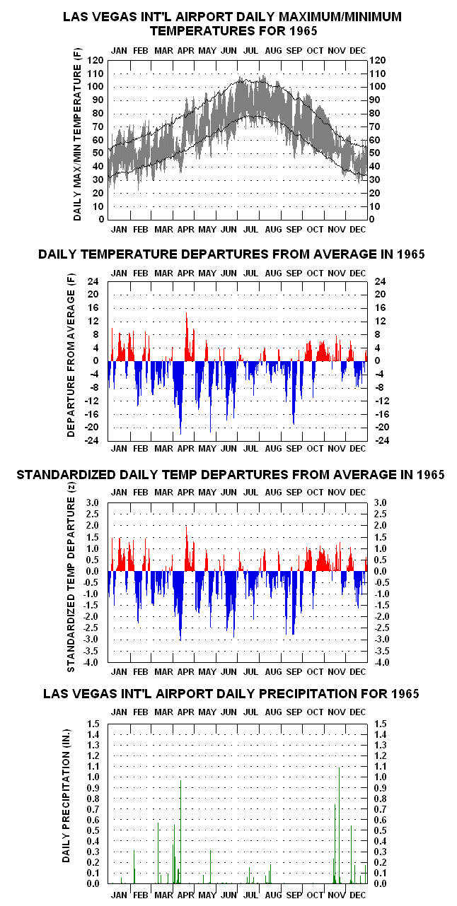
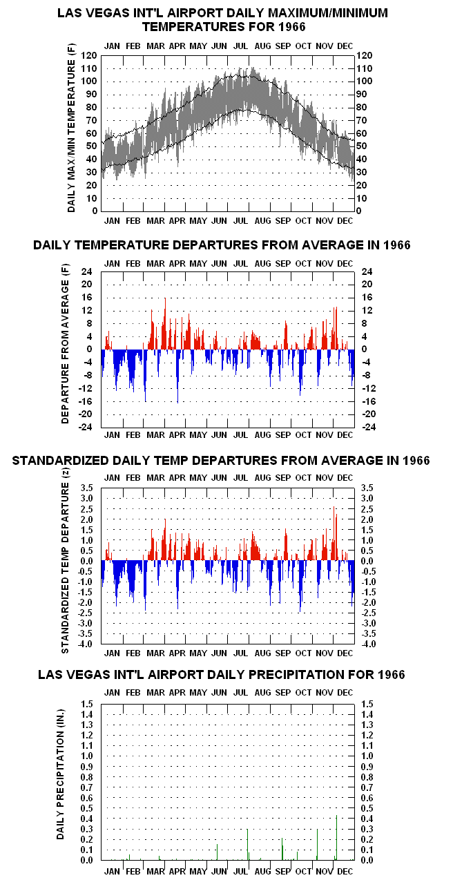
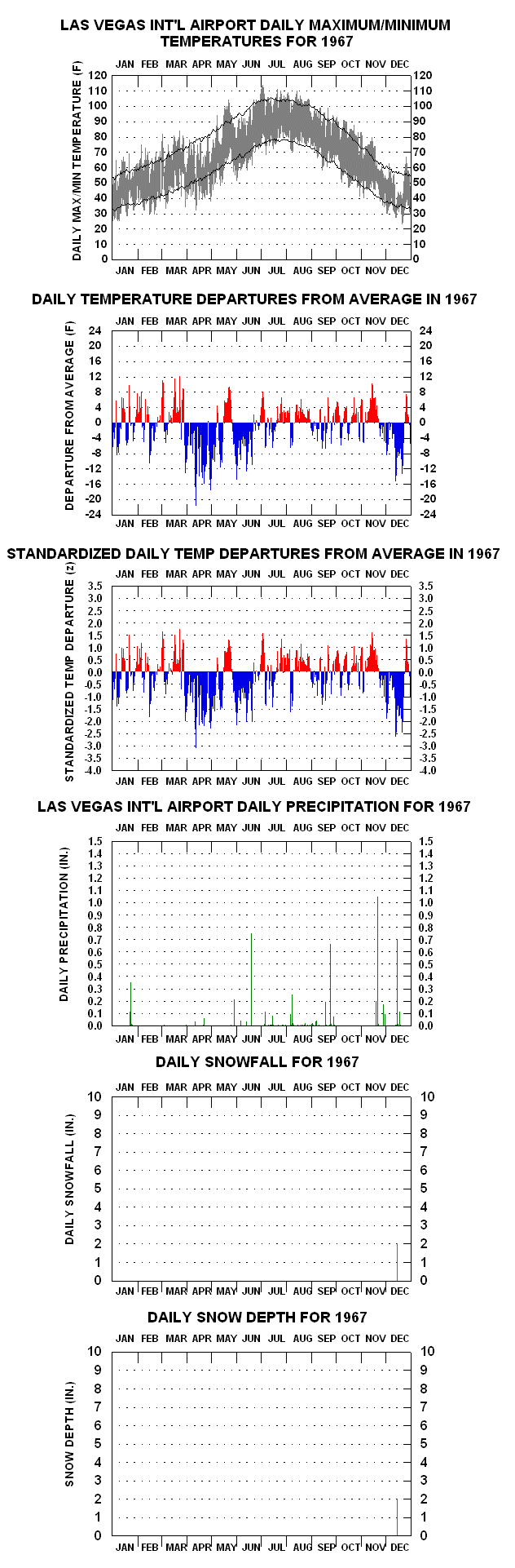
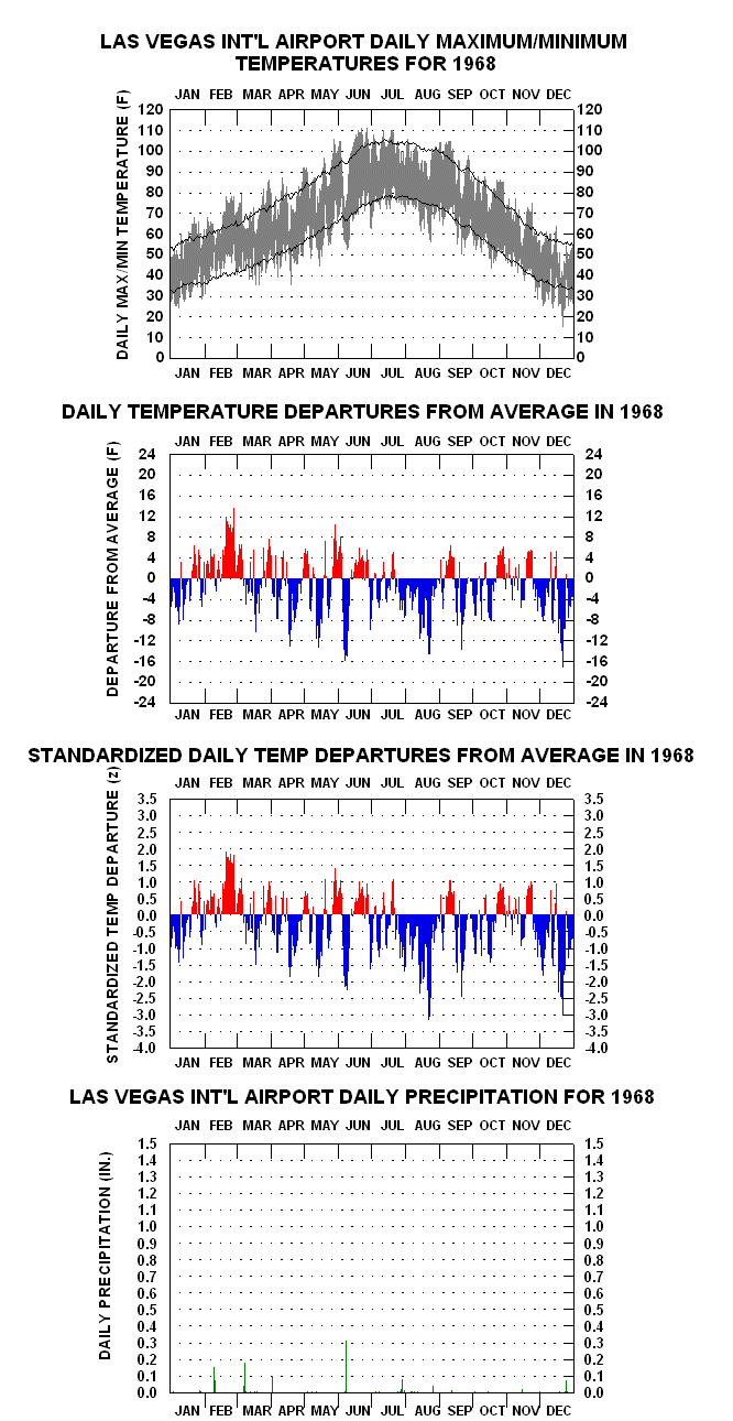
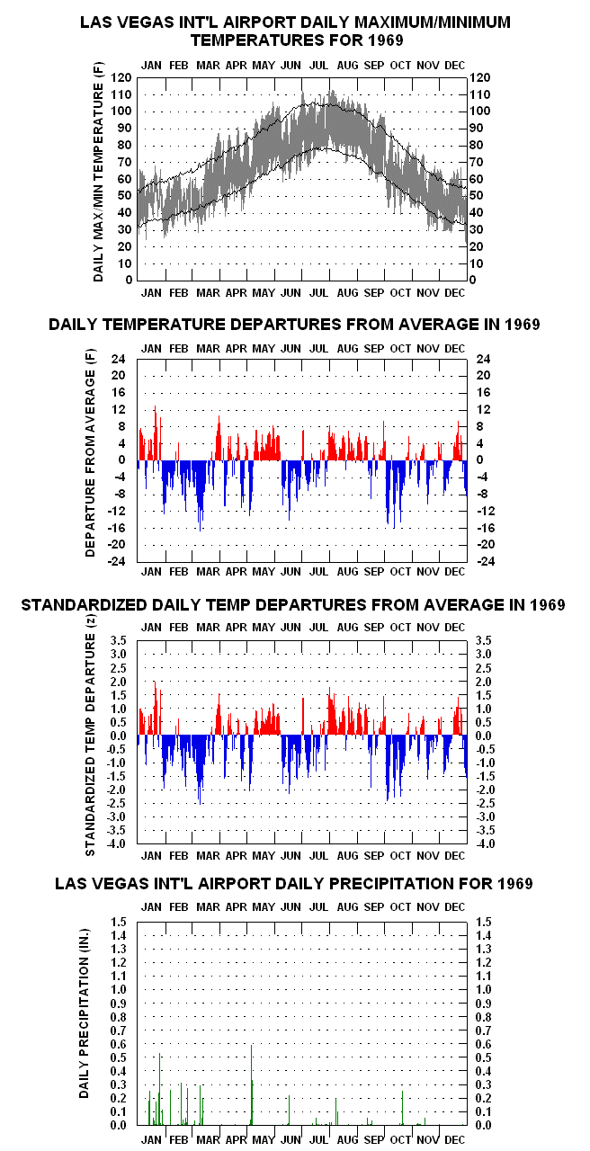
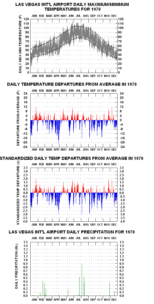
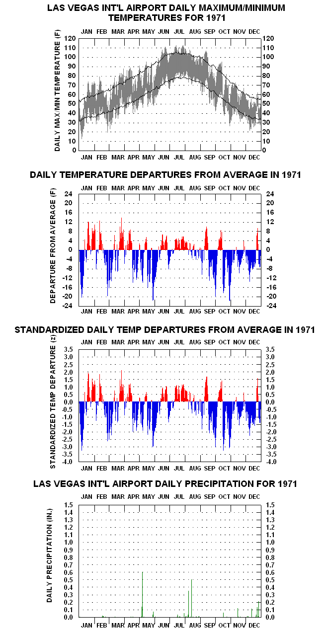
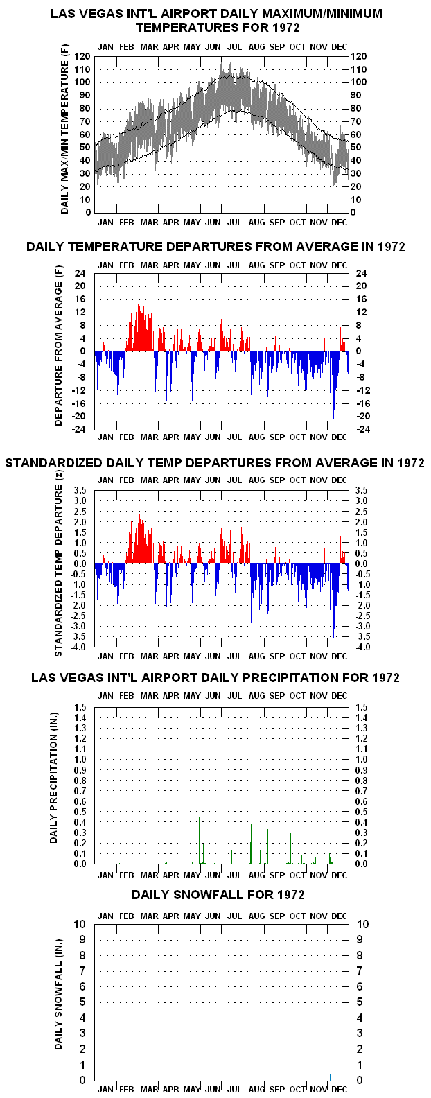
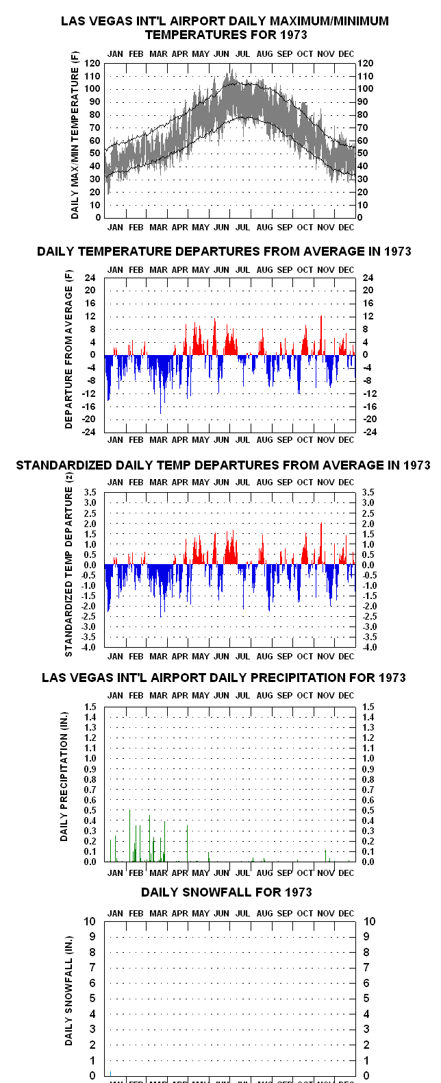
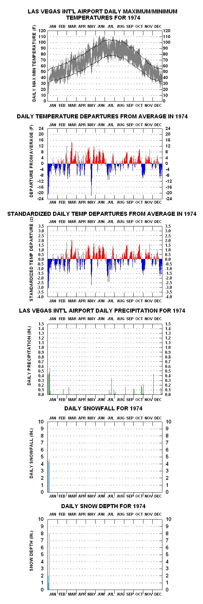
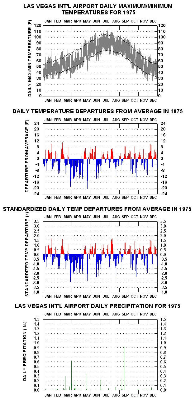
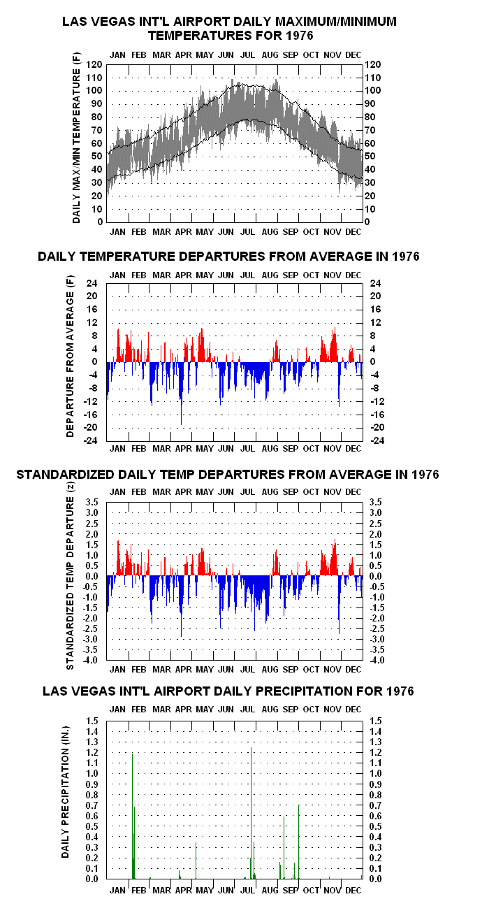
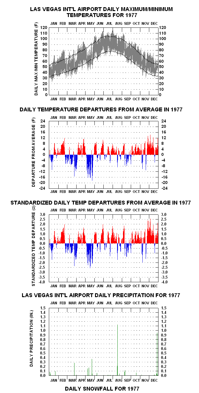
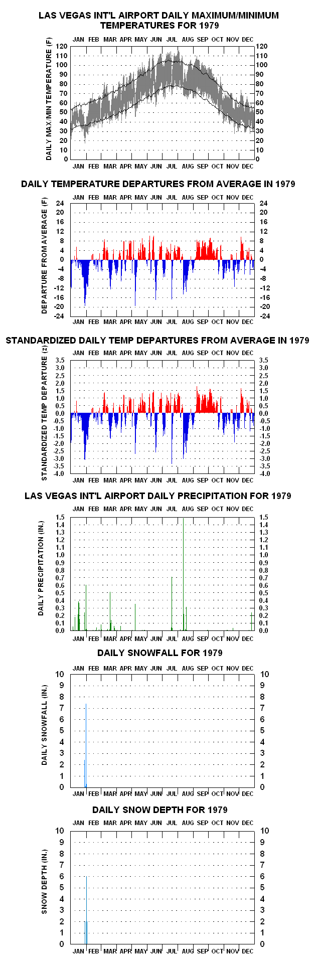
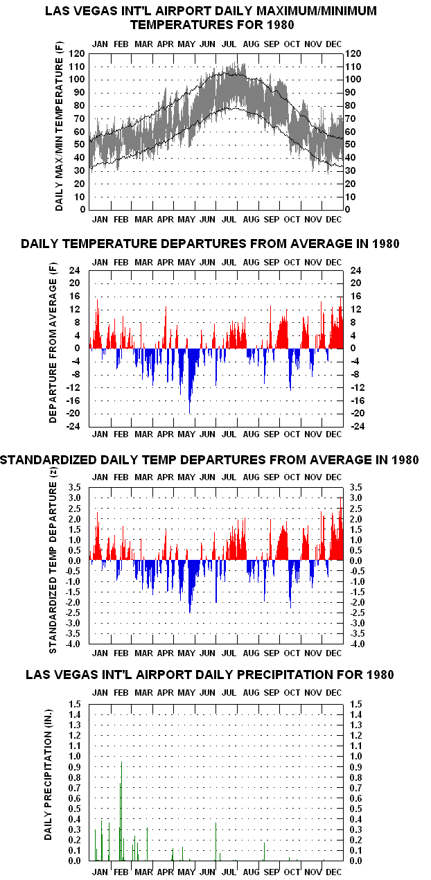
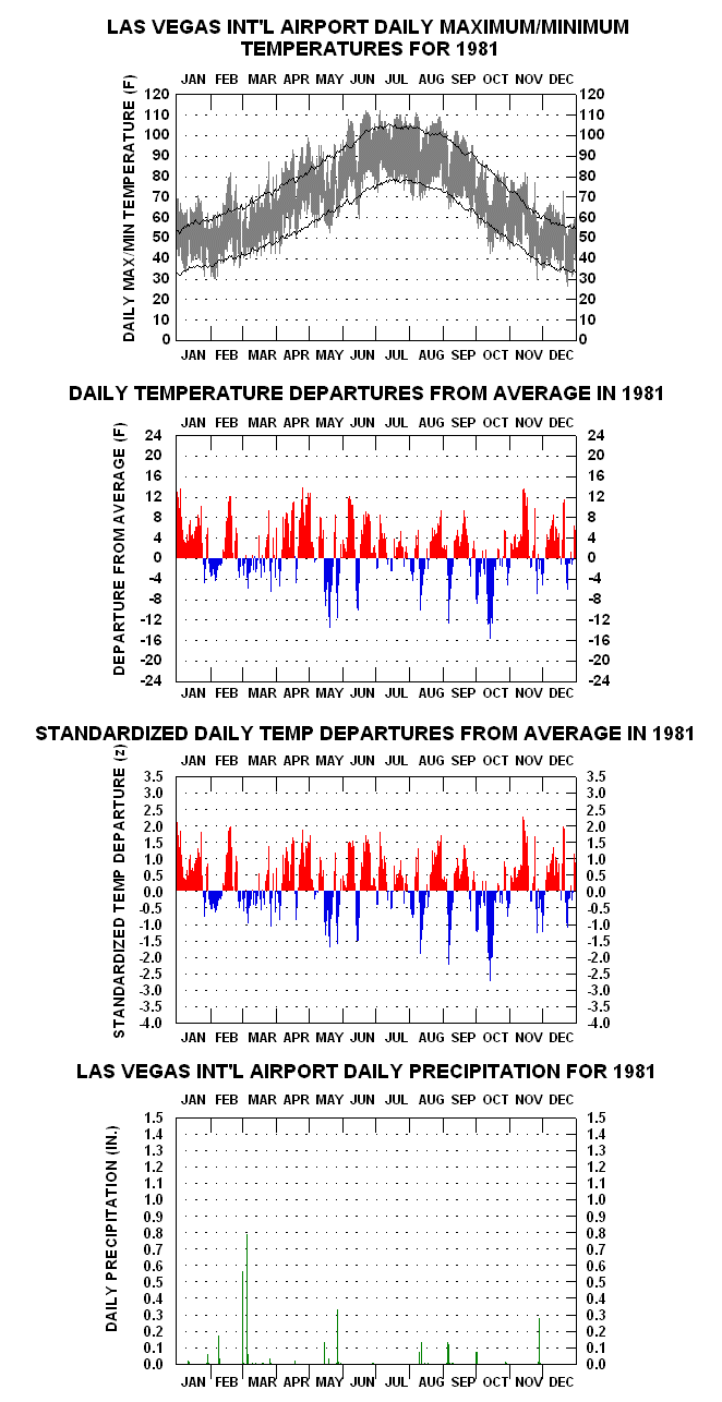
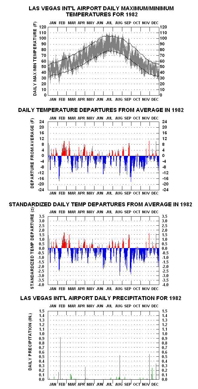
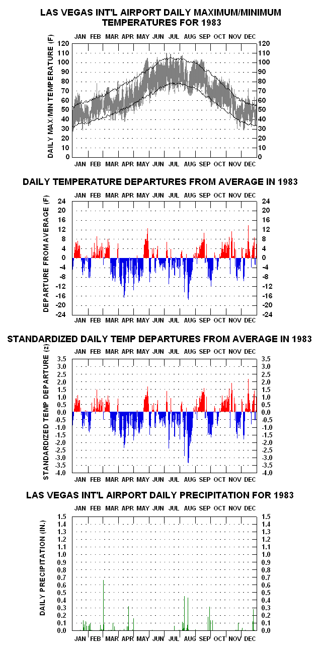
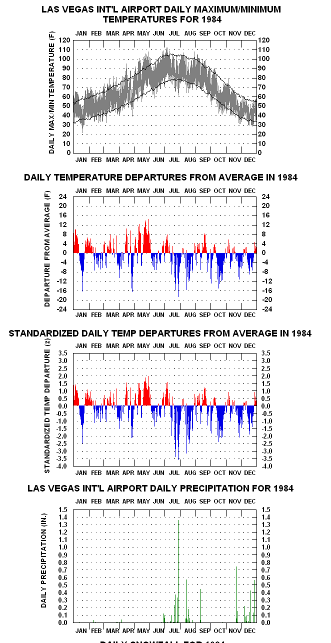
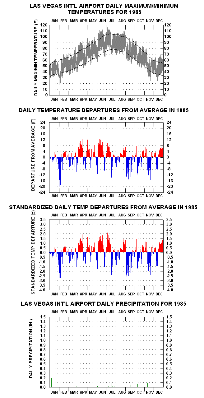
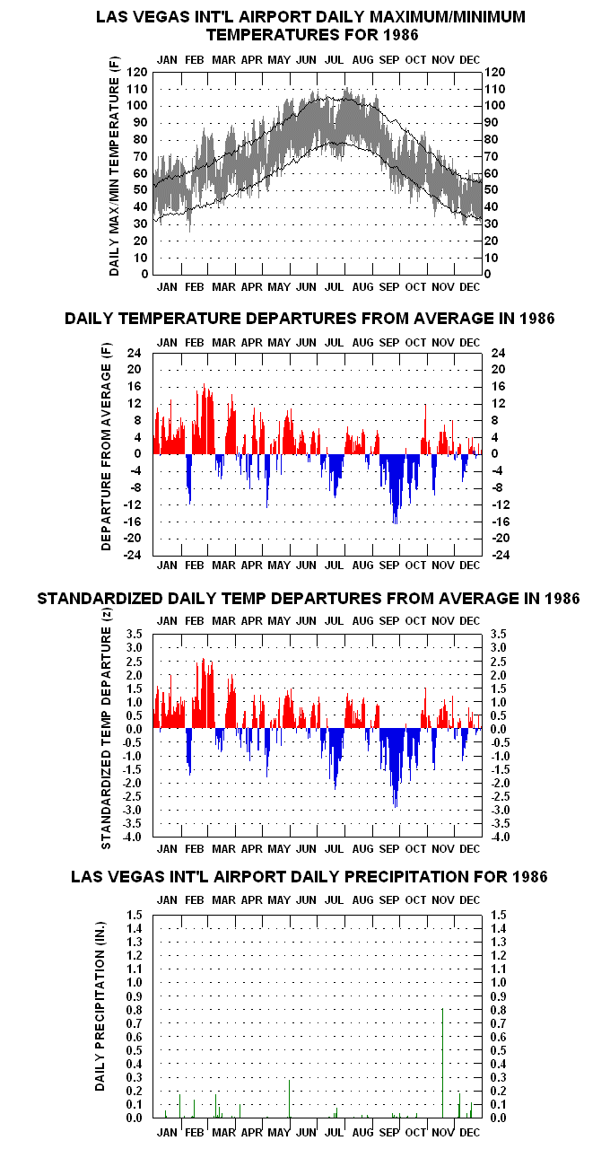
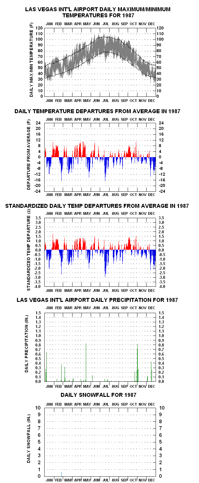
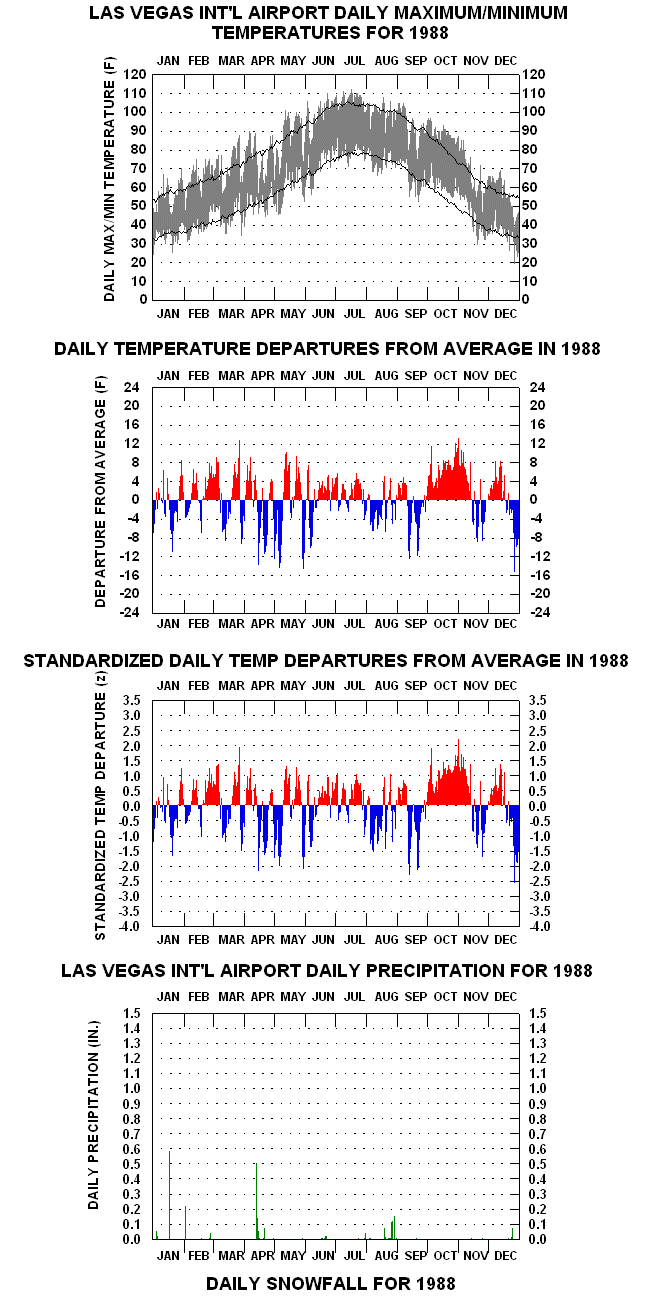
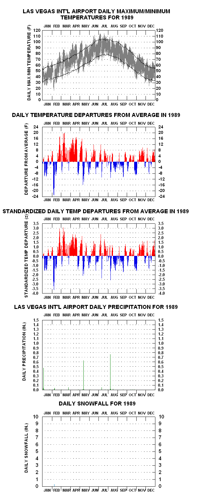
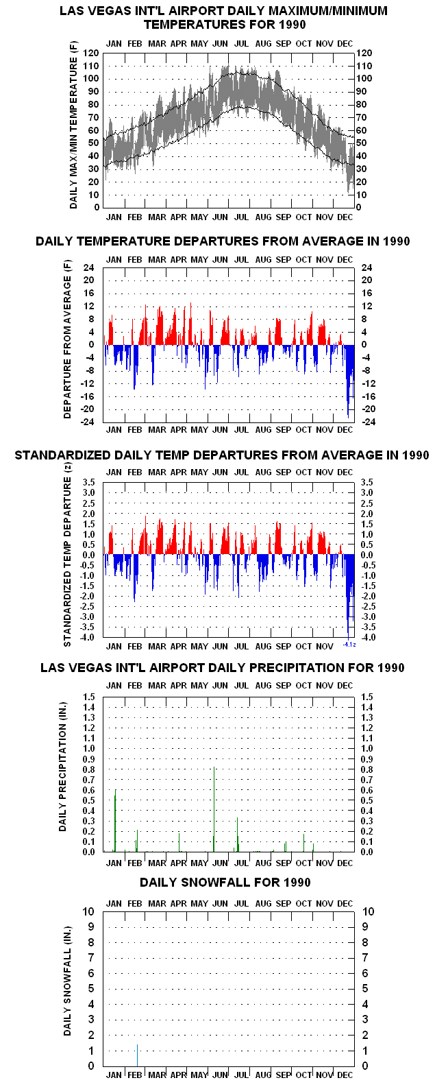
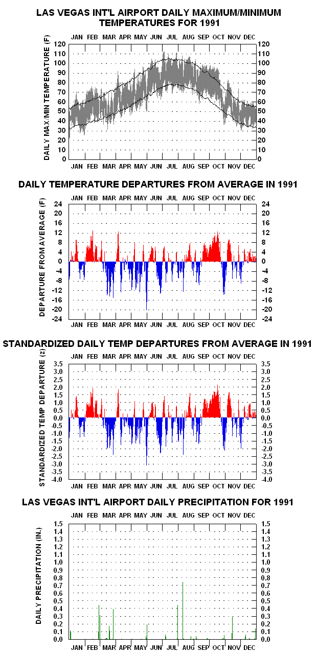
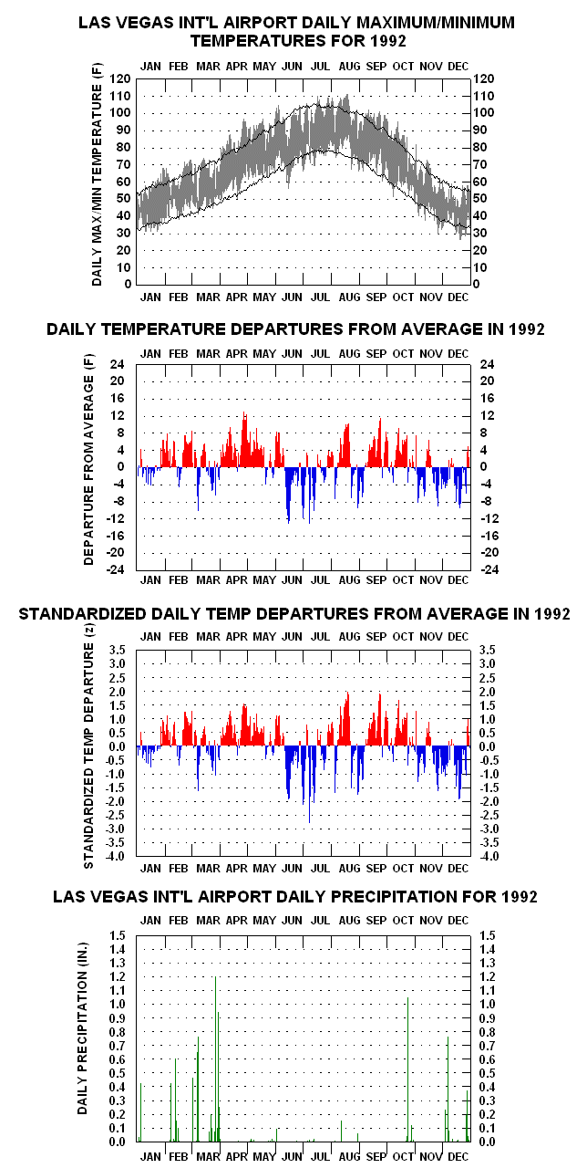
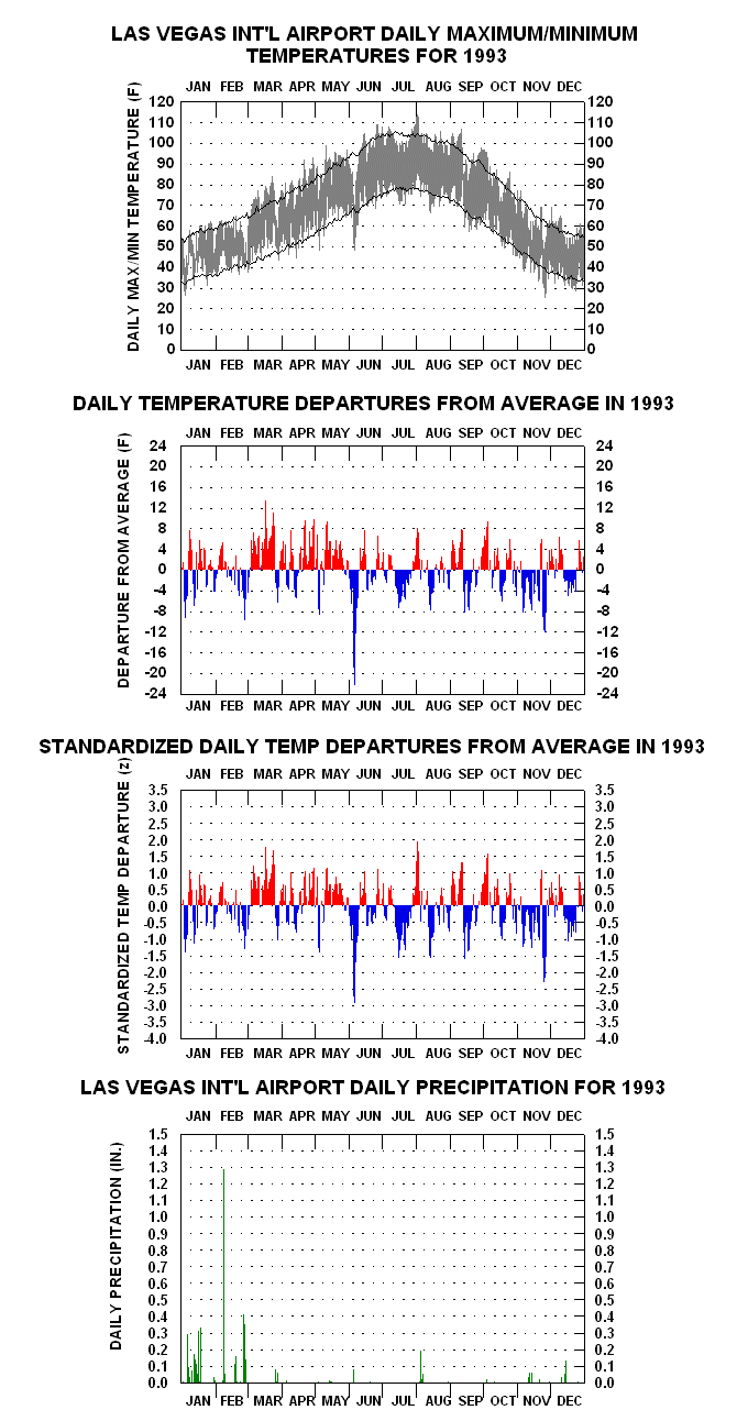
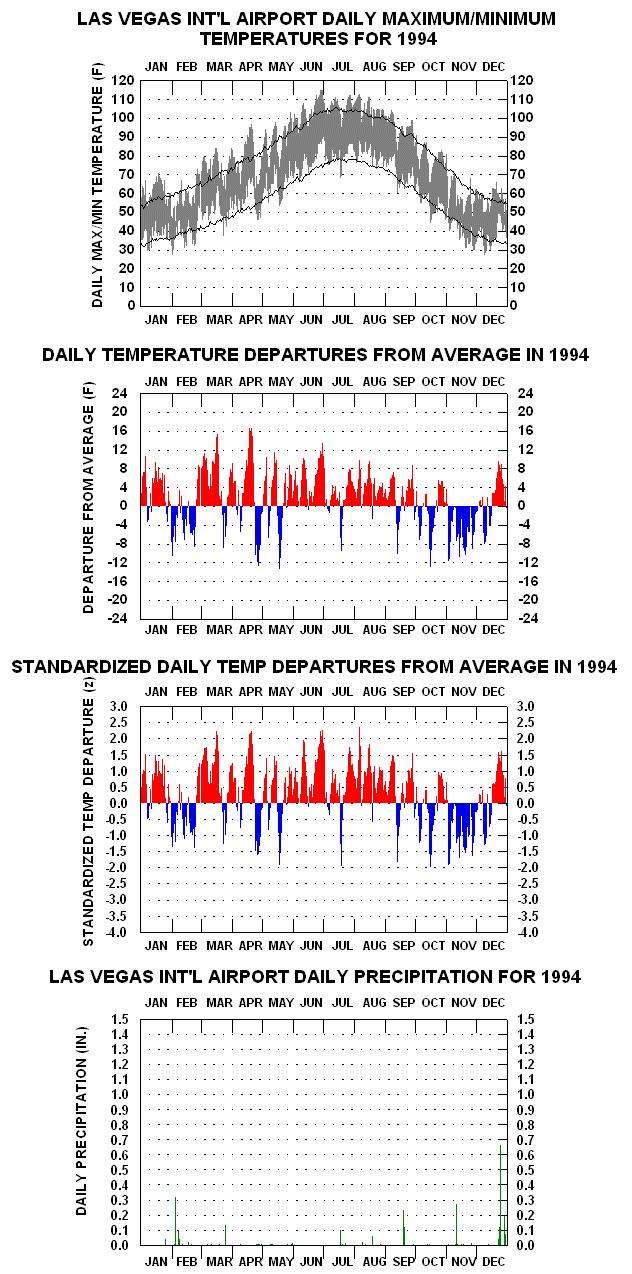
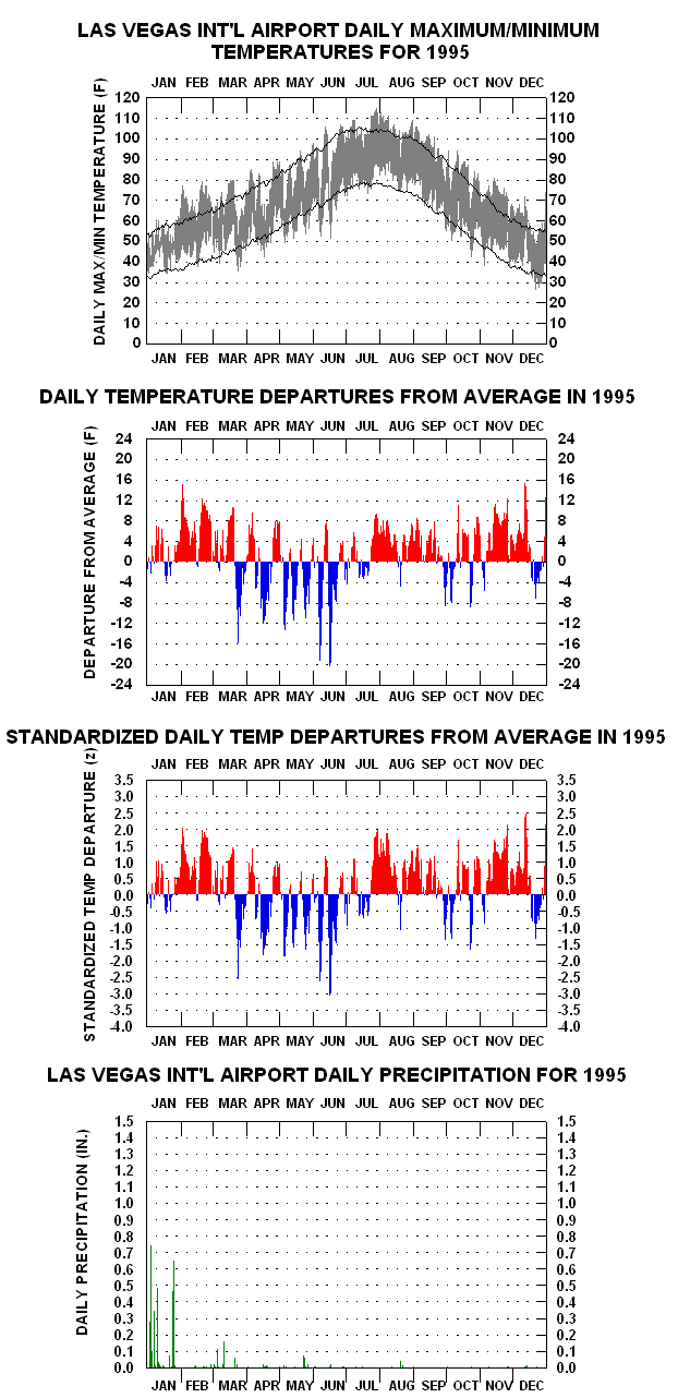
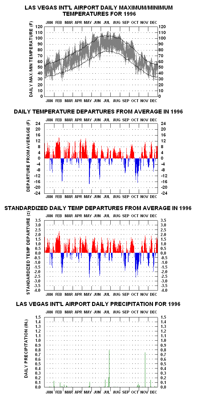
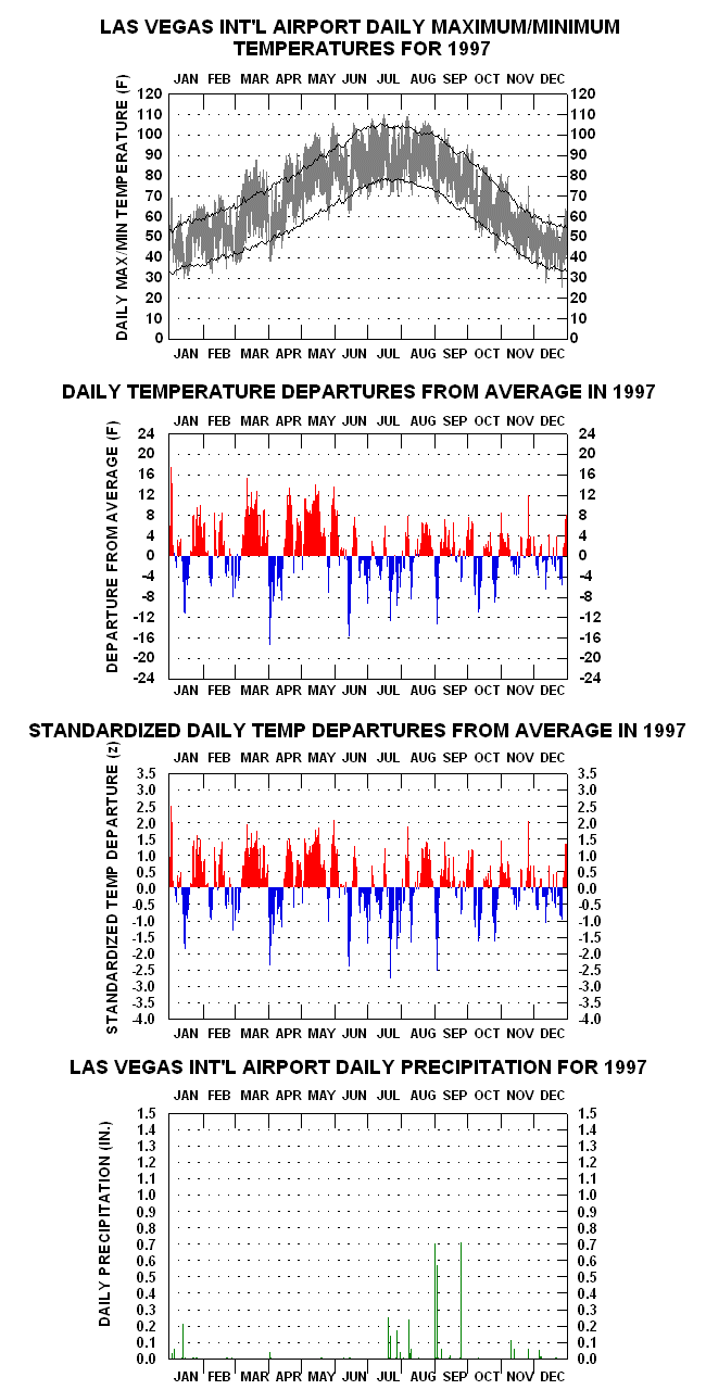
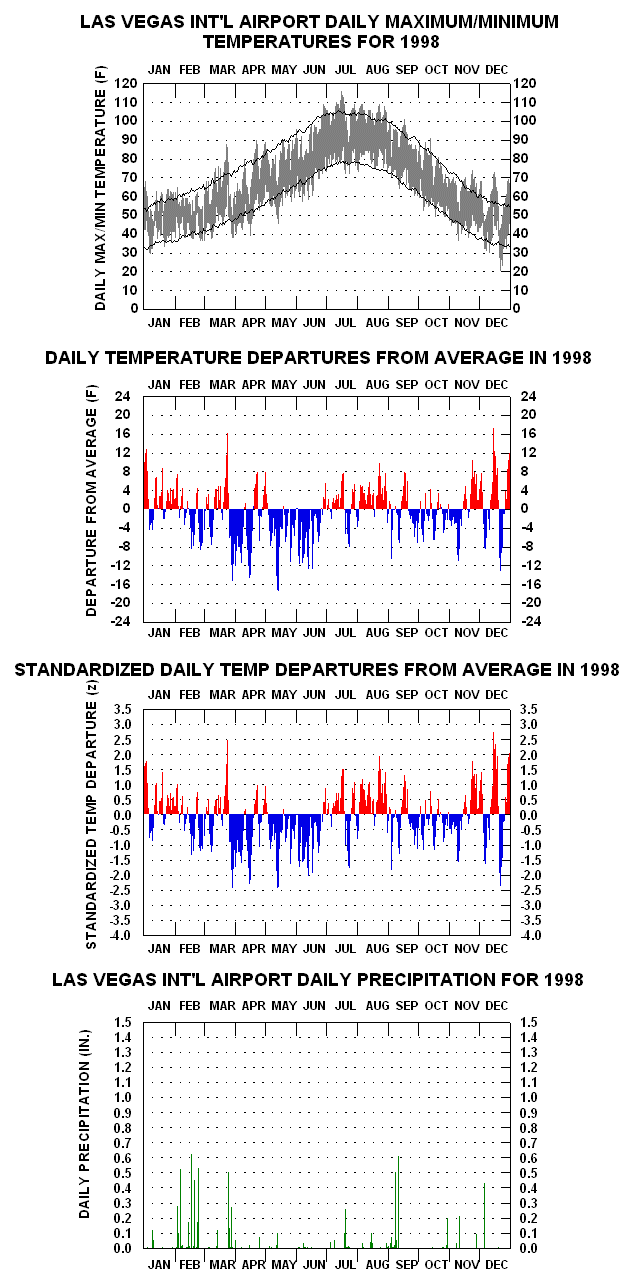
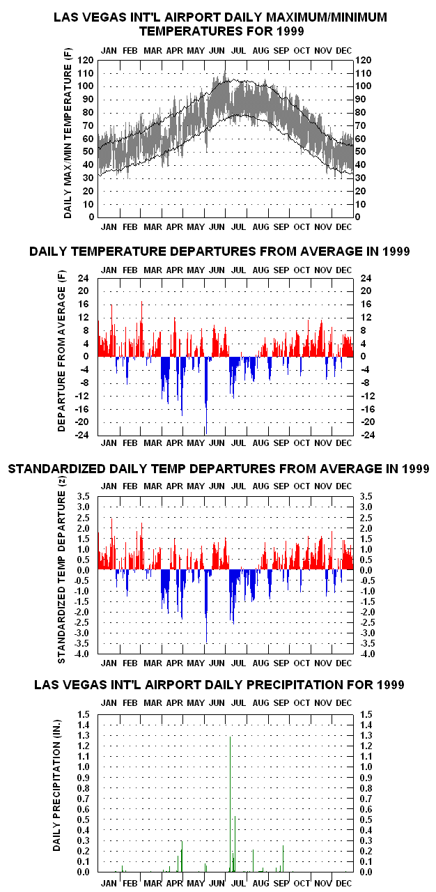
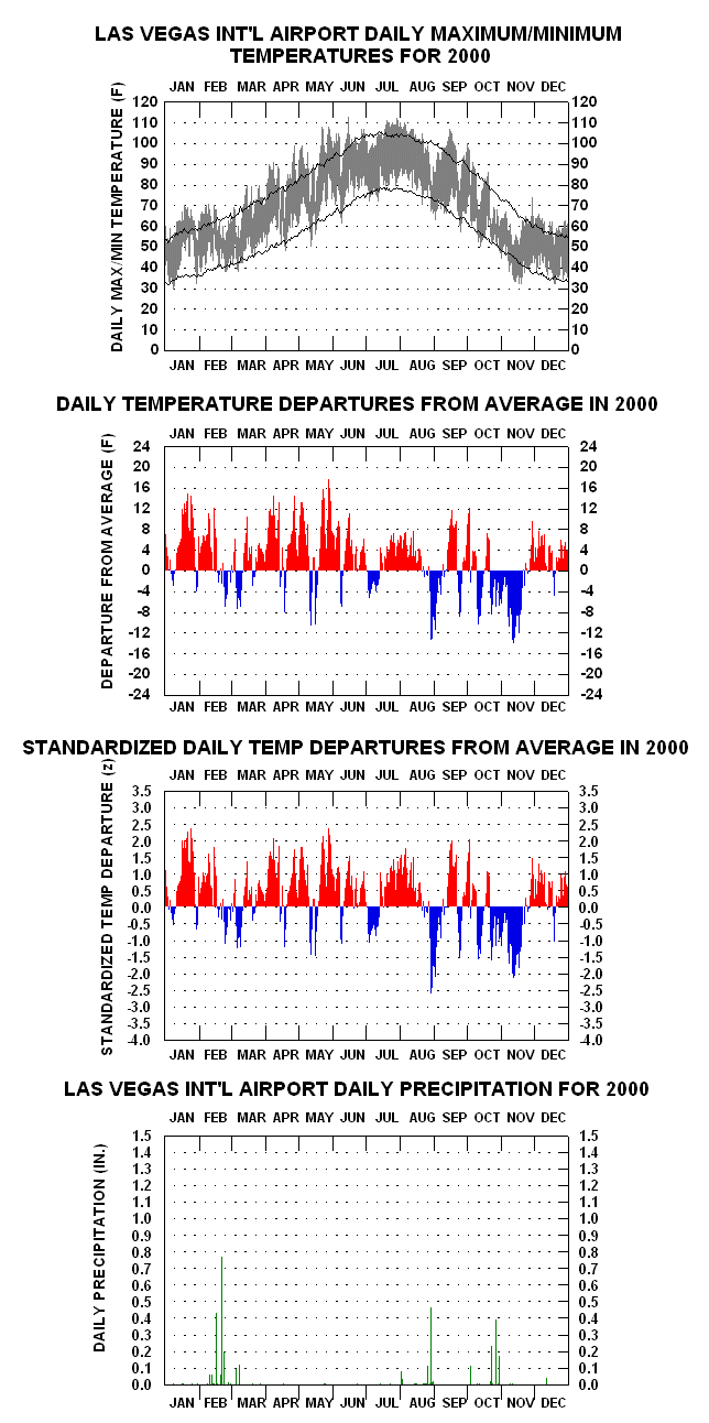
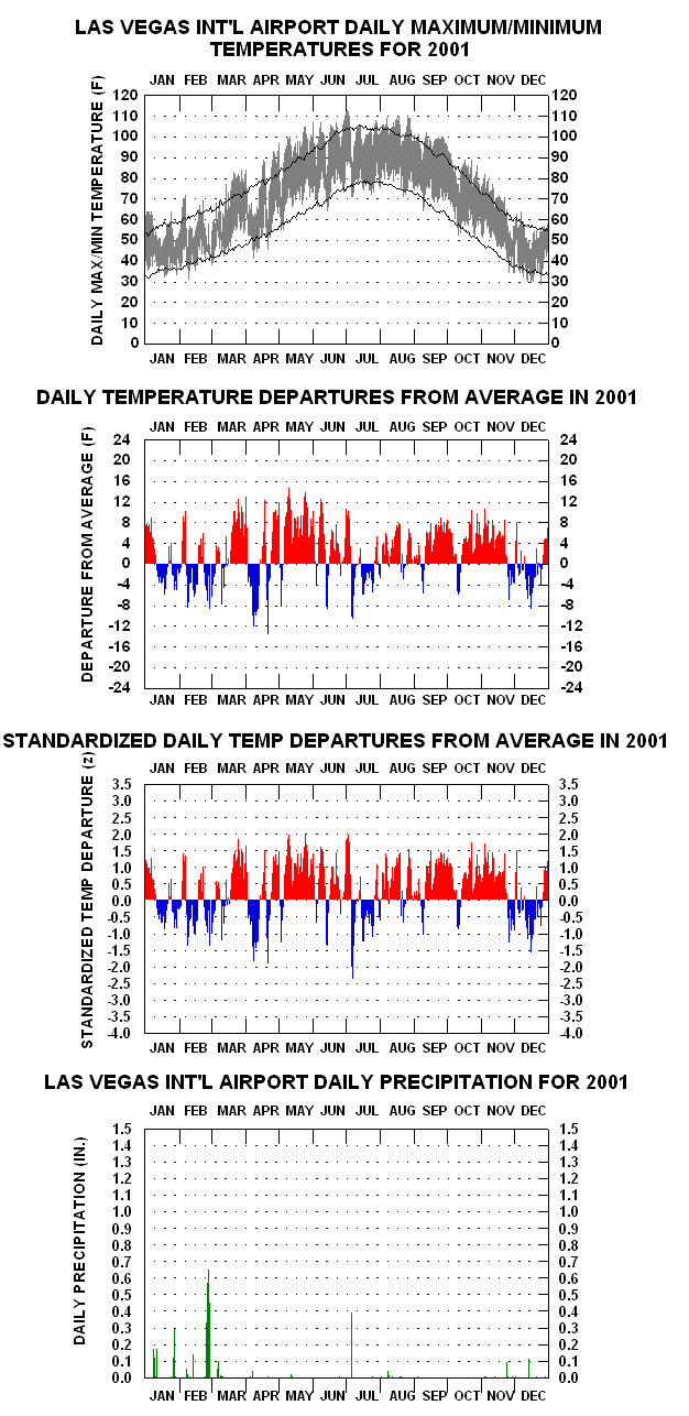
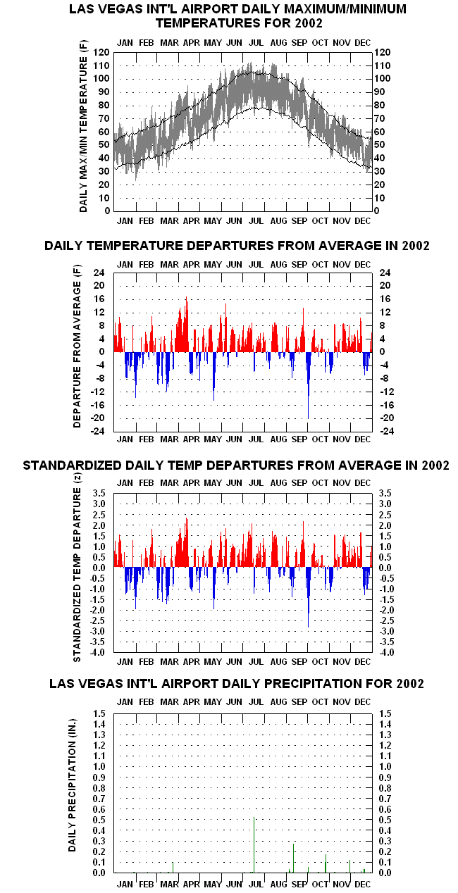
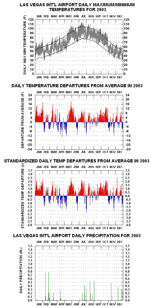
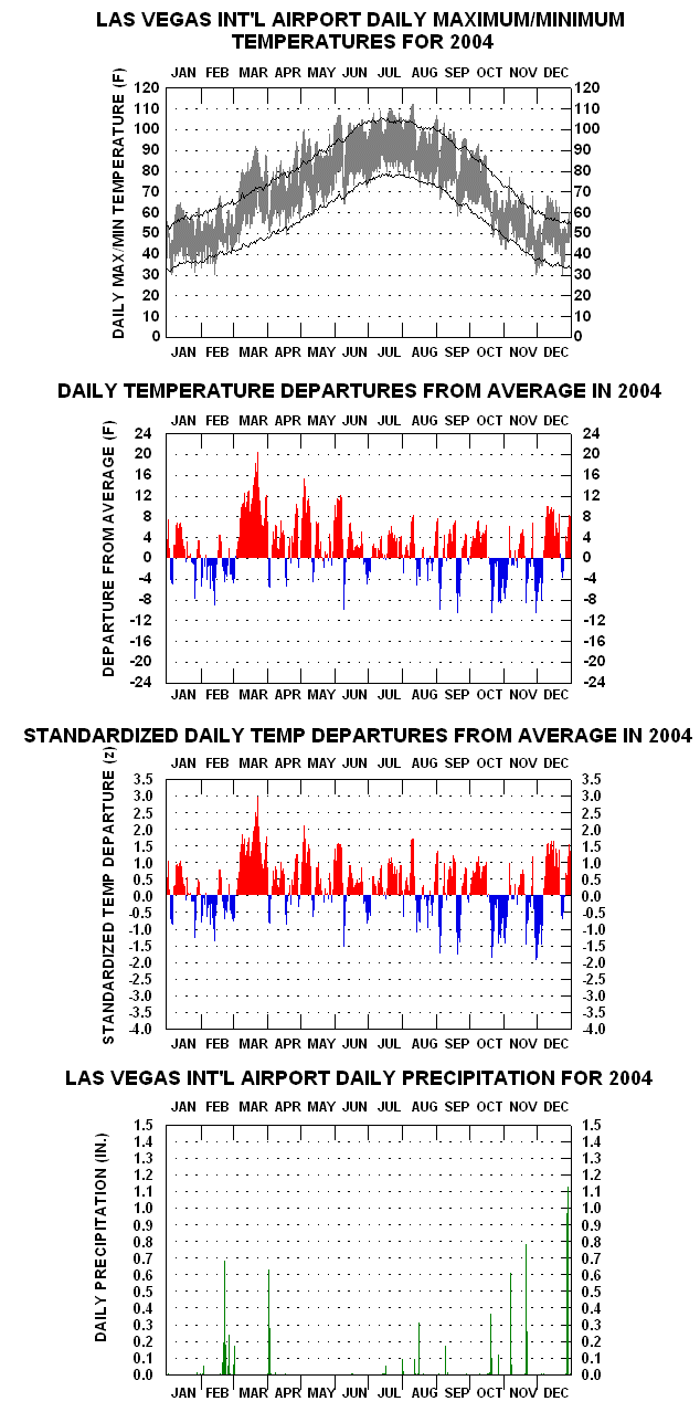
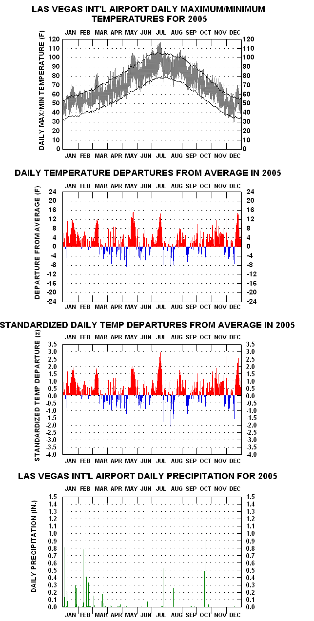
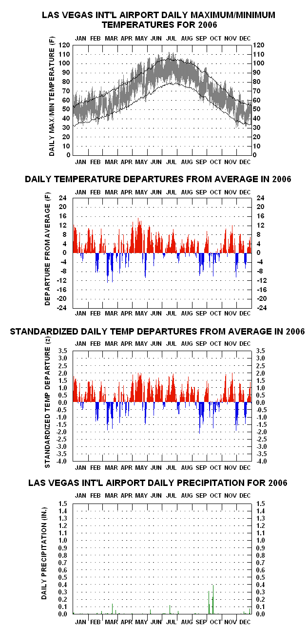
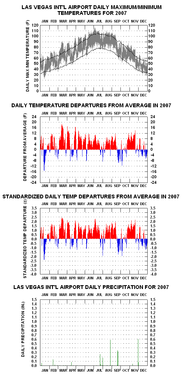
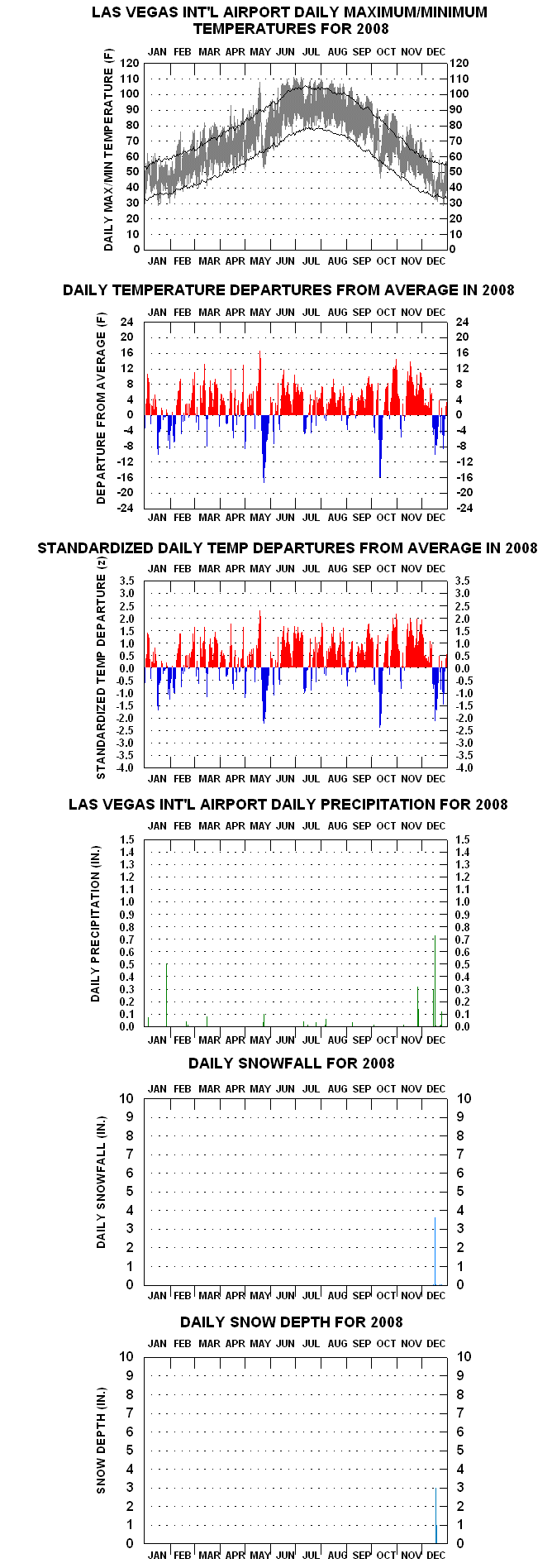
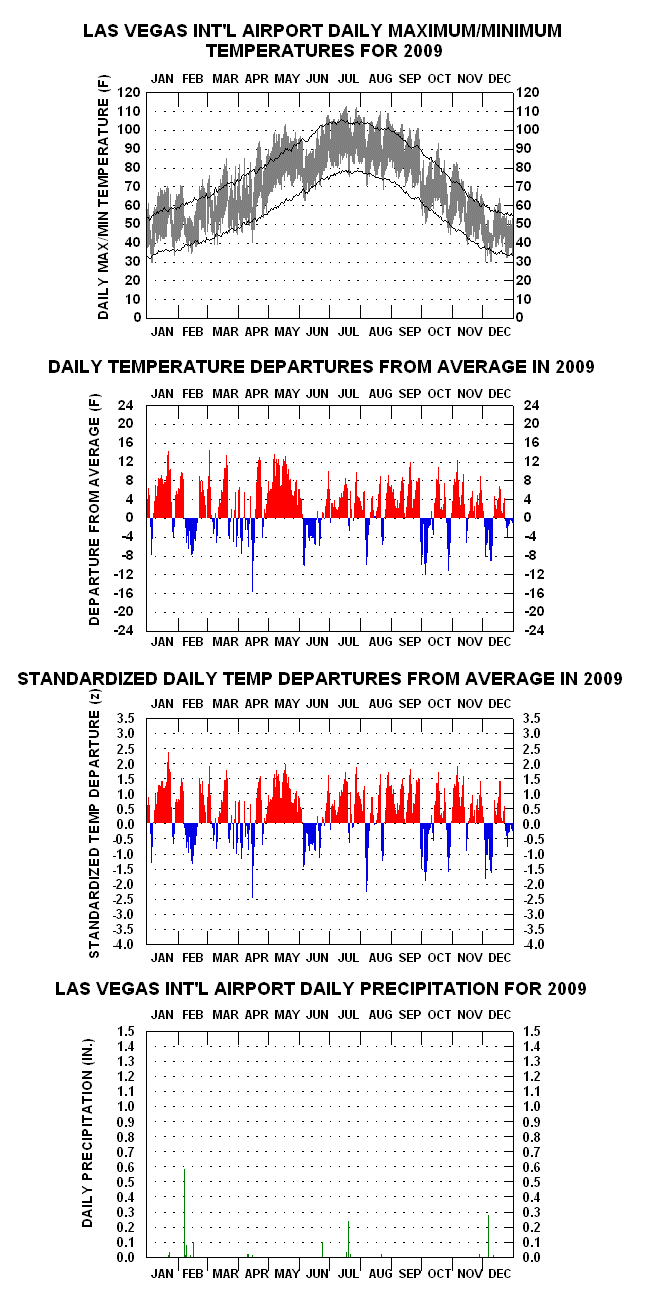
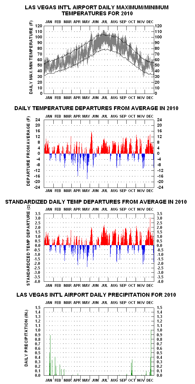
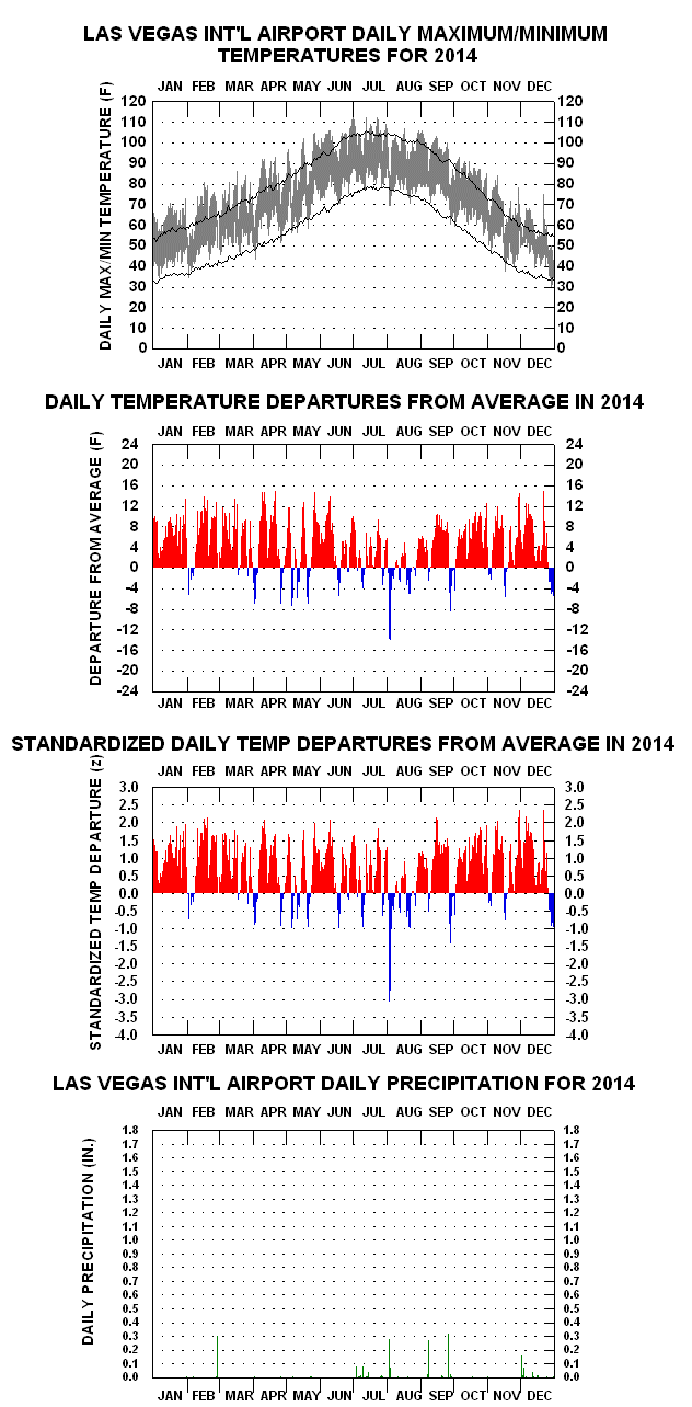
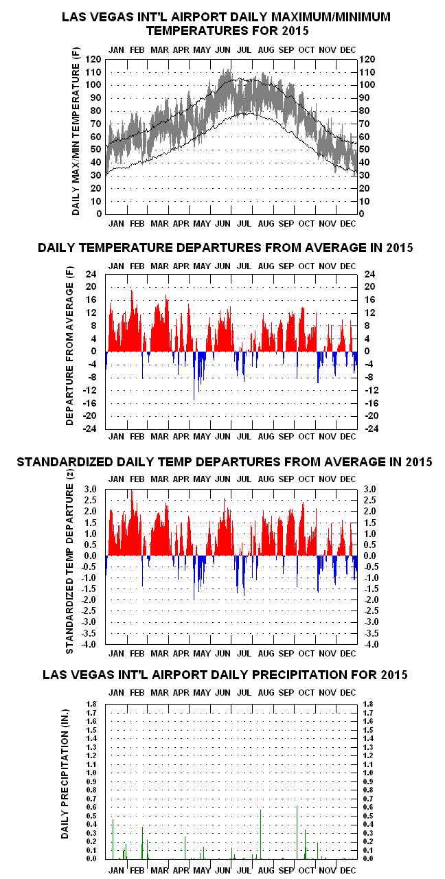
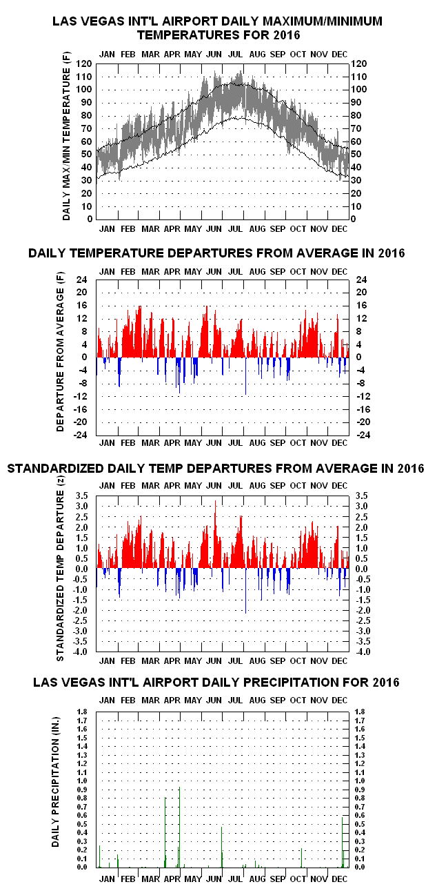
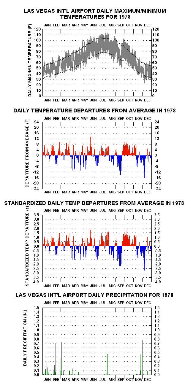
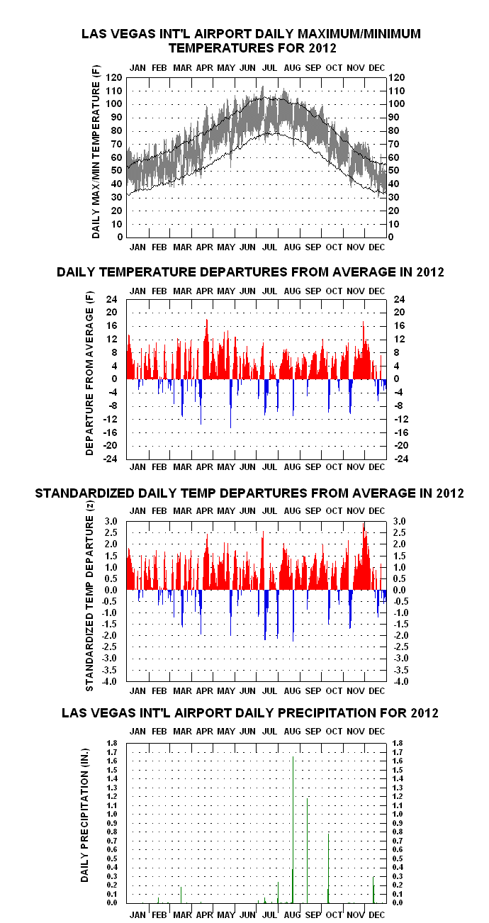
The year-to-year daily graphs pages (links below) consist of four charts tiled horizontally. The uppermost graph displays “floating-bars” or “hi-lo” depictions of the daily maxima and minima. Each bar represents an individual day’s temperature range. Superimposed are two line traces, the upper one connecting average daily maxima, the lower one average daily minima. The bars depict the varying diurnal, synoptic, long-wave, and seasonal influences on temperature over time.
The second chart down shows the arithmetic departures of day-to-day mean temperatures less the corresponding calendar-day average means. Red lines extending upward from the zero line indicate above average means for the day, blue ones extending downward depicting below average ones.
The third chart down shows the second chart’s departures in deseasonalized or “standardized” form. Standardized anomalies are calculated by dividing the arithmetic departure by the climatological mean temperature standard deviation for the calendar day in question, creating “z-scores”. Through 2023, the most extreme z-score is -4.59 z, for 22 January 1937
The fourth chart down depicts daily rainfall, as high as 2.58 inches (21 August 1957), the fifth shows snowfall, as high as 7.4 inches (31 January 1979), and the sixth snow depth, as high as 8 inches (5 January 1974).
YEAR-TO-YEAR GRAPHS – COMPLETE SET OF LINKS
1937 1938 1939 1940 1941 1942 1943 1944 1945 1946 1947 1948 1949 1950 1951 1952 1953 1954 1955 1956 1957 1958 1959 1960 1961 1962 1963 1964 1965 1966 1967 1968 1969 1970 1971 1972 1973 1974 1975 1976 1977 1978 1979 1980 1981 1982 1983 1984 1985 1986 1987 1988 1989 1990 1991 1992 1993 1994 1995 1996 1997 1998 1999 2000 2001 2002 2003 2004 2005 2006 2007 2008 2009 2010 2011 2012 2013 2014 2015 2016 2017 2018 2019 2020 2021 2022
LINKS TO YEAR-TO-YEAR GRAPHS OF INTEREST, WITH ACCOMPANYING NOTES
- 1937 – January the coldest month (32. 1 F) in Las Vegas history down to the present. Coldest month in Nevada history back to at least the 1870’s
- 1939 – Tropical storm remnants drop 3.39″ of rain in September. Wettest calendar month in history until February 1992.
- 1941 – Wettest Year in history (10.72″); 52 days with measurable falls (climatological mean: 26 days).
- 1942 – 117 F in July, highest reading in history until July 2024 with 120 F.
- 1949 – January the second coldest calendar month in history (34.2 F); 16.7″ snowfall during the month – most for any month in history.
- 1953 – Driest year in history, just 0.56″.
- 1955 – Persistent below normal temperature spells through July; 3.29″rain over July and August.
- 1957 – 2.58″ rain on 12 August, most for any single day in history.
- 1961 – Hot Summer – daily max temperatures reach 110 F or higher 21 times, most until 1994.
- 1963 – Frigid two-day spell in January: 29 F/14 F on 12th, 31 F/8 F on 13th (8 F coldest in history).
- 1965 – Frequent abnormal cool spells; wettest April (2.44″) and wettest November (2.22″) each, in history.
- 1967 – Latest 32 F or lower temperature on record (32 F on 12 April). Coolest April on record.
- 1971 – Highly fluctuating temperature anomalies over course of the year – mostly below normal. Coolest October on record.
- 1972 – Very mild February & March, but persistent relative coolness from August on. Severe cold snap in early December.
- 1974 – Frigid two-day spell in early January: 31 F/13 F on 2nd, 32 F/12 F on 3rd with snow. Eight-inch depth on 3rd.
- 1975 – 77 F on 26 January, record high temperature for that month, but cold late March thru April.
- 1977– Cool March and May, but warmest year overall to date by 1.1 F.
- 1978 – 103 F 1 October, highest ever recorded in that month.
- 1979 – Cold late January/early February with 7-inch snowstorm over former; 110 F on 8 September, latest 110 F or higher temp in history.
- 1984 – Warmest May in history (80.7 F). Record wet July (2.48″), frequent cloudiness depresses temperatures.
- 1986 – Very warm January & February, but cool late September.
1988 – Very warm October and record warm November maximum (87 F) on 1st.
1989 – Record cold February minimum (16 F), but very warm March and record warm April (72.6 F). - 1990 – Severe cold snap in late December; 11 F on 23rd, coldest recorded temperature since 8 F in Jan. 1963.
1991 – Very warm September and October, but sharp temperature drop late.
1992 – During ’91-’92 El Nino episode, March receives 4.80″, highest amount for any individual calendar month in history. Total precipitation for 1992 (9.98″) the most since 1941.
1994 – Hot Summer; 22 days at 110 F or higher, surpassing 1961′s record (21 days). 115 F in June sets new high mark for that month. - 1995 – During ’94-’95 El Nino episode, wettest January on record (3.00″). Warmest February in history by 2.7 F. Curious short-term temperature anomaly oscillations from late March into June. Record three-day heat in July: 116 F/93 F on the 17th, 116 F/92 F on the 18th, and 117 F/95 F on the 19th. Latter day records a tie for highest daily maximum and records absolute highest minimum mark.
1998 – During Great El Nino episode of ’97-’98, wettest February in history (2.89″).
2000 – Warmest year to date (69.7 F). - 2001 – Warmest year to date (69.8 F). Warm May-June & October-November.
2003 – Warming trend continues (70.2 F annual mean): January, May to early June, and Late Sept thru October with anomalous warmth.
2004 – Warmest March in history; earliest 100 F or higher, on 4 May; wettest December in history (2.10″).
2007 – Warmest year in history mark surpassed by 0.8 F (71.0 F); earliest 90 F or higher, on 13 March. - 2009 – Warmest May and September marks set.
2010 – July warmest calendar month in Las Vegas history (96.2 F); earliest 110 F or higher, on 6 June.
2012 – Warmest Calendar Year to date (71.2 F).
2014 – Warmest Calendar Year in history (72.0 F).
2015 – Record Warmest February (60.1 F) and March (66.7 F).
2017 – Warmest Calendar Year to Date (72.3 F).
2018 – Warmest September in history 88.1 F. - 2020 – Warmest August in history (95.6 F); 114 F on 6 September sets new high mark for the month.
- 2021 – 117 F/94 F daily range on 10 July; warmest November in history (63.4 F).
- 2022 – 93 F on 26 March, sets new high mark for the month
- * Member, American Meteorological Society